Good Tuesday, everyone. Gorgeous fall weather rolls on for the rest of the week, but big changes blow into town for the coming weekend. That means an increase in rain and wind, and a decrease in temperatures. Even bigger changes may show up in the closing days of the month.
It continues to look like a strong cold front moves our way by Saturday with an increase in showers and thunderstorms. That front slowly crosses the state into Sunday with temps on the decrease…
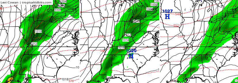 The models are still trying to develop a couple of systems in the tropics. Whether or not they actually develop into something tropical remains to be seen. However, it appears a lot of unsettled weather is likely from the Gulf to the Caribbean. What happens with all of this mess will likely have some kind of impact on what happens with our weather.
The models are getting very, very close to showing a big system across the east next week. The Canadian Model is leading the way with other models trending toward it. Check out how this system deepens on top of us…
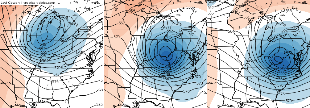 The same run of the Canadian Model shows a lot of cold air around here with a storm to our east…
 The European Model is trending toward something similar, but is slower with this system…
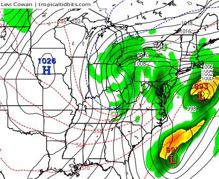
 That’s a lot of chilly air around here with very cold air across the Great Lakes and northeast. If we can somehow get more of a merger between the northern stream and the active southern stream… hmm.
That’s probably a sentence you’re going to hear me say a lot this fall and winter! 😉
Have a great day and take care.

I say this at the changing of every season, but I love to see everything that happens during each part of the year.
Just amazing what’s happening in the Pacific right now..Just look at the warm waters SW of CA..Really no true analogs to compare this strong El Nino that’s basin wide and the Npac..If the Npac cooperates like the last 2 winters added with strong El Nino could be something to behold..lol..
http://s18.postimg.org/7mpejndah/cdas_sflux_ssta_global_1.png
Where did you get that map? and is their one that shows the forecasted SST
Why do I see the moon right.now? That’s weird lol
Like CB and some of the other hardy weathermen on this blog, I think this COULD be a potential 1970s kind of winter if we have a battle of two active Northern and Southern jet streams. I wasn’t alive in the late 70s, but I know of the records set in KY!!!
it looks like deepening low pressure with upper level very cold air could produce something to watch next week according to Chris he is the true blue weather dude. I really love this weather page. very accurate. My hat off to Chris. Also I would say snow. But sleet and thunder could occur also next week. Let’s see what Chris says.