Good Wednesday evening, gang. Our weather is about to really crank up over the next week and I wanted to drop by for a quick update on the possibilities.
It all starts this weekend with a cold front moving into town. Showers and storms increase ahead of this front on Saturday as winds howl. Showers will carry us into Sunday before tapering off in the afternoon and evening.
Next week is a very active week of weather that has the potential to get a little interesting before all is said and done. A system dives in from Canada and may pick up a system across the south and produce a deep trough in our region…
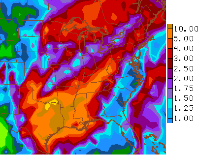
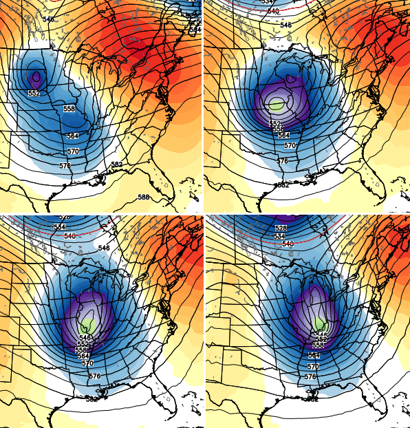 That’s the European Model and it shows a heck of a storm system with a lot of rain and wind for us from Tuesday-Thursday…
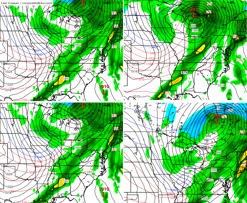
 The Canadian Model has a similar look to it…
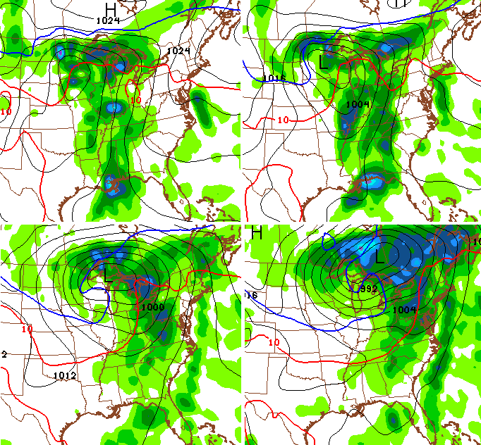
 The GFS isn’t as strong with the stormy, but still shows a healthy storm…
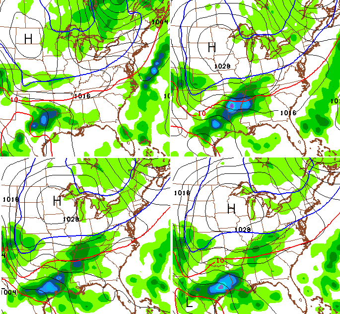
 That run then tries to develop another system that skirts by to our south by Friday…
 Whoa… that’s a cold look.
The active pattern rolls into early November with the models spitting out a lot of precipitation over the next few weeks…
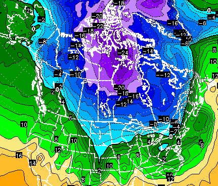
 Something else really getting my attention is the amount of cold air forecast to develop across Canada next week. 850mb temps to -24c?
 I will have another update coming later tonight. Until then, take care.

Wow Chris. I can just feel the colder weather excitement starting to build in anticipation of a taste of winter in your post. Just tell me when I need to put the blanket on the bed. Thanks for the update! Have a great evening all.
I think this is going to be the winter of wet snow storms across our area. I honestly don’t think it will be as cold as last year for the entire period, if of course the Southern Branch is as active as it could be with the upcoming El Nino. Only time will tell, but I feel confident that we can ignore the Weather Channel’s dry and warm winter prediction…not buying it:)
Also, I hope the South Central states can get in on that 5 to 10 inches plus predicted here as these folks are getting super dry!
You can definitely feel the excitement and anticipation of winter weather in this post. This is the first post to get me excited because it’s a whole different feel when there is a post about long range possibilities (2+ weeks) compared to one that we are talking about within, or just out of the 7-day time frame. If we’re gonna get October snow, it has to show up on the most models within the next 5 days of so. Regardless, just to think about the fact that from now on, snow could pop up in the forecast at any given moment until May next year.
So what we are experiencing weather wise right now is considered Indian Summer? Most if not all has had frost and freeze conditions this past weekend and temps having a solid shot of hitting 80 degrees tomorrow and Friday. I do believe that qualifies as Indian Summer.
That’s it I’ve seen enough!! I’m going to break both of Daniel Murphys arms. Unreal!!!