Good Thursday, everyone. October is typically a pretty boring month and this month has certainly fit the bill. But, things look much more active as we close out the month. As a matter of fact, one could argue this pattern looks a little supercharged over the next week and change.
The pattern gets cranking this weekend as a cold front nears the area from the west and northwest. Showers and thunderstorms will increase ahead of this front on Saturday. Winds will also be very gusty and could approach 30-35mph at times.
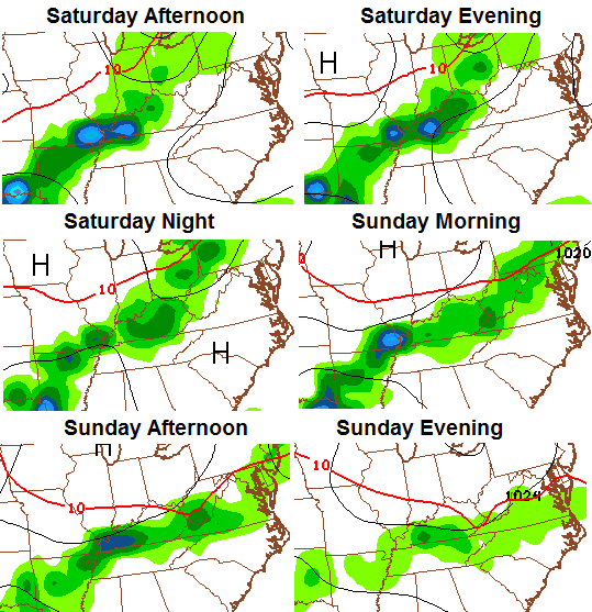
The front slowly works through here Sunday with rains tapering off from northwest to southeast later in the day. Highs will be cooler with readings in the 60s.
A leftover shower will be possible Monday as we find ourselves in between storm systems.
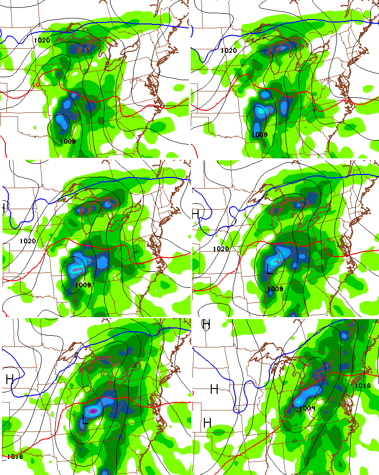
The next system coming in late Tuesday and Wednesday has the potential to bring a lot of rain and wind to our region. Some kind of storm is likely to be along the gulf coast and should get drawn northward ahead of a trough digging into the plains states. How these two interact will be the key on just how powerful of a storm we see and how much cold air comes in behind it.
Either way, a lot of rain and wind looks increasingly likely from Tuesday through Thursday. Here’s how the GFS plays it…
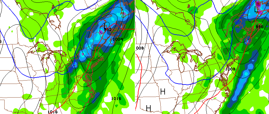
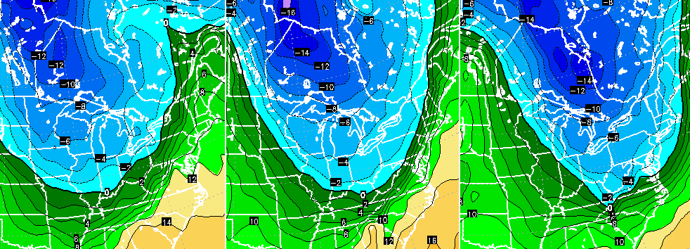
 That’s not a full blown hookup between the southern storm and the storm diving in across the plains, but it’s enough to pull down a nice shot of chill behind it…
The European Model has a slightly different solution with the same end result. It features a stronger northern stream system winding up across the lakes with a potent low lifting slowly northward from the Gulf into the Carolinas…
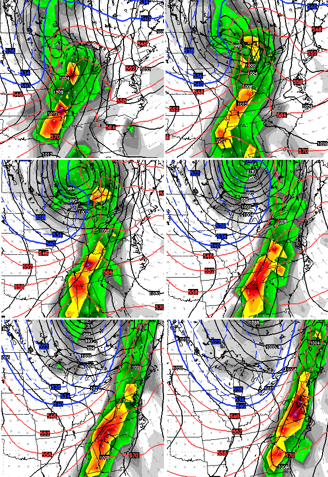
That’s a lot of rain and wind with a nice shot of cold behind pushing in here…
This setup resembles the big Halloween storm from 2013. Remember all the problems that one caused across our region?
I will likely have another update coming later today, so check back. Make it a great day and take care.

So I`m guessing that our 4 year October snow streak will come to an end this year?
Buckle up, its gonna be a crazy ride over the next few weeks
Blowtorch winter is my call.
Definitely looking gloomy and rainy.
For the next couple of weeks
Its October lol
Someone PLEASE go call these guys out for ripping your stuff and stealing it. It is constant. Not just your forecast either. They have been doing it to other local forecasters in southern Illinois and western Kentucky.
What is worse is that they are acting like it is THEIR forecast.
http://www.facebook.com/181650435356226/photos/np.1445514863614573.636505308/471633526357914/?type=3
http://www.facebook.com/MurrayCalloway-County-Weather-181650435356226/
They aren’t maps Chris made. He made a picture and included the maps on the picture its not a forecast only a model run.
Right, but they ripped his wording. Word for word. They do it a lot. Not just his pictures. They took his forecast word for word and made it their own.