Good Thursday evening, folks. Our weather pattern continues to look like it will take a walk on the wild side over the next week and change. Buckle up for a pattern that’s in full supercharged mode.
My thoughts on the weekend have not changed. Showers and storms increase Friday night in the west and across the rest of the state on Saturday. Gusty winds of 30-35mph will be likely into Sunday as showers taper.
The next storm system is likely to have a HUGE impact on our weather from Tuesday through Thursday of next week. For well over a week, we’ve said to watch for a system diving in from Canada that tries to pick up something of a tropical nature in the Gulf of Mexico. That scenario is exactly what’s now showing up on the models.
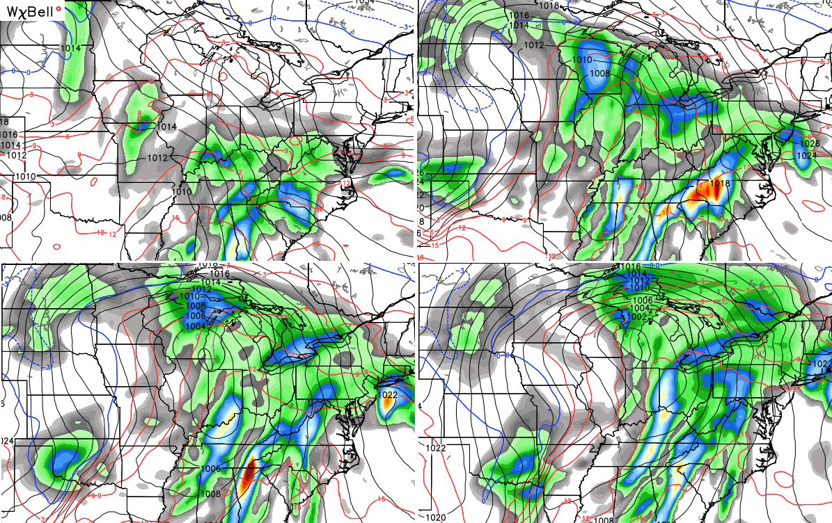
Check out this monster on the European Model…
 The Gulf system works right into the Ohio Valley on Wednesday with heavy rain, thunderstorms and high winds. It then merges with the system dropping in out of Canada to form a powerhouse of a storm in the Great Lakes…

Taken verbatim, the European Model shows wind gusts of 50-60mph on Wednesday.
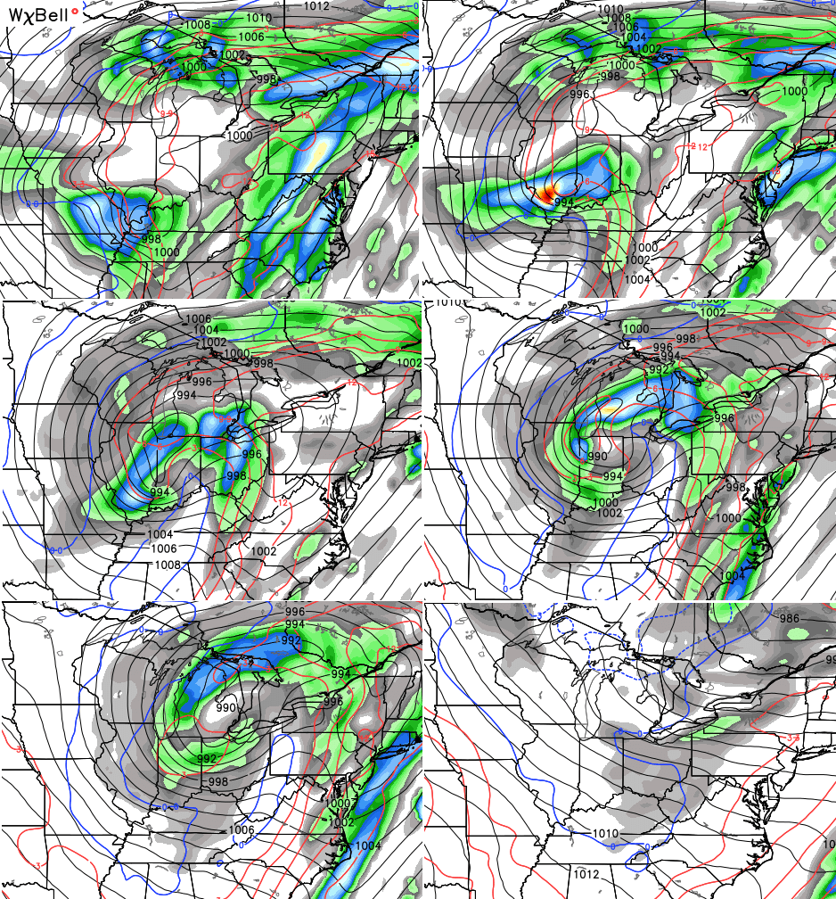
The Canadian isn’t as strong with the Gulf system, but still brings a lot of rain, wind and storms our way…
 Once that swings through, the same model run shows another northern system diving in behind if and becoming a healhty system across our region by Thursday and Friday…
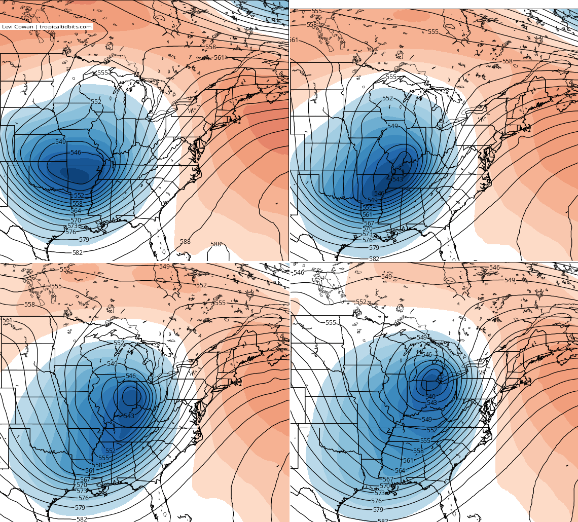
 Check out the upstairs look on that potent storm…
 The air coming in behind the storm can get really cold for the end of next week into the weekend. If things worked out exactly right, it could get a littler “interesting” for the 4th October in a row.
The same Canadian Model produced another deep trough into early November…

The new GFS agrees with that and has another potent storm Halloween weekend…

I will have another update later tonight. Take care.

thanks!
Next week should be wild for sure. Hoping models could merge on a colder solution with that system behind the one around Wednesday, I am definitely looking forward to some white stuff this winter.