Good Friday evening, gang. I wanted to drop by for a quick update on the super duper busy weather pattern kicking off this weekend.
I have nothing more to add to the weekend forecast… rain and wind will increase on Saturday and decrease later Sunday.
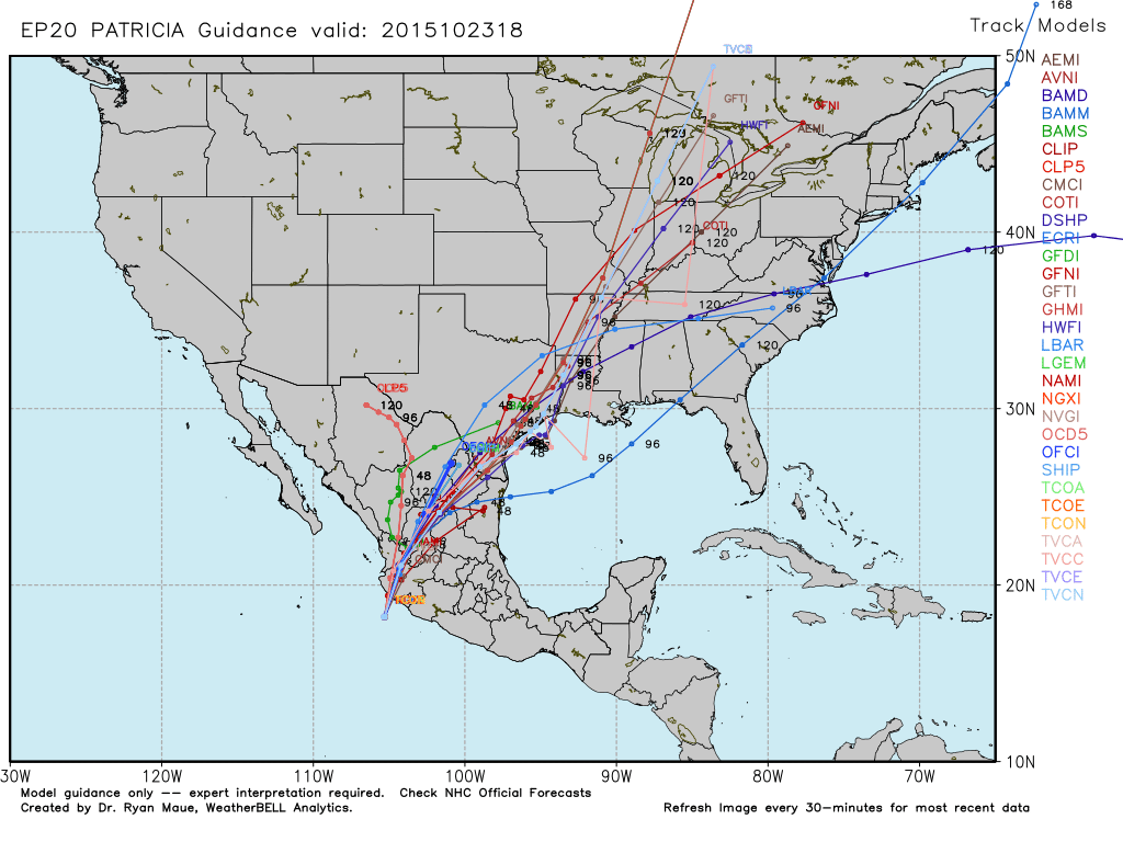
Hurricane Patricia is coming ashore on the Pacific coast of Mexico after reaching historical status over the past 24 hours. Unreal at how strong this thing is. What’s left of it will cross Mexico and emerge into the western Gulf of Mexico late this weekend.
There’s a chance this refires near the Texas/Louisiana coast and hangs out a few days before being drawn northward.Check out the hurricane models on this thing…
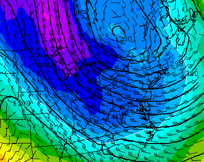
 This northward push happens as another storm drops into the plains states from Canada. Those two then hook up with each other by Wednesday and Thursday…
 That would bring our region high winds, heavy rains and the potential for strong or severe thunderstorms.
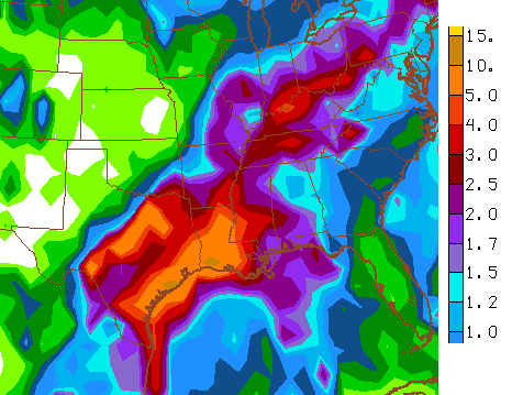
Many of the models are spitting out quite a bit of rain through Thursday…
 Much colder air then surges in here for Thursday as a strong northwesterly wind settles in…
 Highs Thursday may struggle to get out of the 40s.
Friday’s weather looks good with low 30s in the morning and 50s during the afternoon. Winds will still be very gusty.
The models then bring another potent system our way at some point Halloween/Breeders’ Cup weekend. The GFS is the fastest with rain arriving late Saturday…
 Not only is the pattern active for the final week of October, it should stay that way into early November. Big wind events and severe weather usually occur in a pattern like this. Behind these events come some decent shots of cold like the one showing up in early November…
 These systems will also take on more and more of a winter aspect.
A full update comes later tonight. Have a great evening and take care.

Awesome! I get to post before I leave work in the morning, then CB has another great update as soon as I arrive home this evening.
With such cold intrusions and an ever increasing southern storm track, I am wondering if this pre-winter will start earlier than last year in terms of possible wet snow accumulation. I know it will be very hard to beat the early season record cold of last November, but we really had no snow to post Christmas. I am thinking we might get a threat or two pre-holiday this year….also, keep the people of Mexico in your thoughts and prayers as Patricia is ridiculously strong nearing the coast!