Good Saturday evening, gang. I wanted to swing by for a quick update on the active weather pattern over the next few weeks.
I really have no changed to the overall theme of the forecast for the big storm system heading our way. The storm in the Gulf of Mexico lifts northward into our region Tuesday into Wednesday. That means our first taste of rain from this storm reaches us by late Monday.
Here’s the progression from the GFS…

Initially, that’s a chilly rain with some embedded rumbles of thunder Monday night and Tuesday. Warmer and more unstable air lifts through here by Tuesday night and Wednesday. That should give us a good shot at showers and stronger thunderstorms. Notice the line of storms showing up late Tuesday night into Wednesday. That could be a low-topped line of high wind producing showers and storms.
As he low bombs out across the Great Lakes, our winds stay very gusty through Thursday as colder air sweeps in.
We get a break in the action Friday into early Saturday, but another storm is going to try and push in here before Halloween is over. This one comes courtesy of a cutoff low developing just to our southwest. That could mean an extended period of rain and storms for our region…

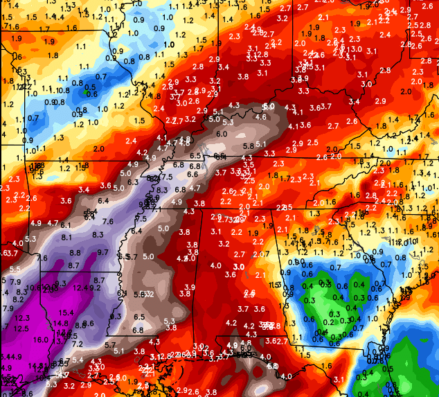
The models are spitting out some very high rain totals from Texas into Kentucky over the next week to 10 days…
We still have gusty showers to track this evening. I leave you with our new interactive radar…
Make it a great evening and check back for the late night update. Take care.

Not that this really matters but AccuWeather extended forecast which will change 500 times between now and next week has our first mention of snow November 25th and several chances after that.