Good Sunday to one and all. As expected, our weather pattern is making the transition into a very busy one across much of the country. That includes here in the bluegrass state as we track a huge storm system into the region over the next few days. To make matters worse, another potent system tries to follow late in our Halloween weekend.
Let’s start with what we have out there today and roll forward. A cold front is pushing across southern Kentucky today with a few leftover showers early in the day. Many areas see a nice afternoon and evening with highs today in the 60s.
Your interactive radar…
You can also zoom in on the system along the gulf coast. You might even find some live cams from storm chasers.
Speaking of the strong low pressure in the Gulf , it continues to develop into Monday. This is what’s left of Hurricane Patricia, but will it become tropical again? For our weather… That really doesn’t matter. This system throws moisture northward into our region starting late Monday with the action kicking into high gear on Tuesday. Gusty winds and widespread showers and thunderstorms develop. Check out the future radar from the NAM for Tuesday…
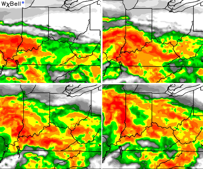
Heavy rains are a good bet Tuesday with temps only in the 50s.
The center of our storm is likely to work right up the Mississippi River Valley into the western Ohio Valley from Tuesday night into Wednesday. This low then gets pulled back toward the northwest as a negatively tilted trough captures it…
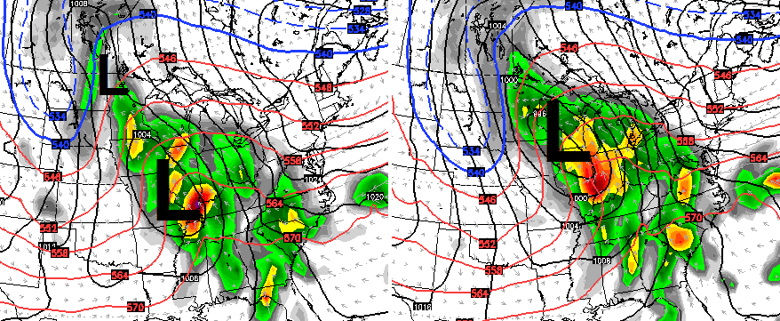
High wind gusts are a given in that setup. If we’re going to get some low-topped strong or severe storms, that would be the time to keep a close eye on.
That low then bombs out across the Great Lakes and drags much colder air into our region on Thursday…
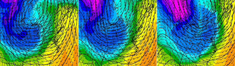
That’s a nice shot of late October chill that can keep temps in the 40s for highs on Thursday. Lows by Friday and Saturday should go below freezing.
The “interesting” potential with this setup is still there on the GFS. Look how close it gets with the flakes on Thursday…
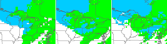
Close, but likely no cigars.
This brings us to Halloween/Breeders’ Cup weekend. Friday looks windy and dry with lows below freezing and afternoon highs in the 50s. Saturday finds another storm system to our southwest trying to throw rain in here before the day is over. As of now, the best rain chance comes Saturday evening through Sunday…

That’s a potent system that COULD keep produce some hefty rain totals into the first week of November.
Updates later today. Have a great Sunday and take care.

WOW: The recent frosty mornings followed by several warm, sunny afternoons have set the trees on fire in Harlan County KY. This is one of the best color shows I have seen in many years! Hopefully if the computer guidance is correct and keeps most of the rain north and west of my location, the fall colors may make a good show through most of next week. It really depends on how much wind makes it down here later next week too though…
looks like a dynamic setup this week i would.say possible severe with a.high wind warning in there somewhere but iIwill go with whatever you decide cChris. but this really looks like a complicated setup.
a couple more winter predictions .
http://i.imgur.com/lntHUby.png
http://i2.wp.com/bamchase.net/wp-content/uploads/2015/10/Screen-Shot-2015-10-21-at-8.54.10-AM.png
I honestly think its gonna be a snowy winter
Yeah, some have already been wrong (not mentioning the main streams who’s) on October’s much above normal temperature forecast. We are right within 1 degree of normal at the 25th!
I like the new radar but not imbedded on main page. It slows down loading and makes it difficult to view and scroll on mobile devices. Like it being available on Radars page but please stop embedding in posts.