Good Sunday evening. I wanted to drop by for a quick update on the busy week of weather for the week ahead of us. Overall, I really don’t have very many changes to what I’ve been talking about for the past week or so.
A storm system lifts northward from the Gulf of Mexico and merges with another storm system in the Great Lakes. That brings rain, wind and the potential for strong storms our way. Here’s the Monday Evening-Wednesday Morning progression on the GFS…
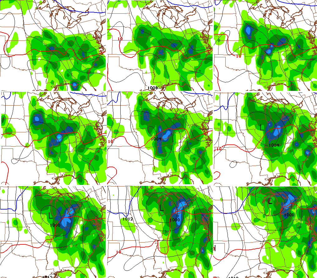
Here’s a breakdown of the week…
– Showers develop from south to north on Monday with steady rains arriving Monday night. Highs will be in the upper 50s to low 60s.
– Tuesday is a very wet day with the potential for a rumble of thunder. Temps will be held in the 50s.
– Tuesday night into Wednesday morning will find warmer, and slightly more unstable air into our region. Winds will begin to really crank as some thunderstorms develop. Low-topped showers and storms could produce strong wind gusts.
– The front appears to pass through a little quicker Wednesday with some breaks in the action later in the day. Winds will continue to crank as temps drop after a morning spike.
– Chilly, gusty winds blow on Thursday with upper 40s to low 50s for highs.
This takes us into the big Halloween/Breeders’ Cup weekend that is already getting my attention. Of course, a lot is riding on the weather that weekend. This we know. The entire weekend weather will be dictated by what happens with a slow moving system ejecting out of the southwestern states.
The GFS continues to bring the threat for late Saturday rains followed by a lot of wet weather…

Again, it’s all about the timing on when that system from the southwest moves east and northeast. This is not a setup to fully trust any run of the European Model. It really stinks on how it handles southwestern energy. As a matter of fact, wild variations will be possible in all the models.
A full update later tonight. Take care.

follow me at Redneck Bunker Handicapping on Facebook!!! for all ur capping action this week!!!!
Thanks Chris. Looks like a very wet week to say the least. Hope Halloween will stay dry until the little goblins are done at least. Been too short of a weekend. Ah well, already looking forward to Friday! Have a great Sunday evening all.
I know rainy Halloween weather isn’t great….but it does make the atmosphere feel much creepier with all the dead leaves on the ground, and dark windy/rainy weather.