Good Monday, folks. A lot of rain and wind is on the way to the commonwealth of Kentucky over the next few days. This is all part of a super-duper active weather pattern highlighted by the remnants of Hurricane Patricia moving into the region.
On Friday, Patricia became the strongest hurricane ever recorded in the western hemisphere, and slammed into the Mexican coastline just hours later. After weakening and crossing Mexico, that system is now along the Texas/Louisiana coastline. It may never be classified as a true tropical system, but the impact down there is the same.
The remnants of Patricia will then lift to the northward along the Mississippi River valley Tuesday and Wednesday. This will be the 2nd tropical system to impact our region this year. Bill brought flooding rains and high winds to the region back in June. I can’t imagine too many years in recorded history have given us June and late October rains from tropical systems. Maybe none?
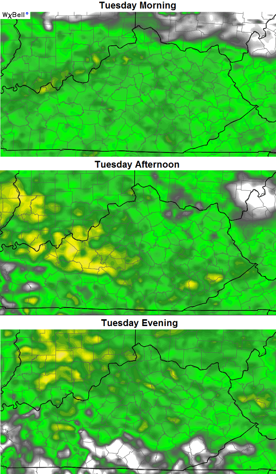
Let’s start with today and roll forward. Showers will increase from south to north as the day wears on. You can track it all on our new interactive radar…
Storm chasers may be active to our south and you can follow their live cams within the radar.
Speaking of the radar, check out the photogenic look of this spiraling system as it moves in later today through tonight…

A closer inspection shows the widespread rains for Tuesday…
Winds will really increase later in the day as a push of slightly warmer air moves in from the south. This allows for low-topped showers and thunderstorms to develop and sweep eastward into Wednesday Morning…
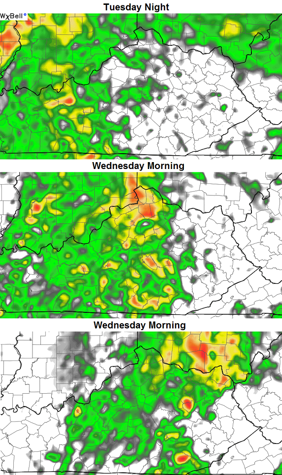
If we are to pop a strong or severe storm, that would be our chance to do so. The GFS is a little more impressed than the NAM with that Tuesday Night-Wednesday Morning timeframe…
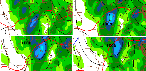
Regardless, wind gusts could top 40mph at times as the low strengthens to our north and northwest. That bad boy then pulls down much colder air. The NAM by Thursday morning shows the colder air surging in from the northwest as this system cranks…

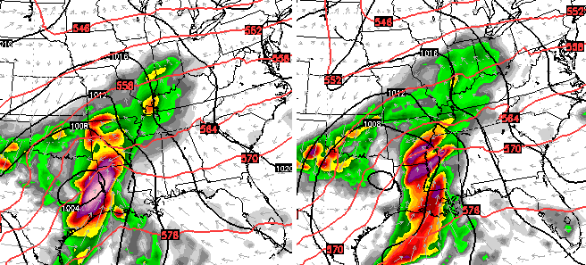
That shot doesn’t get to fully dive in here because there’s another system coming in from the southwest that’s pushing it along. This system arrives at some point over the Halloween/Breeders’ Cup weekend. The GFS is faster with the arrival time and doesn’t show the best looking Saturday…
Once again, it’s early and a lot can change with the timing and placement of that system. My twitter feed has been full of promises of a dry Breeders’ Cup and Halloween. Hopefully that’s the case, but it’s absurd to make a promise on such a huge event from a week away.
I will have another update later today. Enjoy your Monday and take care.

Looks like highs in the 40’s or 50’s for Thursday won’t make it?
I don’t comment often but I just want you to know how much we appreciate you, Chris. I am loving this beautiful fall weather. And I even like the rain, too. All sunshine and no rain is a desert. 🙂
Today’s weekly data pretty much confirms El Nino as a basin wide event..Region 1.2 has cooled the last three week’s..Now at 2.2..Was 2.5 a week ago..Region 4 is warmer and has tied a record for Oct. at 1.3 set in 2009..Region 3.4 is also warmer at 2.5..Record for this region in Oct is 2.6 set in 1997..Clearly the warmer water’s are shifting west..Just one piece of a puzzle of many that’s is trending in our favor..We hope.
http://www.cpc.ncep.noaa.gov/data/indices/wksst8110.for
I couldn’t find any June and October tropical systems in the same year to affect our region, but did find 2002’s ‘back to back jacks’ combination of Isidore and Lili in late September and early October that affected parts of Kentucky with heavy rains and river rises.
So far, Tucson AZ NWS still putting faith in Euro model, keeping cool and unsettled weather through early Saturday for them. Projecting a progressive and open low after that would still favor a dry Saturday for our region, maybe even most of Sunday too. Still, it’s early but am cautiously optimistic.
Looks like SE KY is back in the pattern of missing all of the good rain again:( Oh well, maybe we will be favored for the big snows this winter!!!