Good evening, gang. My time is short, but I wanted to drop by for a quick update on the timing of the weekend storm system.
The NAM and European Models are among the wettest of the bunch for Halloween. They both bring the rain in from west to east during the day and show the action increasing during the evening and overnight.
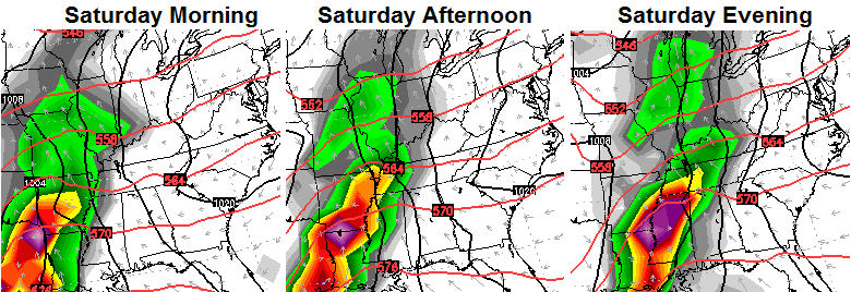
Here’s the European…
 The NAM simulated radar for Saturday afternoon and evening…
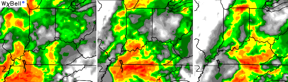 Both of those models would make for an ugly day in the bluegrass state. That said… some of the other models aren’t as wet and have the rains arriving later in the night. Let’s hope those are onto something, but the NAM/European alignment is often hard to beat.
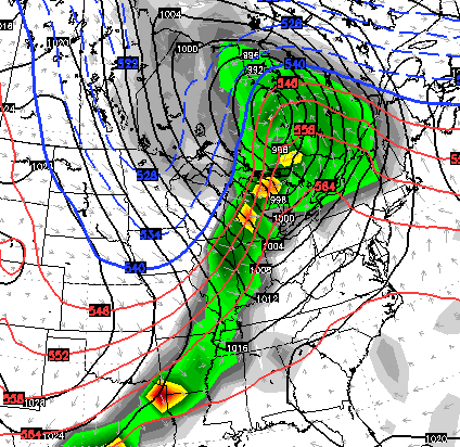
Looking down the road… temps spike into the 70s next week before a powerful cold front brings storms and colder weather by the following weekend. This has a potent look to it…
 I will have another update for you later tonight. I leave you with your radars to track scattered showers through here for the rest of the evening…

Enjoy the evening and take care.

Thanks, CB! 🙂
A few isolated lightning strikes along the Ohio River west of Louisville and near Cincinnati, even a few in east Tennessee. But even these are dying off. Everybody enjoy the abundant sunshine coming our way the next few days!
Chris you sure are not giving much winter talk I guess maybe you thinking we are not oing to have a very bad winter?