Good Sunday evening, folks. Clouds continue to hang tough across the region as we watch another system try to throw some rain back into the region tonight and Monday. That’s how we start a week that will feature a bigger system coming into town by Friday.
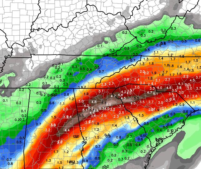
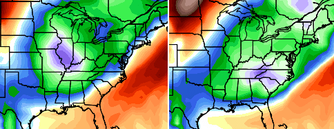
Let’s start with the rain chances to start things out. This southern stream storm should deliver a glancing blow of rain to central and eastern Kentucky. The farther southeast you go, the heavier the rains…
 Once that gets out of the way, temps start to mild up for the remainder of the week. Things aren’t looking quite as warm as what I was thinking a few days ago because of low level moisture hanging around. Highs from the upper 60s to low 70s should still be a good bet from Tuesday through Friday.
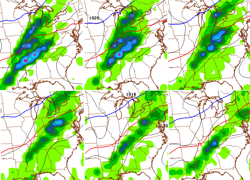
The low level moisture could also squeeze out a shower or two during this time. The NAM future radar for Wednesday shows some returns…
 Any day with clouds or showers could keep temps under the forecast values.
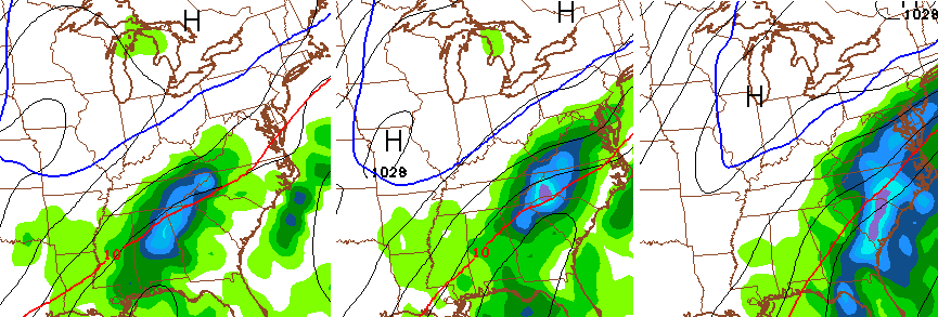
The next storm system arrives Thursday night into Friday with an increasing threat for gusty showers and thunderstorms…
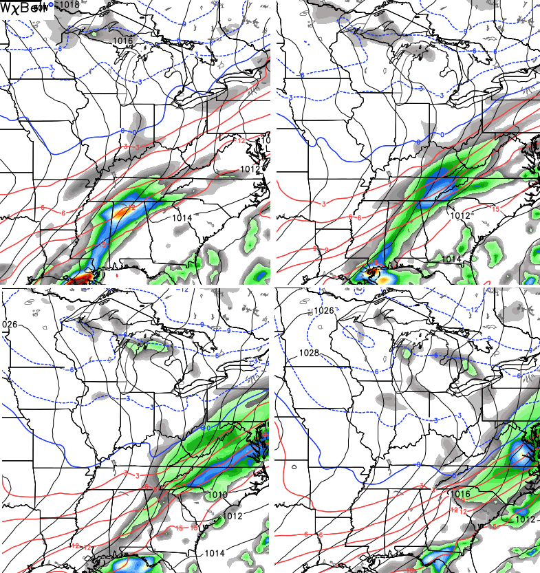
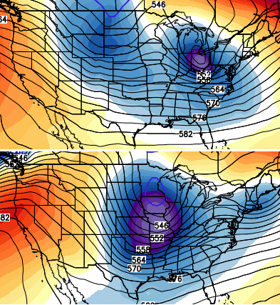
 Notice how that front appears to be slowing down across the region. All the models now suggest this and bring a second low across the Tennessee Valley and into the Mid Atlantic states over the weekend…
 That’s from the GFS. The Canadian model is similar, but colder…
 That would be a good look for the winter months. It is interesting to note the fall storm track setting up is for these big systems to pass just to our south and east.
Once that system passes, we should see a nice shot of seasonal cold invade the region. The GFS Ensembles have a nice shot of below normal temps centered on our region during that time…
 I’m still watching the middle of the month for the potential of a bigger amplification of the pattern across the country. That continues to show up as a pretty good signal…
 See you later tonight for the regular update. Take care.

Thanks Chris. Have a good evening.
I’m not sure how to take that when you said:
the storm track is setting up for storms to go just to our south and east. Is this a good or bad thing? I know snow lovers want to storm to go south of there, but as this last storm is doing, had it been cold enough for snow, we wouldn’t have gotten anything at all because no precip fell, so I’m thinking that is a bad thing for snow lovers perhaps?
Dense Fog becoming a issue region wide