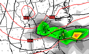
Good evening, folks. A strong cold front is rolling toward the bluegrass state and will throw some showers and storms into western Kentucky overnight. Some of those storms could be on the strong side with gusty winds. I will get to your trackers in just a bit.
Before then, let’s touch on a very active pattern revving up. It’s one that is just itching to really see a significant amplification around the middle of the month and beyond.
We’re likely to get a system coming our way every 2 or 3 days in this setup. After Saturday morning showers usher in colder air for the weekend, another shower maker approaches by Monday…
 A much stronger storm will then sweep in here later Wednesday and Thursday or next week…
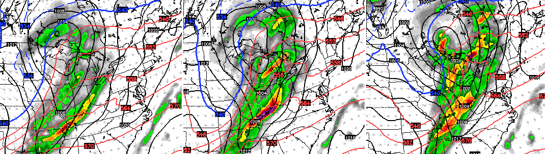 That one moves away with another system trying to replace it a few days later. This brings us into the middle of the month and there continues to be a signal for a big amplification of the jet stream at some point. The GFS offers a wild solution during this time…
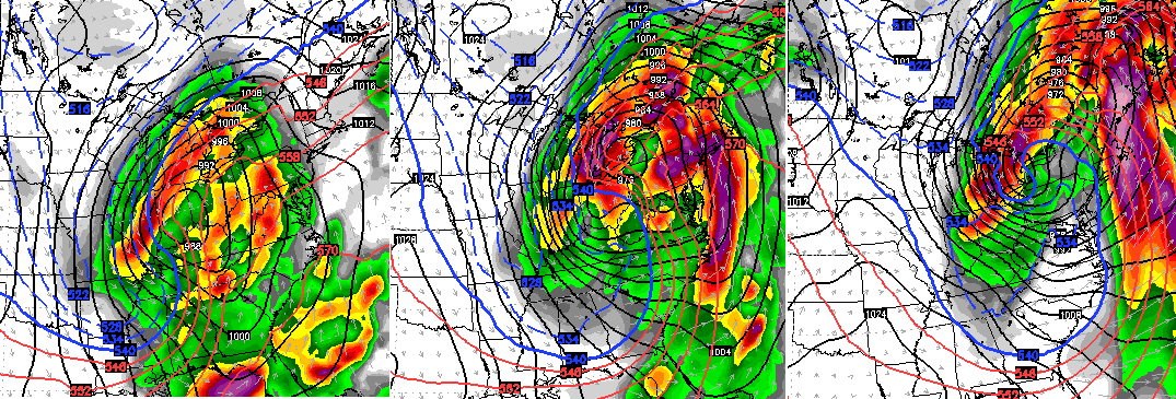
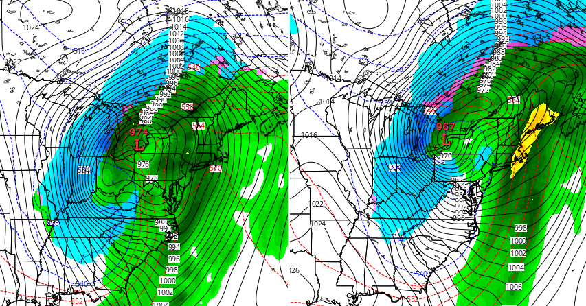 Now, I’m not crazy enough to believe any model solution from 2 weeks away. However, this is the type of pattern that can produce a major early season headline making storm somewhere across our region.
I will update all this later tonight and show you a new forecast for the upcoming winter. Until then, let’s track some storms into western Kentucky. Don’t forget to use the interactive radar to follow the severe weather to our west. Live storm chase cams are going.

Current watches

Possible watch areas 

Take care

Love those models! May not happen that way but isn’t it neat to get in to the fun and games?
And let the games (model madness) begin!