Good evening, folks. Showers continue to push across the state as one storm system works off to our east and northeast. That leaves us watching for the next, more powerful, system to roll into the region later Wednesday and early Thursday.
This storm really wraps up as it moves from the plains to the Great Lakes. That drags a cold front across Kentucky with a line of showers and thunderstorms…
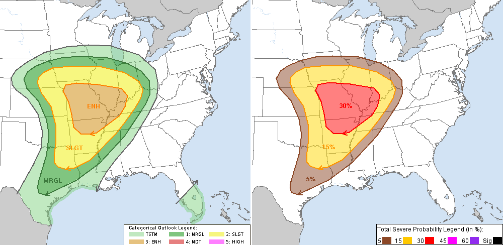
 The high wind threat is what to be watching for with this setup. Even without thunderstorms, winds are going to be very gusty. There is a lot of wind upstairs and any thunderstorm could be able to transport that down to where we live… especially in western Kentucky.
That’s where the Storm Prediction Center is highlighting for the best chance for some severe storms…
 I will update on where we go after that front with my late night update. Until then, track the leftover showers across our region…

Take care.

Prelude and mike s. Everybody has there opinion and I made mine. Wasn’t trying to be disrespectful.