Good Sunday to one and all. Our weekend is wrapping up on an absolutely gorgeous note with some sun and pleasant temperatures. After today, things begin to get a little bumpy with a big storm system rolling in through the middle of the week ahead. After that, the pattern starts looking a lot like winter across much of the country.
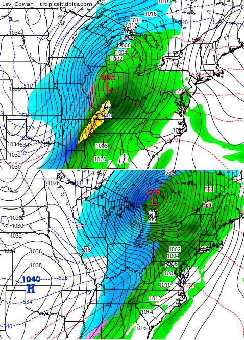
This huge storm develops across the Rockies later today and rolls SLOWLY into the plains early this week. It throws some scattered showers and storms into western and central Kentucky Monday into early Tuesday. The majority of the heavy rain and storms comes late Tuesday through Wednesday. That’s when this wall of water slowly crosses the state…
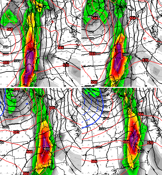
Rainfall numbers could be very high across the west. I can see some 3″-4″ totals in that area. General 1″-2″ amounts across the central and east would be possible, with locally higher amounts.
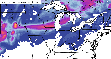
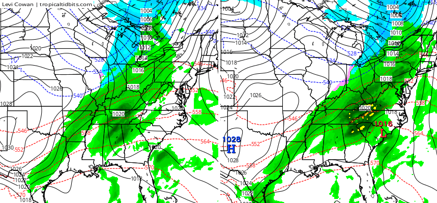
Much colder air comes in behind that late Thursday into Friday with another system arriving over the weekend. The models go back and forth on how to handle this. One would expect that from a week away and with such a hyperactive pattern in progress. Throw a significant pattern change into the mix and that’s what you get.
The latest GFS shows a cold front sweeping through here Saturday with some rain and snow…
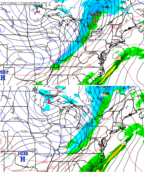
That’s a very cold shot of air coming in behind whatever we see developing with that front. The same GFS shows another borderline system right behind it…
Check out what it does for Thanksgiving and Black Friday…
Once again, don’t get too caught up in that run or any single run of a model. From this far away, they’re only being used to get a general idea of the overall pattern. This is also a pattern that does not bode well for the European Model. It typically does not do well with this much energy diving into the west then swinging eastward. User beware.
This is a cold pattern setting up, any potential snow chances will be dealt with on a system by system basis as we get closer.
Overall, I feel like I have a pretty good handle on this pattern. A few weeks ago, I said to watch for a major amplification around the middle of the month and that’s coming this week. I was asked on twitter and on WKYT-TV when I thought we would see our first flakes. I replied with Thanksgiving week. That doesn’t mean we will, but it makes me feel pretty good about my thoughts heading into winter.
Speaking of… the winter forecast on WKYT-TV will be Wednesday November 25th… the last day of ratings. I guess they want to go out with a bang… or a dud. Time will tell, as always. 🙂
I will have another update later today. Take care.

Thanks Chris. Yesterday was about as perfect a fall day as one could ask for around here. Today sounds like another one for sure. Going to get out and enjoy it, as it looks like it will be the last one for a while. Have a great Sunday everyone. Thanks again for all you do Chris.
Looking forward to the winter forecast Chris!
Rodger loves waking up on a gorgeous Sunday morning surrounded by his man cave seeing wintery maps like this! Bring on the flakes!
So your saying it will snow 3 feet on Thanksgiving? Just kidding 🙂 Thanks, Chris !
Flakes on the maps…? Where’s Rolo?
The last system that rolled through here with rain and cold sent my shoulder, 4 surgeries, and knees to hurting really bad. Last year did the same the whole winter. I sure hope this isn’t a sign that we are in for another winter like last year. I’m still hoping that the few wooly worms I saw this year, black at the beginning large area of brown in the middle and a small section of black at the end will be right this year!
Doesn’t that mean a harsh winter?
An all black wooly worm means a harsh winter. I saw a HUGE all black wooly worm in Versailles outside the library last week. I’m excited to see what this Winter holds! 🙂
If I am correct Corey, black means harsh and brown means milder. I’m 57 and have heard since I was a kid the story of the wooly worm. There are numerous other signs that were told every year at the start of winter. The larger the ice crystal’s around the moon, the deeper the snow will be is another One thing I do know is my knees and shoulders hurt very badly when a cold front is coming.
What a beautiful stretch of weather we’re having.