Good evening, all. A big storm system will impact our weather over the next several days and will bring a lot of rain our way by the middle of the week. My focus continues to be on what comes behind that as we head toward Thanksgiving Week.
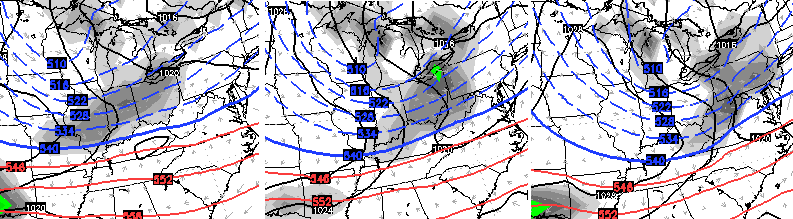
A shot of much colder air sweeps in late Thursday into Friday. The GFS and European Models show another system zipping into the Ohio Valley next weekend, but differ on how to handle it. The European shows a flatter system…
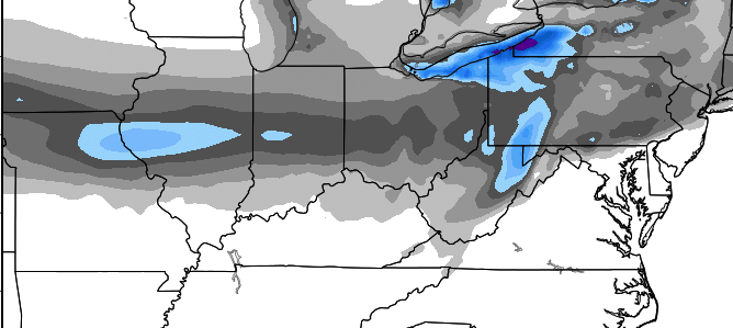
Here’s the snow forecast from that run of the European Model…
The GFS has more of a storm system working across the Ohio Valley into the Great Lakes…
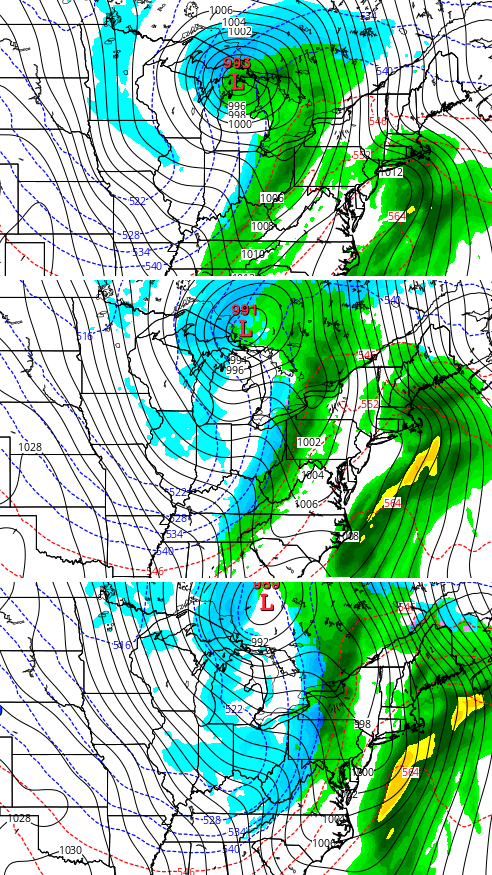 The snow forecast from the GFS…
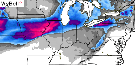 As you can see, both models suggest the potential for our first snowflakes at some point next weekend. Doesn’t mean that’s going to happen, but the models support the possibility. Check out the raw data from this morning’s GFS for Lexington…
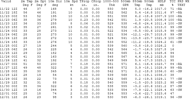
The date is on the far left and the precipitation type is on the far right. Looks fairly wintry through the start of December.
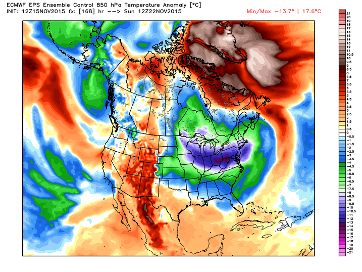
The European Ensembles agree. Check out the cold next weekend…
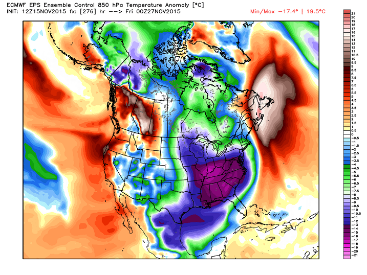
 That same run for Thanksgiving show a much more expansive cold shot…
I will have a full update later tonight. Take care.

Buckle up and enjoy the ride.
Thanks for the extra update.
Wow! Looks like the cold is going to make itself felt in a hurry! Thanks Chris. Looking forward to the next post.