Good Monday, everyone. Here’s hoping you had an excellent weekend and had a chance to get out and enjoy the nice weather. Why? Things go downhill this week as another big storm throws wind and rain our way. After this, our pattern takes on much more of a wintry look as we head into the final two weeks of November.
Showers and isolated thunder moves into western Kentucky today and may reach parts of central and eastern Kentucky by evening. Locally heavy downpours are possible in the west.
Tuesday finds scattered showers and storms in the west with mainly dry weather in the east. Winds will be gusty and temps should take off during this time. Our storm system then works into the plains states and sends a wall of heavy rain and thunder from west to east across the state Wednesday…
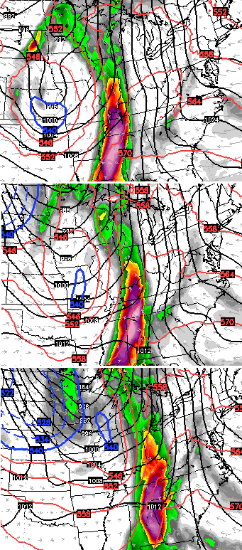
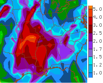
Rain totals will be highest in the west with local 3″-4″ amounts possible. Farther east, a general inch or two is possible…
Winds will also be a big factor with gusts pushing 35mph at times late Tuesday through early Thursday.
Much colder air pushes in Thursday into Friday, but it’s nothing out of the ordinary for this time of year. Winds are still going to be gusty ahead of another system working quickly into the region over the weekend. That one has the chance to bring some wintry weather to the Ohio Valley.
Here’s the Canadian Model…
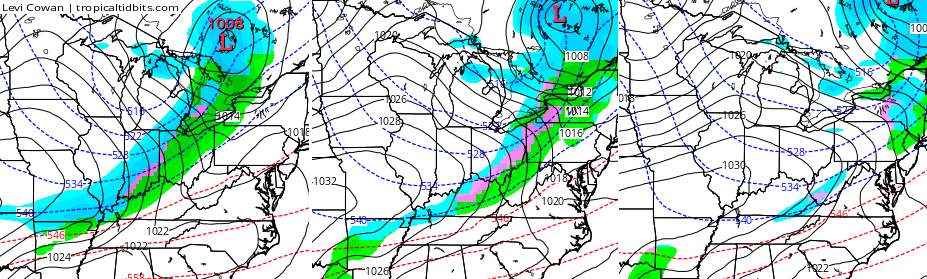
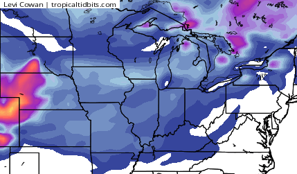
All the models flip from run to run with how to handle the weekend system and the various cold shots Thanksgiving week. As I have said, don’t get too caught up in any one run of any particular model. All I can tell you is the pattern is going colder and it suggests we could see our first flakes of the season before November is out.
I will have another update later today. I leave you with your toys to track the approaching rains from the west…

Enjoy your Monday and take care.
