God evening, folks. It’s another ugly day wrapping up in the bluegrass state, and we have some more ugly to go through this week. That said, it’s all eyes on a monster of a storm developing this weekend into early next week. It’s one that can bring some very wild weather our way.
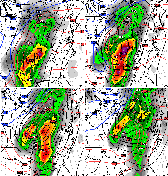
All models not named the GFS show a big ticket storm. The European Model continues to show this bad boy very well…
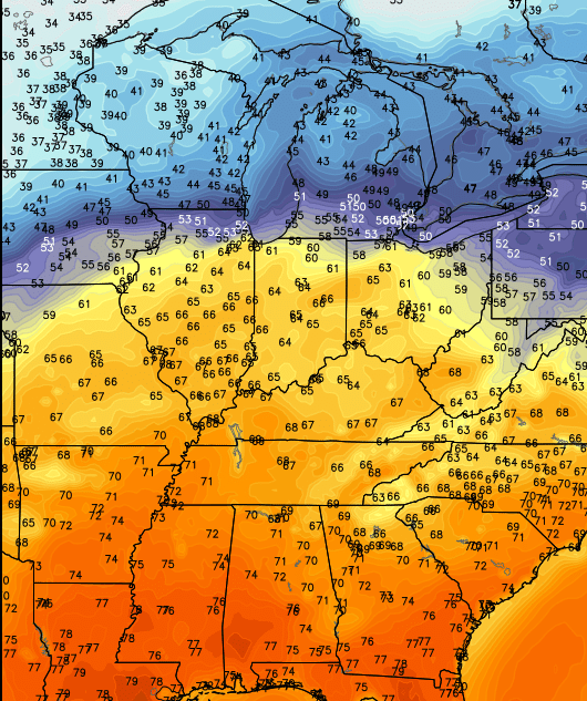
Ahead of this storm… temps surge on a strong southwesterly wind flow…
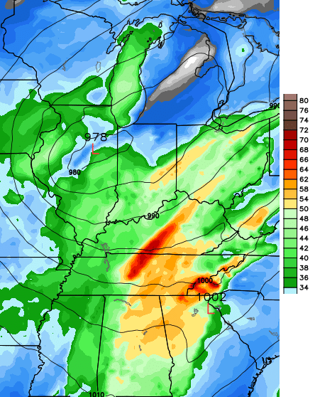
Humidity levels and instability increase during the same time. That could set the stage for strong or severe thunderstorms from late Saturday night through Sunday night. Damaging winds would be the primary threat if these storms develop.
With or without thunderstorms, damaging winds may still be a problem. The latest wind gust forecast from the European Model suggests pockets of 70 knots across our region late Sunday…
That’s absolutely absurd to see on a forecast model and should be getting folks attention. If that’s even close to verifying… widespread damaging winds would be possible.
A big temperature crash comes in behind the departing storm and that could lead to a few flakes flying.
I’ve mentioned how this storm should force the pattern to change up a bit, and that still appears to be the case. We notice the mean trough position shifting from the Rockies into the Mississippi Valley next week. That would allow colder shots of air in here and force the storm track farther south and east. The European Model next Tuesday and Wednesday…
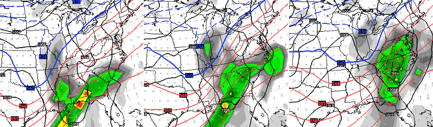
The Canadian at the same time…

I’ll have a full update later tonight. Until then, enjoy the evening and take care.

We have seen temps hit 70 degrees and the following week get hit with a foot snow. So anything can happen.
Sure need something to shake the pattern up..Hopefully the cutter will do the trick..Just don’t seem right mowing in Dec..