Good Sunday to one and all. We have another day of potential record setting warmth across the bluegrass state, but high winds will try to steal the show later tonight. All of this leads us into a new week that sees honest to goodness December air show up before it’s over.
Highs today will hit the upper 60s to low 70s as clouds thicken and winds increase. These winds will really ramp up tonight and early Monday with a few gusts of 40-50mph possible. A wall of rain, with some embedded thunder possible, sweeps into western Kentucky later today. That will then cross the state tonight into early Monday.
Track away…

Temps behind this front will still be above normal into the first half of the week. We just won’t have the crazy stuff like we have out there this weekend.
The December air shows up behind a strong cold front moving in late Wednesday into Thursday. Colder air really presses in behind that by Friday and Saturday…
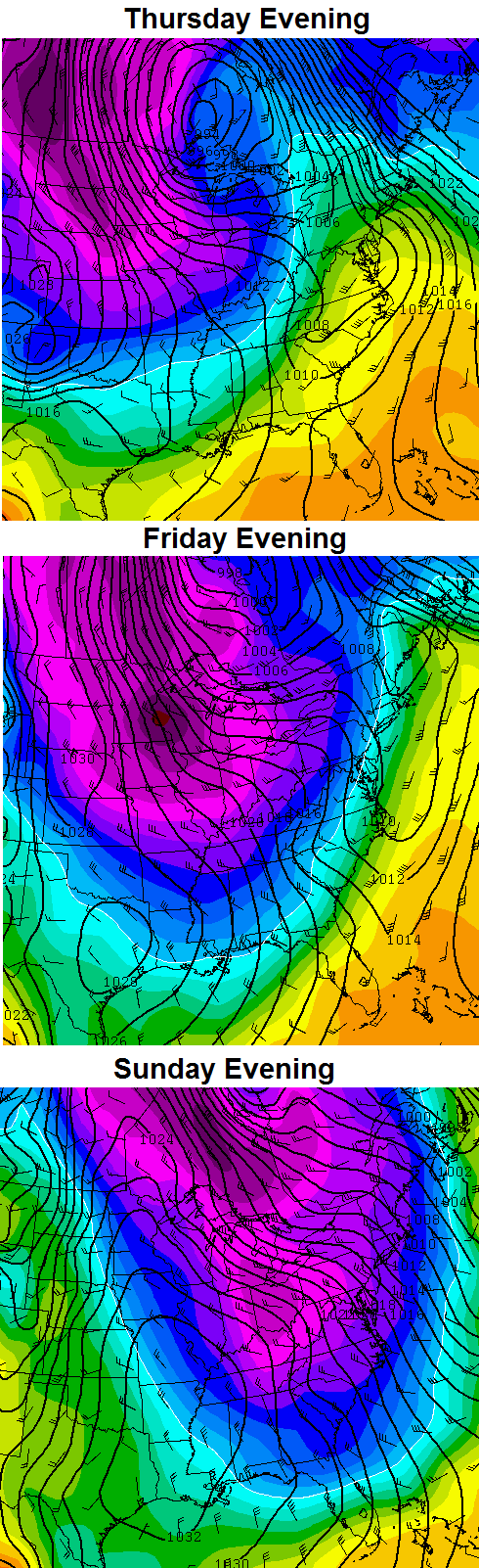
That flow on the European Model would be able to tap some of the warm Great Lakes water to help produce snow showers and flurries around here.
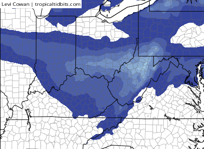
The GFS continues to bring a disturbance in from the northwest late Friday and Saturday with a band of light snow…
Regardless… this is going to be a major shock to the system with temps that may drop into the teens for lows next weekend.
That is NOT winter locking in by any means. Christmas week is likely to feature some VERY big temperature swings with two big storm systems possible. That week could be fun to watch with such big temp gradients.
I will have another update later today. Enjoy another day basking in the December warmth and take care.

Snow drought will continue a few days of temps slightly below normal late next week into the weekend before bumping right back up into the 50’s.
More like high 60’s heading into Christmas..Tis warm and gonna get warmer..Horrifying pattern..Santa delivering presents on the John Deer..
Yeah I agree wouldn’t surprise me to see a 60 degree temperature.
This December warmth has been a real treat for my wife and I as we ventured out to hike Natural Bridge yesterday. Something we rarely ever do this time of year!
On the other hand, this winter weather lover could really use a change of scenery. Hoping Christmas week can feed that appetite a little. Looking forward to seeing how this winter plays out and when the big “flip” decides to show itself.
Yeah, most other weather sources do agree with low 20s and upper 10s next weekend for lows but right back into the 50s and 60s for Christmas week for highs with above freezing nights. This December is almost certain to land in the top 10 warmest!!!
Thanks Chris. Apparently everyone thinks the week if Christnas is all warm, and they bay be right. But you said “Christmas week is likely to feature some VERY big temp swings with two storm systems possible. That week could be fun to watch with such big temperature gradients.” That tells me that the whole week is not going to all be so warm. Guess we will see. Thanks for all you do. And other weather lovers, this is no pun intended at your thoughts. Have a great Sunday evening all. Let’s go sing a Contata.
If those in eastern parts of KY and TN are wondering where the strong winds are, well it won’t be long. It’s really blowing in the last few hours in Nashville where the airport has recorded a 40mph wind gust.
Folks I can remember it hit 80 degrees on Christmas day back in early 70’s and yes this was at ky. Any thing can happen.