Good Tuesday, everyone. We continue to find temps running above normal across our part of the world, and that trend takes us into Wednesday. After that, we will track some honest to goodness December type weather across our part of the world.
Today will feature clouds slowly eroding from south to north with a temperature gradient setting up in similar fashion. Winds won’t be nearly as gusty, but some decent breezes will be noted.
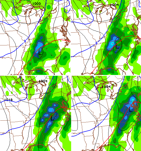
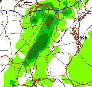
Wednesday finds our cold front working into western Kentucky during the afternoon with windy and mild temps ahead of it. That front moves eastward Wednesday night as our wave of low pressure develops along it. That should mean some chilly, soaking rains across central and eastern Kentucky into early Thursday…
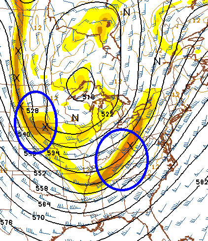
Temps take a tumble from west to east behind this front with most areas in the 30s by Thursday evening. That sets the stage for a big dip in the jet stream on Friday with a couple of decent disturbances embedded within the flow…
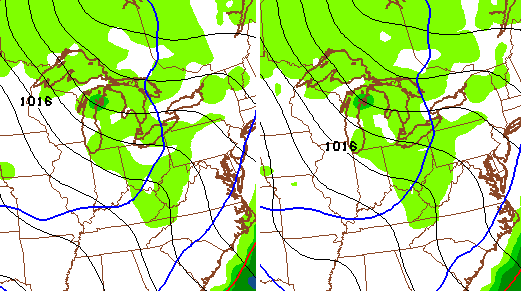
With low-level moisture rather plentiful, these disturbances can kick off plenty of flurries and even some out and out bands of snow showers. Something else to consider is the Great Lakes. They are way above normal and could throw some moisture our way. The GFS is even picking up on that across central and eastern Kentucky…
The more I look at this, the more I think it’s possible for a few spots to pick up on some very small accumulations. That’s especially true Friday evening across the east. Now, don’t get too carried away by me saying that. I’m not talking about much more than rooftop coatings.
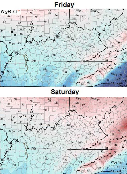
Temps during this time are going to be a BIG shock to the system. Here are the highs from the GFS…
Gusty winds will make it feel even colder through the weekend.
As temps recover late Sunday and Monday, moisture will quickly increase. A round of moderate rain should push back in from the west and southwest…
 This kicks off what is likely to be a super active Christmas week across much of the country. Temps continue to spike into the first half of the week as rounds of heavy rain roll our way. A potent storm system develops across the plains and works into the Ohio Valley and Great Lakes by Christmas Eve. We will get into that a bit more in future updates.
Make it a terrific Tuesday and take care.

One thing is absolute sure there will be no snow of any consequence till after the New Year. A quick shot of cold that has no staying power and then right back to above normal temps.
It would be great to see a snow flurry on christmas day! Think positive about the snow!
not sure what some r looking at, but Christmas forcast look be upper 40s low 50s temp wise. so that’s a bummer at least like it to be COLD!!!!
Your being conservative upper 50’s lower 60’s possibly it’s like having Christmas in the panhandle of Florida
I’d at least like some cold weather for Christmas, please. Not only does the warm weather not feel like Christmas time but it messes up the storage of my Christmas foods. Lots of food being made for Christmas dinner and I like being able to keep some of the food outside on the back patio in nature’s refrigerator/freezer. It’s hard to find enough room in the refrigerator. Guess we’ll just have to eat it all instead of keeping left-overs, lol.
I remember a Christmas in 78 or 79 can’t remember exactly witch year. It was raining like crazy with mild temperatures. We went to my brothers house to exchange gifts without a jacket.
It wasn’t the temperature that I would have chosen, but once we got inside with the family, eating and exchangeing gifts we forgot that it wasn’t cold and snowing outside. Had a wonderful time!
I remember lots of warm Decembers across my 50 years….I remember several when we still had flowers blooming in our flower beds…but winter always showed up eventually…and will again!
Remember the winter of 84/85? Many December days in the 70s with zero snow for the month. January-February had a nearly 5 week stretch without temps getting above 40 with lots of snow. Temps hit -20 at one point.
I was going to bring up a point about 84-85, but you beat me to it. President Reagans’ inaguration was moved inside because of the cold. It was the coldest air in much of the Eastern U.S. since February of 1899!
Yea, in January 1985 the Florida citrus industry was devastated. Orlando and Tampa dropped into the teens which resulted in even citrus trees being killed, not to mention the crop itself.
An interesting side note about Reagan is that his first inaguration (Jan 1980) was one of the warmest inagurations ever!
Did you forget December 5? Several places saw freezing rain and heavy snow between 5-10″ fell across the west and north.
I just want it to be cold for Christmas. If I wanted temperatures like this in December, I’d move to Florida.
I agree I hate ky weather
Thanks Chris! Maybe I will finally get to wear that cute Christmas turtleneck this weekend! 😉 I will take the cold weather however we can get it for now, even if it is the yo yo effect. We might be wishing for these temps later on. Have a great Tuesday everyone!
It seems that our pattern shift keeps getting postponed…. I think Bowling Green might have to wait until January for the first flakes unless we can possibly send some snow our way Friday.
That’s not happening you’ll be awaiting till January for snow.
Well….. That`s Exciting! 🙁
1984-1985 brings an interesting parallel to this year. There is also the comparison of 1889-1890, the warmest winter on record for Kentucky. December 1889 was slightly warmer than this December but the warmth carried on through January and February. December 1984 was also very warm, but January and February of 1985 featured some brutal cold shots, including the coldest air in much of the Eastern U.S. since February 1899.
Good to see you back, Chris.
One other interesting comparsion is that both 1984-1985 and 1889-1890 were La Nina periods (of course, we’re currently in a strong El Nino)..
But Chris Bailey and a few other wise mets have stated over and over that no two La Ninas are exactly the same and no two El Ninos are exactly the same. Also, as very strong as El Nino/La Nina can be on shaping our weather, they are still far from the only factors.
If this mild weather is due to global warming… I’m all for it!