Good evening, folks. We have a blast of actual December on the way later this week into the start of the weekend. Ordinarily, this wouldn’t be a big deal, but this isn’t an ordinary December.
Temps spike ahead of a strong cold front rolling in late Wednesday. That front has a few showers along it, but the real action comes with a wave of low pressure developing along it. That low will likely put down heavy rains across the eastern half of the state…
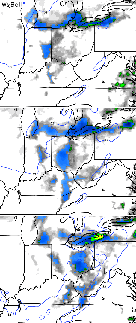
 Temps tumble through the 40s on Thursday with 30s for highs showing up Friday and Saturday. A few snow flurries and snow showers will also show up Friday into Friday evening. That’s mainly across central and eastern Kentucky. Here’s the simulated radar from the NAM…
 Again, this isn’t a big deal, but it’s a big shock to the system. There’s a small chance for a rooftop coating or two in the east before the flakes wrap up Friday night.
From there, we focus on a big storm system coming for Christmas week. Temps warm early next week as waves of heavy rain move in. Precipitation totals through Christmas are impressive…
 Can we get some cold and wintry stuff by Christmas Eve or Day? There’s a chance at this point. Notice how the warm flow gets replaced by a typical brand of colder air…
 Enjoy the rest of the evening and take care.

Keeping fingers crossed for a white Christmas, even just a little will work!
If you go by the Euro model we should see 70’s on Christmas. Yippee!!!
Blowtorch….
Called it since October.
Can we please block prelude… Just kidding