Good Wednesday, everyone. We have another very windy and mild day taking shape across the bluegrass state. This action is ahead of a strong cold front barreling our way from the west later today into early Thursday. A taste of wintertime blows in behind this for the rest of the week into the start of the weekend.
Highs today reach the 60-65 degree range for most areas as winds gust up from the southwest. Clouds increase quickly this afternoon as showers move into western Kentucky.

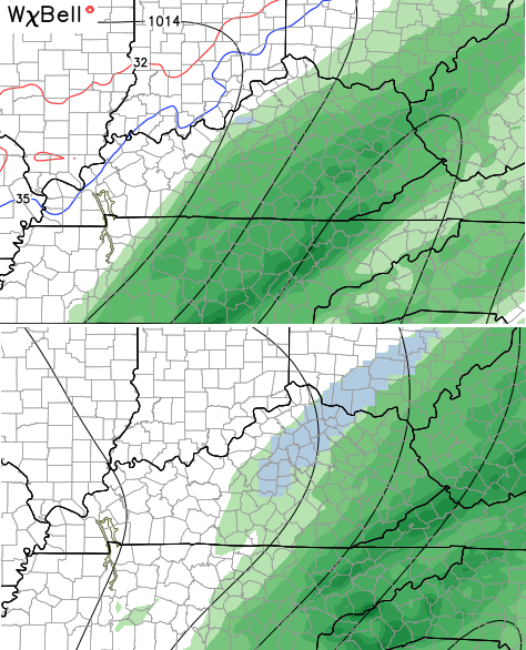
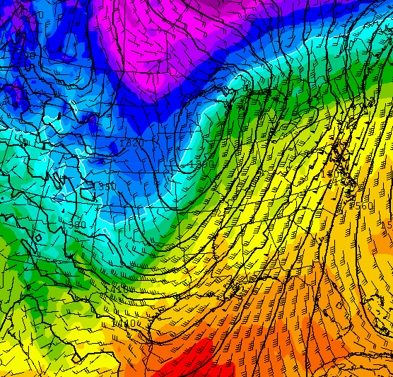
That action then increases the farther east we go tonight into Thursday morning as a wave of low pressure develops along the front. The GFS throws a new wrinkle into the mix with a colder solution and the potential for some snowflakes to mix in on the back edge of the rain…
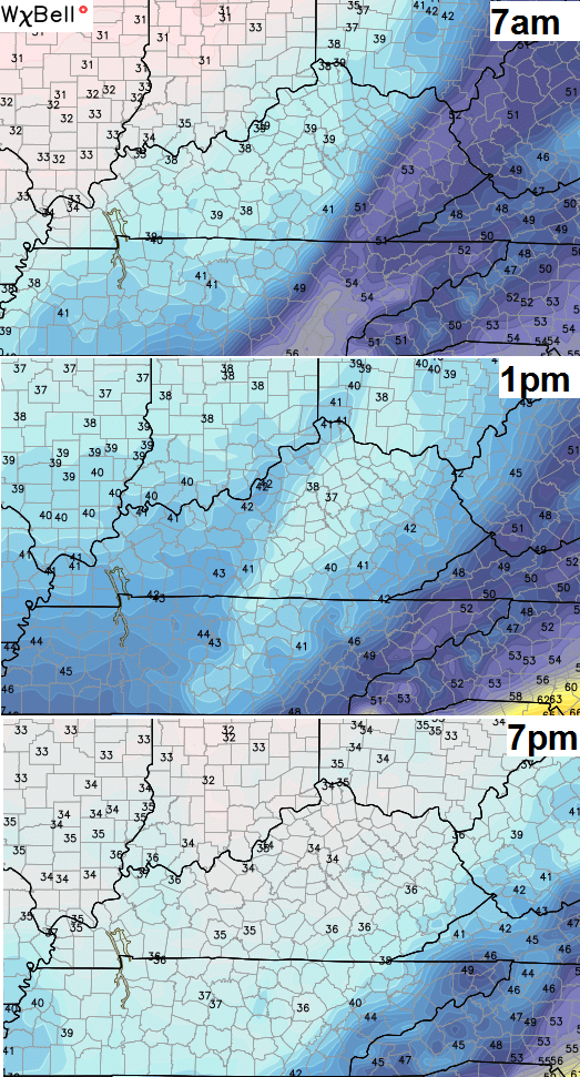
 Notice how quickly the cold air filters in on Thursday…
 With that wave of low pressure… heavy rain is a good bet across southeastern Kentucky. Some areas could pick up greater than an inch of water…
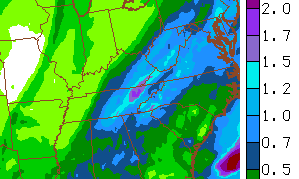
Even colder air filters in for Friday and Saturday with highs in the 30s with gusty winds making it feel even colder. The threat for some snow flurries or light snow showers will be with us Friday into Friday night. The Hi-Res NAM shows the flakes developing by Friday morning…
The pattern for Christmas week continues to just look very ugly. Temps turn mild early in the week on a strong southwesterly wind flow setting up…
A lot of rain is possible next week and I’m already watching for another storm system to potentially impact our weather later Christmas weekend. All this wet weather in the Ohio Valley and Great Lakes isn’t very strong El Nino-like.
I will update later today. Enjoy another mild one and take care.

If this type of weather continues through January, winter lovers need not give up, because things can change drastically….Not saying that will happen, but I’ve seen this happen so many times in the past. No winter at all, then February ……….
Christmas time snow > some random snow toward the end of winter.
The mega snows we got this year were enough for a few years, so no harm no foul if so for me. No shoveling for hours is a win 🙂
That said, if we have a wimpy temperature winter the bugs will be bad this summer and we are usually more susceptible to ice events.
La Nino..
Noticed today some type of fruit tree, cherry, plum? had buds starting to open. Also there were honey bees on all the dandelions that popped up last week. I am 52 years old and I remember some warm days in Winters past but it was brief periods not extended like this year. This is bizarre
We are on the cusp of a mini ice age and Kentucky will be the frozen tundra zone 😉
Don’t worry about the warmth… It’ll get cold the week after next!!! 😉
Local Mets in Louisville are forecasting high temperatures on christmas day to be over 70 degrees. The record high is 71! Will we break the record? What I want is some cold temperatures and a little snow for christmas!