Good Thursday, everyone. Much colder air continues to sweep eastward across Kentucky, ushering in a true December feel for the next few days. This cold air could even bring about a few snowflakes as we roll into the start of the weekend.
Temps today will drop into the upper 30s and low 40s and hang around there throughout the day. A shield of rain pushes through central and eastern Kentucky, and exits by the late afternoon hours. Some sunshine may even be noted before all is said and done.

Friday brings about a cold day with temps only reaching the 30s for highs and a quick drop into the 20s once the sun sets…
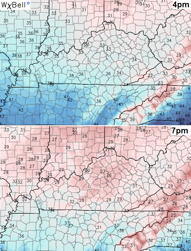 A few snow flurries will dance about the air from time to time with the best chance across the central and east. Some out and out and snow showers may be noted in the north and east with the possibility of a rooftop coating in a spot of two.
Saturday is a seasonally cold day with sunny skies back in the bluegrass state.
Sunday looks milder with some clouds rolling back in. Those clouds will produce more rain on the region by Monday…
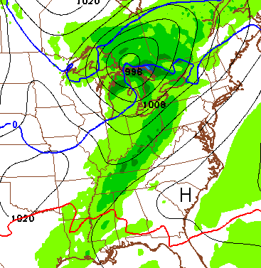
This kicks off an absolutely wild Christmas week with two big storms set to impact our region. The first one moves later Tuesday and lasts through Christmas Eve. The air in front of this is very mild to go along with heavy rain and some thunder…
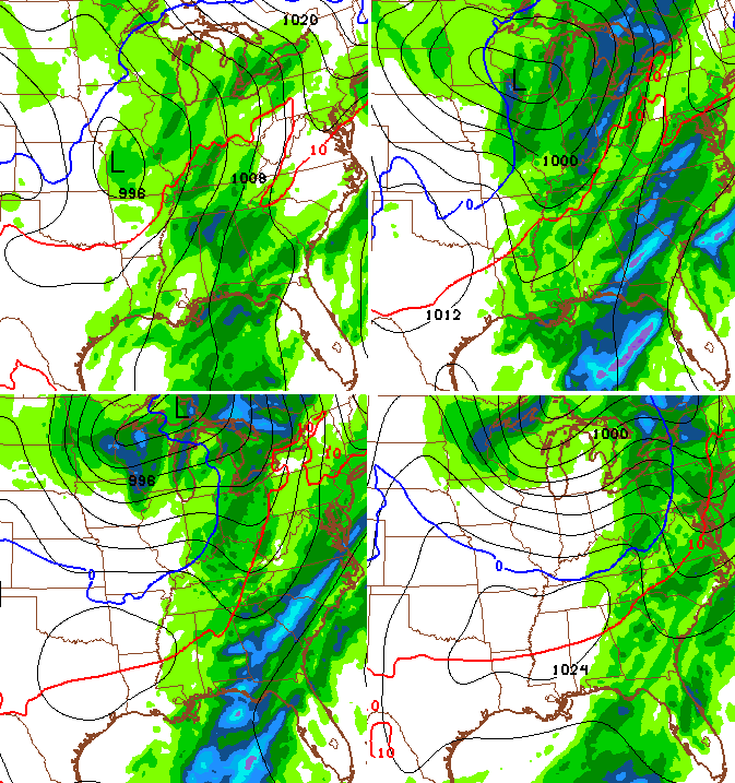
Notice that little drop in temperatures coming in behind the front on Christmas eve. That lasts into Christmas Day, but really doesn’t look that cold.
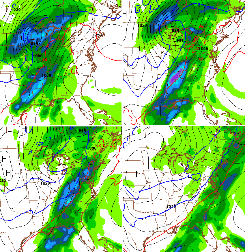
The next storm quickly sends temps soaring again shortly thereafter as it winds up in the plains states. Very warm air should lead to additional heavy rains and some thunderstorms before temps crash behind that storm…
 This is an absolutely insane pattern that really doesn’t match any of the super El Nino’s. Folks like to compare this to 1997 but this weather is totally different than 1997 and has been since fall. 1997 has was a colder than normal September- November. This fall was well above normal. This December is also MUCH warmer than that December.
All this wet weather in the Ohio Valley is also not supposed to happen during strong or super El Nino’s.
As I started saying back in early Summer… there is no true analog to this El Nino or overall setup. I’m finding bits and pieces of years that were similar, but not one single year fits this one.
I will have another update later today. Enjoy your turn to colder and take care.

I’m going to go out on a limb and say shorts and t-shirt weather Christmas Eve and Christmas Day highs in the 70’s. Off and on rain breezy conditions blowtorch weather.
I wouldn’t say you’re out on a limb because Christmas is 8 days away, and we can usually already see what the weather could look like by that time. ECMWF has consistent record warmth for Christmas with highs in 70s and lows even in the 60s! If true, warmest Christmas could be on the table. Heck, highs in the 80s not too far south in Georgia. VERY warm throughout central and eastern US this Christmas. Check out the records…
http://www.weather.gov/lmk/historical_christmas_weather
The historical record link was interesting. I noticed that the warmest recorded Christmas in the area was followed the very next year by the coldest Christmas.
I like what you are saying. I can look at snow on a postcard!
Rodger is depressed with this warm weather. Yuck!
I was actually being sarcastic about being out on a limb.
Dang. Bugs will be real bad this spring & summer. Ditto for snakes.
Watch out for a mild summer as well- Again a sign of the cusp of the next mini ice age. Maybe a micro one? 😉
I already have stocked up on parkas and snowshoes for everyone that would like some. #snowmageddon2016 😉
Pretty interesting that even though El nino was forecasted by almost everyone that all signs are pushing for a complete opposite. Shows how far we’re still behind in tracking weather!
So, when will the real cold weather get here?
If you are asking ” when will the cold get here and stay here”, then I would say the safest bet, at this point, would be about the of middle January through February.
Still not sure if that’s even a safe bet
The safest bet is go to Alaska for cold and snow. 🙂
Listen to ‘On Point’ with Tom Ashbrook…on WEKU at 11 this morning…the segment on how microclimate change is occurring and what is happening with insects, birds and plants….interesting, provocative and topical.