Good Saturday, everyone. Snow flurries and snow showers swept across the bluegrass state right on cue, Friday. This action finally gave us a wintertime feel, but it’s not going to last long. A super soaker of a pattern is taking shape for the next week and change. It’s one that could cause some issues before all is said and done.
Highs today will range from the upper 30s in the east to the low and mid 40s far west. Skies will be partly to mostly sunny.
Clouds thicken from west to east Sunday as temperatures start to rise. Rain then sweeps in here Sunday night and Monday…
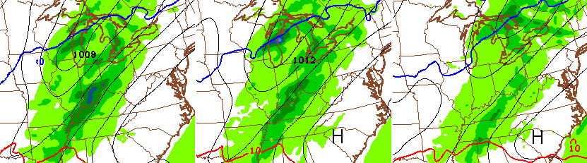
That system passes by early Tuesday as temps start to climb toward the low 60s. That will take us through Wednesday as another storm system throws rain our way…
Temps will come down a few degrees by Christmas Eve and Day, but should still be above normal. It looks like low and middle 30s for Christmas Morning.
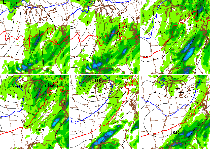
Temps really take off into the start of Christmas weekend as a BIG storm system wraps up and slowly works our way. This will have one heck of a temperature gradient to feed on across the Ohio Valley, and that could spell rounds of very heavy rain…
The actual low then wraps up late weekend into early next week and crosses the region…
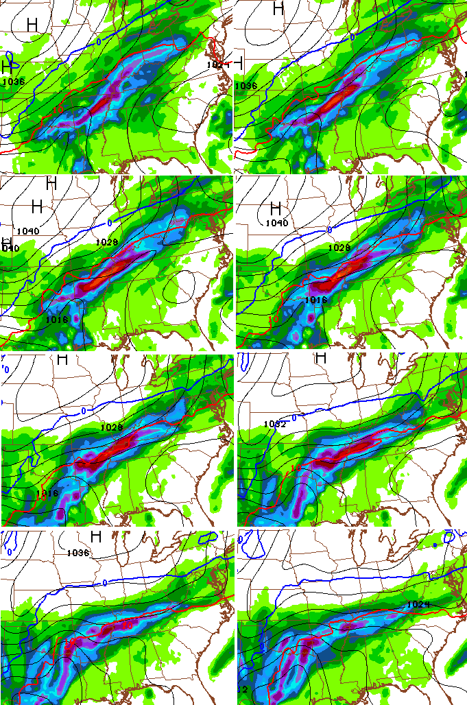
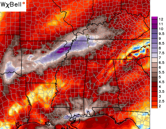
That’s a setup for a lot of rain. Recent runs of the GFS have been spitting out crazy amounts for the next week and change. The latest run looks like this…
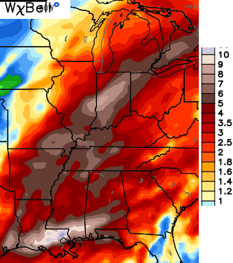
The Canadian Model isn’t quite as wet, but is still pretty darn ugly…
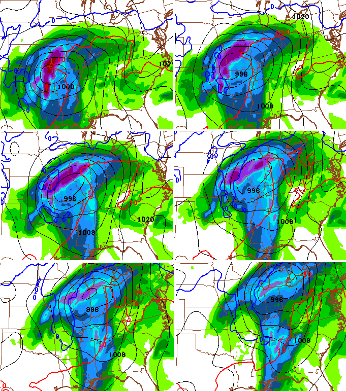
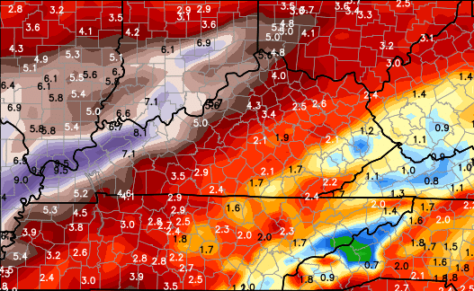
I stayed up late jus to see how much rain the European Model printed out, and it’s impressive. These totals are before the actual low works through here…
Wow.
I’ll try to get you an update later today. Make it a great Saturday and take care.

Was nice to see some snow on the deck today. Xmas lights sure look better with some snow on them rather then rain.
Think I’ll go ask Santa for a kayak and some waders for Christmas! Looks like I may need them. Happy Saturday everyone. Thanks Chris.
Ugh, going to Paducah for the holidays and it looks like that is ground zero for the heaviest rain.
Winter won’t visit Kentucky this year folks. Anyone telling you other wise is reaching for ratings