Good Sunday, everyone. We’re putting the finishing touches on the final weekend before Christmas. While temps have been on the seasonally cold side, I hope you had a chance to enjoy the sunshiny skies of late. A very wet pattern kicks in on Monday and carries us through Christmas weekend, at least.
Today will find sunny skies across the region with some afternoon clouds thickening from west to east. Highs will range from the mid and upper 40s in the north and east to the 50s in the west.
The clouds slipping into town will start to produce some rain in the west later tonight. That rain then progresses quickly through the rest of the state on Monday…
From there, rain chances ramp up a bit later Tuesday into Wednesday as temps take off. Another round of 60s are on the way during this time.
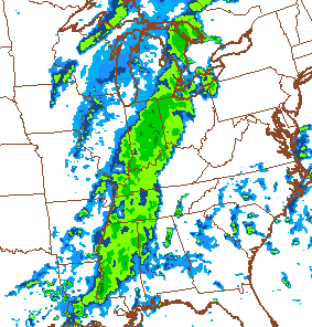
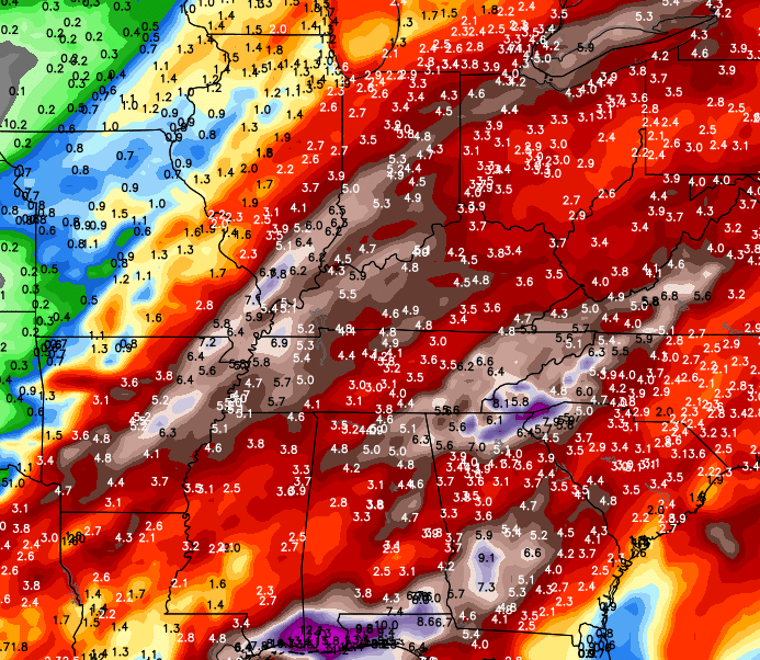
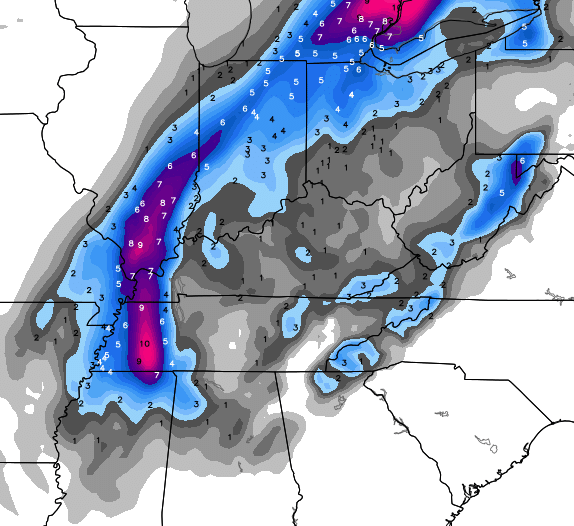
There could be a break in the rainy action for Christmas Eve and Day, but that’s not lasting very long. A corridor of very heavy rain then sets up from southwest to northeast into our region over the weekend. With a sharp temperature gradient, we will really have to watch this setup for very heavy rains.
The actual storm system doesn’t roll through here until next Sunday or Monday. The European Model offers a rather interesting solution…
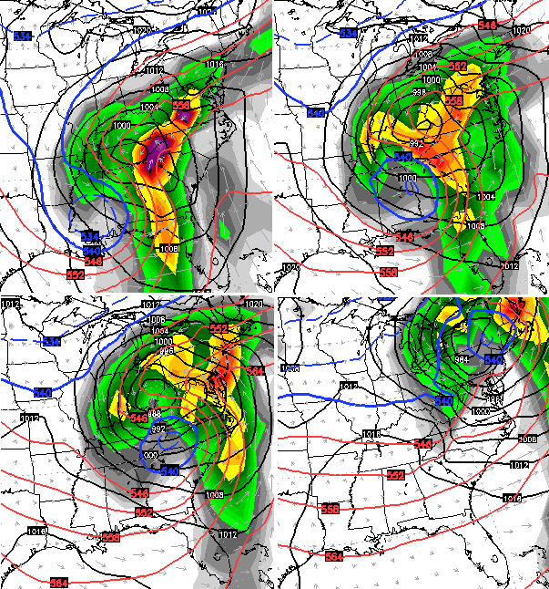
That actually brings a pocket of cold air across the region as the low dumbbells through here. The end result on that particular model run is likely an outlier with… snow…
The control run of the European Ensembles also show a similar setup…
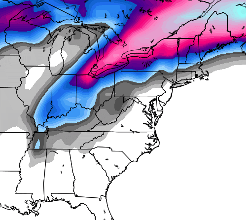
I still don’t believe that scenario, but we shall see.
Make it a great day and take care.

Yay! 54 inches of rain so far this year in Lex and more before the new year….
Anyway, – my power bill and KU
So, I’m on the budget, right? As I have mentioned SEVERAL times, I run my AC a lot in the summer, but I keep my heat set really LOW, like 64. My budget for each bill was 146/mo, right? My electric bill during the summer was a little more than my budget, but I KNEW I could make this up during the fall by not running heat/ac as much, right? So, around Sept, they upped my budget to 169/mo, and like clockwork, as soon as they did this, my electric bill dropped because of the usual not having to run heat/ac much at all, and the past 2 mos, my bill has been 80 to 85 dollars, yet I paid the 169 new budget amount, and NOW, so far they OWE me 156 dollars. They should have left the budget amount along, but NOOOO. Oh well.
I like the weather the way it is right now.let’s not change it.no snow is what I like.
Then you should live in southern California lol
Mmmm – this is the wrong blog for you lol
Thanks Chris. Guess we need to change the words to “I’m Dreaming of a WET Christmas.” That should make for a whole different set of travel issues, like high water and flash flooding. Especially if those predictions on amounts pans out! At this point I can say I was happy to see the snow showers we got on Friday. Seemed to put the folks I dealt with in a Christmasy spirit. I’d take that on Christmas Day! Have a great Sunday everyone.
The Euro model is laughing at us and our lack of snow.
I’m going all out on this one. Who does not think Louisville will have one of the top 3 warmest December’s on record? Lexington?