Good Saturday, everyone. The weather over the next few days looks pretty good, but the overall pattern continues to trend toward winter. It’s a setup that has some extreme potential with it for much of the country.
The first system for us to watch is a cold front dropping in from the north Sunday night and Monday. This will have a shot of very cold air coming across the warm waters of the Great Lakes. That means snow showers and squalls kick in during this time…

Light accumulations appear to be a good bet across central and eastern Kentucky. This could cause some delays or cancellations for the first time this winter.
Temps may stay in the 20s for highs Monday and Tuesday with lows that can drop deep into the teens…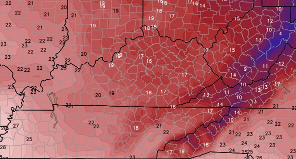
Winds are going to be very gusty, creating wind chills down in the single digits at times…

Another system moves in toward the end of next week as temps return closer to normal. The one coming in behind that late next weekend into early the following week is the one to watch. With arctic air coming in behind it, it could develop into quite the storm system.
The GFS keeps showing the storm, but varies from run to run as is to be expected. Look at the real estate covered by the storm on its latest run…


I will try to update things later today. Make it a great Saturday and take care.

an apps runner
My thoughts exactly!
What does he mean by light accumulations?
What does he mean by light?
Now that’s what I’m talking about! Well, we’ll see. But it is at least something to talk about 🙂
Thanks Chris. Certainly sounds like Winter is ready to make a run at us for sure! Don’t mind winter unless it tries to overstay it’s welcome as it has been known to do in recent past years. Guess we will see, but the blog will get interesting for sure over the next little bit. Make this first Saturday of tre New Year a great one! Thanks again Chris fur all you do.
Hey now! That looks interesting. That would be a nice way to kick off the winter season.
Thanks Chris.
Go Big Blue
The cold wind’s a blowing’
Soon it will be snowin’
It makes the kids so happy
Don’t mean to sound too sappy
But the best thing of all
Will be watching the snow fall
To some a day to dread
But we teachers go back to bed!!
We LOVE the SNOW DAYS at Corbin Middle School!!! We say bring it on!! Hahaha
CBS.com had a story yesterday or the day before saying that the el nino is very strong this year and that means a warmer winter for us with a lot of precipitation. Anyones thoughts on this?
Given the fact that winter is a little over week old and we have finnaly come to normal temps for this time of year. These so call scientist are going by the way the previous nino has done. I think this will be just as opposite. But time will tell.
06z and 12z runs of the GFS don’t look good for precip.
Gfs is a flip flopper…but you know this lol
The GFS should be considered fiction until about 3-4 days out.
Even then the GFS can be sketchy 3-4 days out.
Probably more like 3-4 hours. 😉
Haha you’re right about that
I hate the fact we live by what computers says. We can’t always be depend by computers its not always accurate. Let mother nature be what it is.
If you don’t want expertise from CBailey and his computers…go to the feed store and ask the old timers to recollect. I like both. CBailey is experienced and scientific in HIS forecasts and the oldsters are experienced and not scientific but truly entertaining.
I like it with no snow myself.
I want the 70s back that we had a few days ago
I totally agree ray.
what happened to all the videos on the WKYT website? I used to be able to watch weather forecasts from earlier newscasts and now I can’t.
Test.