Good Sunday, folks. We have a nice little taste of winter weather ready to blow into the bluegrass state to start the first week of the new year. This could even mean light snow accumulations for much of the region. For winter weather lovers who have been sweating out the past month… The other shoe is trying to drop.
A strong cold front drops in tonight and unleashes a strong north to northwesterly wind flow. The stage is set for snow showers and squalls to kick in across central and eastern Kentucky. Bursts of snow will likely reduce visibilities and can cause slick travel to develop.
I’m not talking about a lot of snow, but the potential for local 1″ amounts will be there for some areas…

Can we get a few overachieving snow squalls? Yep, and that’s something to watch for on Monday. Winds will also be very gusty with temps in the upper 20s and low 30s. Wind chill numbers will be in the teens.
Tuesday starts with some flurries and wind chills dipping into the single digits. There’s some Brr in that forecast.
That brings us to the transition into a VERY cold pattern for much of the country. That transition starts late next week into the weekend with a couple of storm systems to impact our region. I don’t know exactly how these will play out, and I suspect the models won’t know until a few days before each of them. You guys have heard me talk about this many times before… When you’re getting true arctic air diving into the country with an active southern jet… It’s just too much for the models to handle.
That said, if you know what you’re doing, you can still get a good idea on the overall pattern and setup. This setup and pattern is screaming COLD!!! The European Ensembles show the core of the cold right on top of us in week two of the month…
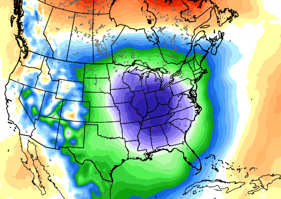
Talk about a serious pattern flip from December! For more than a month now, I’ve thrown out the winter of 84/85 as an example of how a super warm December can flip straight into a harsh winter pattern across our region and the country. Unfortunately, many now in the weather business have no historical perspective of the actual weather.
So, how do we get to that DEEEEEEP trough across our part of the world? The models still spin up a storm system with arctic air coming in behind it. They just differ from run to run and model to model on what to do with it.
After a late week rain system, The latest European Model has a snow maker following that up out of the Gulf of Mexico next weekend…
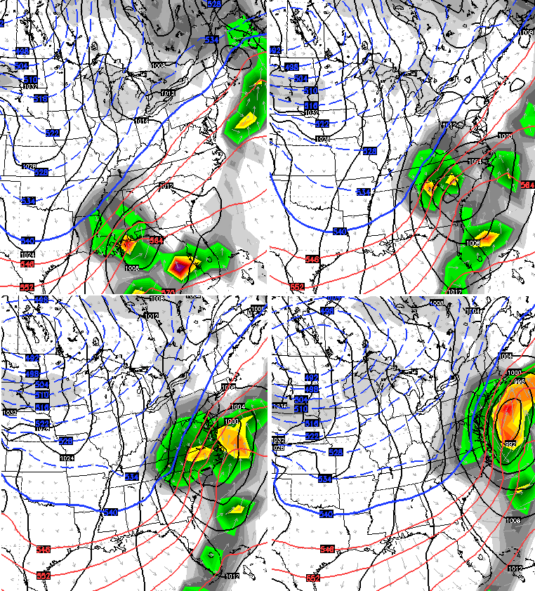
Bitterly cold temps then dive in behind an arctic cold front. This run of the European Model is developing a wave of low pressure along this bitter cold…
If that were to verify… you would see some crazy snow, high winds and temps threatening to go below zero.
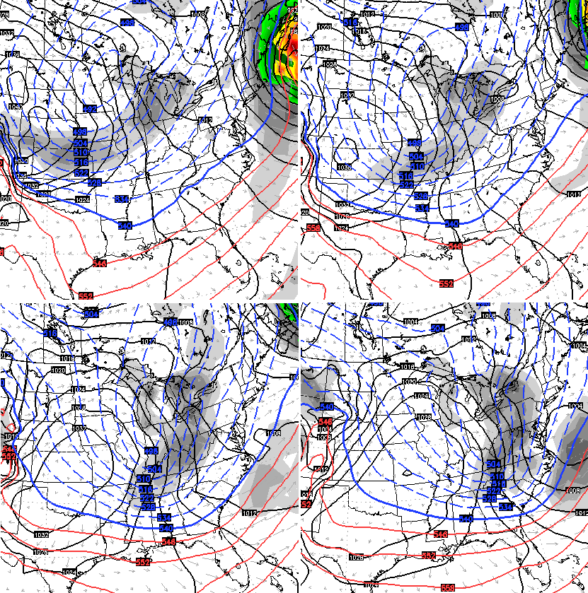
The latest GFS has a similar evolution, but sticks the first storm right on the east coast…

That run shows a mega-snowsquall event for our region that carries on for several days as bitterly cold air moves in…

It should be noted the GFS and European Models offer similar evolutions into a very harsh winter pattern for the second week of January.
For fun… A few days later, that same GFS run shows another arctic surge diving into the country…

I will update the winter threats later today. Make it a good Sunday and take care.

After reading of several YEARS in the past of this happening, either 76/77 or 77/78, one of those Decembers was dull boring, warm with no snow at all, and come Jan, all blank broke loose….this happened a few other times in the past too…,so this would not surprise me at all.
On the flip side, Dec ’89 was bitterly cold and snowy here, but that following Jan things warmed up and I think there was little snow the rest of the winter…..at least from what I’ve read.
sounds fun…….
so the flipping patterns from one extreme to the other seems to happen a lot.
I hate to comment on model runs more than a week away since they always change, but GFS and Euro are performing a rare tag team that shows parts of our region struggling in the 20’s with lows in the single digits by the 11-13th time period. Could be colder with a fresh snow pack…have to wait for the ‘waffles’ to get done first.
Louisville sets mark…6th warmest year on record, no fanfare from NWS though. Only mention was above normal…really? See Louisville NWS Web page ‘2015 in review’.
Winter has arrived, I was afraid it was going to stay warm!!! Looking forward to some Snow Days with sledding and hot chocolate to follow. Thanks Chris for the updates and the broadcast this morning with Bill Bryant. I was glad to hear you say we would get some SNOW!!!!
Been looking forward to this pattern flip for a good long while now! Hoping it can deliver a couple good snow events for our region before January is over!
Nice name^^^ I like it! 🙂
Rodger has a feeling the “big flip” will lead to some disappointments. Stuff like the storm track either too far south or just far enough north for a cold Kentucky rain. Rodger hopes he’s wrong! Rodger in Dodger
Rodger needs to stop.being a negative Nancy! Have faith my brother! Lol
How do you think why he’s name is? He’s always saying the snow is gonna dodge us. Lol
Lol dodger is a good guy…like reading his posts on here
Me too.