Good Thursday, everyone. After a few quiet days, our pattern is about ready to ramp it up a notch or ten as we start the month of February. This should kickoff a month that tries to take things back into the extreme side of the weather spectrum.
Before we get to February, we have one more system to track out there today. It’s a cold front dropping in from the north. Winds will be gusty ahead of this today as temps spike. Once the front moves in, some snow showers and flurries will be possible into Friday morning. A sugarcoating of snow is possible in a few spots.
Temps over the weekend will really take off and soar well into the 50s on a gusty southwesterly wind. Temps may reach the low 60s before all is said and done.
There is a weak front that drops in here Sunday night and Monday with the chance for a few showers. That could knock temps down just a bit in the north. Still, readings run above normal and we have a shot at record highs for Groundhog Day on Tuesday.
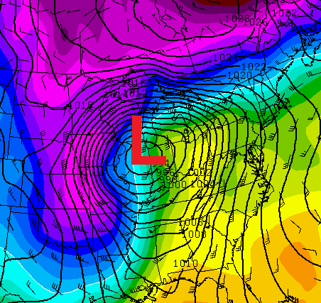
That’s not a good thing. Why? Because it comes just ahead of a powerful plains storm system that could have a blizzard on one side and severe weather ahead of it. Look at this bad boy crank…
A potent line of showers and thunderstorms will be ahead of that system as it rolls through here on Tuesday…
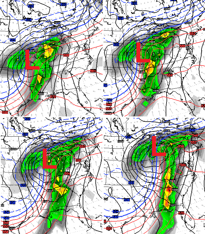
There’s the chance we get strong to severe thunderstorms to go along with high winds. That’s a setup we will monitor in the coming days.
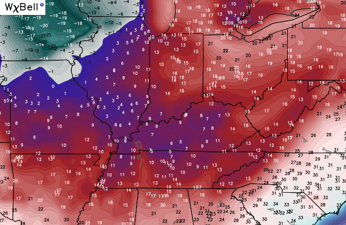
Some wraparound snows will be possible behind the storm as cold air surges in. The air coming in is impressive…
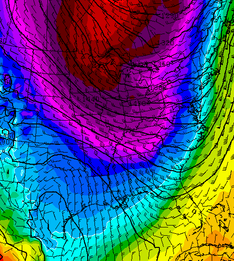
The Canadian Model has picked up on these cold shots very well this winter…
Once this trough gets established, we will need to watch for energy coming in from the west and sneaking underneath it. That’s how we can winter weather systems to track. Kinda like this one on the Canadian Model…
 I’ll hook you up with updates later today. Make it a great day and take care.

Thanks for you time and efforts on this. I appreciate it.
Thanks Chris for update. It is a cold 14 degrees in Clay county. Still under a Snow pack. Storm for Tuesday sounds scary. Have a great day and enjoy your weekend! Rest may be limited again next week.
Thanks Chris. Looks like a wild ride into February!
CB..I was in Lexington yesterday and was surprised to see how well the snow is melting …. here in western Pulaski my front yard is still white! LAYIN’ ON FOR ANOTHER SNOW….was what I alway heard growing up. But with the temp going up this weekend that might not be true.
Thanks for all you do for us …you’re the man!!!!!
12z GFS looks ugly for Tuesday!!