Good afternoon, everyone. I wanted to drop by for a quick update on the busy pattern setting up for the next few weeks. The system getting the most attention is one that comes early next week. It may bring severe thunderstorms before unleashing arctic air behind it.
The Storm Prediction Center has already highlighted our region for the potential for severe weather for Groundhog Day Tuesday…
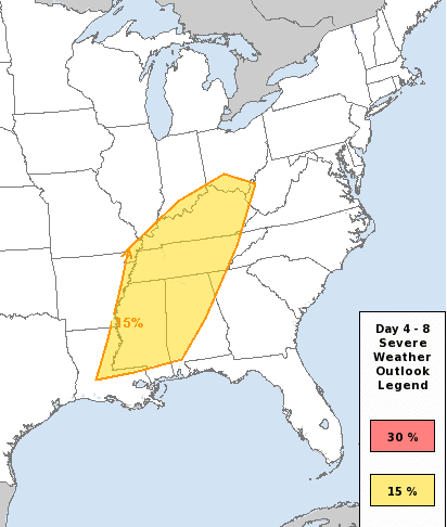
I’ve been slowly trying to hit this potential over the past few days, because I don’t like the setup I’m seeing with this system. A strong low pressure with a mega temperature gradient and ample moisture and instability out ahead of it, with a negatively tilted trough. I see that and ding ding ding… The alarm bells in my head go off.
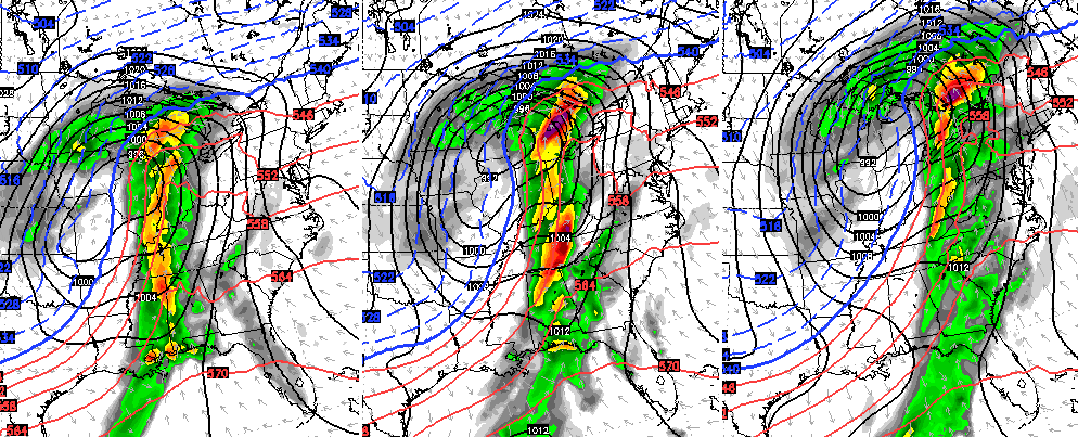
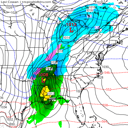
Here’s the GFS for Tuesday…
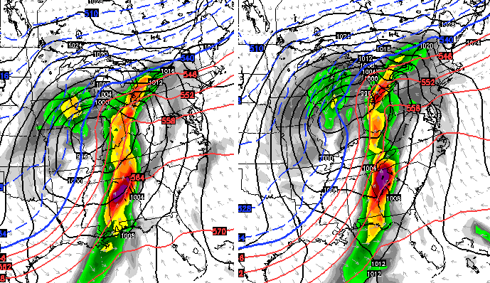
The Canadian…
You can see what amounts to the models showing an explosion of thunderstorms ahead of that system. I will keep watching this setup and update as needed.
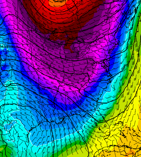
The amount of cold coming in behind this continues to look very impressive…
With the cold locking in, systems are going to try and work east to west underneath the cold. The Canadian Model continues to show this…
Let me be clear on something… I think we have a lot of winter, possibly harsh, taking shape for February into early March. Just because I’m focusing on the potential for severe storms early next week doesn’t change that fact. 😉
Make it a great day and take care.

Can you call the GFS UGLY! Sheesh, everyone needs to keep track of the Tuesday system, because it is not looking pretty around here. Lots of directional wind shear and high CAPE values on a strong SW flow spells trouble. Warmth this time of year almost always comes with a price.
Yeah, things could get really dicey Tuesday.
Temps looking to possibly hit low 70’s on Tuesday.
which would break the record in lville of 68
Yeah that 12z was screaming UGLY
Thanks Chris! You don’t know how much you are appreciated!
Extreme and severe sound very scary..
Very similar system that led to some midwest tornadoes on Christmas Eve. That system unlocked a colder pattern that led to last week’s BINGO! snows! Very similar pattern coming back. Rodger likes the cold pattern part of this story! Rodger in Dodger
Thanks for the continuous updates mr Bailey! Just curious, “alarm bells going off”, does this mean for potentially dangerous/severe storms? Just curious as to what exactly made the alarm sound! 🙂
(I’m not a good map reader. Although I agree it looks very colorful!)
Thanks!
Sounds like we’ll all be gathering back on the snow wagon! Make room for me!
Hard to believe it’s almost a week after the storm and the ground is still covered here in Charleston. What a storm
On Tuesday, Groundhog Day, I will be at the closing of a refinance on my house here in Frankfort. Hopefully I will still have a house once this system is through with us.