Good Friday, everyone. Much milder air is on the way to the bluegrass state over the weekend, and this air will hang around into the start of February. This is where things start to take a walk on the extreme side with the potential for record highs, severe storms. high winds and arctic temps. Oh… All of that could happen in the span of 48 hours.
Highs today will be mainly in the 30s with some morning flurries moving away. This leaves partly sunny skies this afternoon with gusty winds making it feel colder than it is.
Saturday looks great with temps spiking deep into the 50s, with a few spots around 60. Winds will be very gusty, but it looks dry and sunny.
This changes late Sunday as a cold front moves our way with an increase in clouds and showers. Those showers really kick in Sunday night into Monday morning…

Temps come down some on Monday, but that cold front retreats back to the north as very warm air moves back in ahead of a BIG storm system.
It’s this storm that will likely bring us a wild Groundhog Day for Tuesday. A strong storm system will work from the Mississippi Valley into the Great Lakes. That may have a blizzard in the cold sector and severe weather ahead of it. Check out the explosion of thunderstorms on the Canadian Model for Tuesday into Tuesday night…
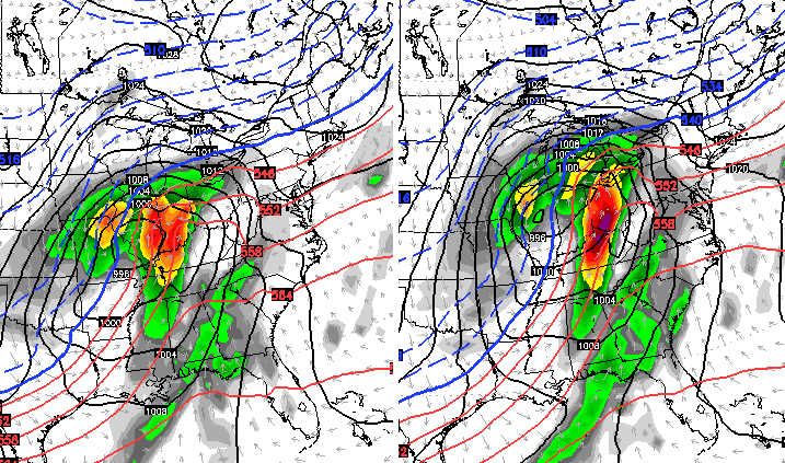
The GFS has a similar look…
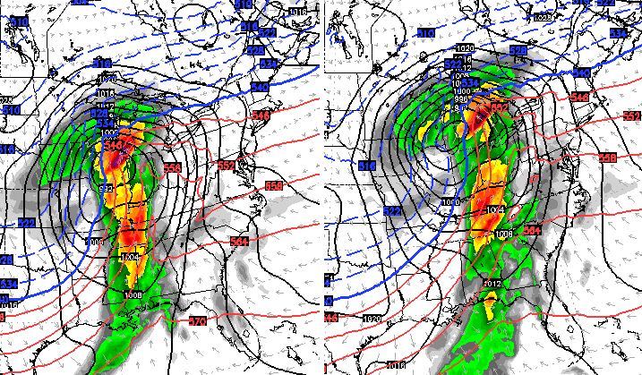
If we can get enough sunshine before the storms develop, record highs will be possible across our region. It could also help get the atmosphere primed for strong to severe thunderstorms working quickly through here. High winds are likely to be a major player with this event. Notice how the GFS has winds of greater than 50 knots sweeping eastward…
The potential is there for some wicked weather on Tuesday and we will keep watching this setup to see what it may throw our way. Here’s hoping it’s not as potent as the models are indicating.
Temps crash behind this on Wednesday with some wraparound light snows. That air continues to grow colder into Thursday and Friday as some arctic air arrives. Speaking of arctic air, much of the country may go into the deep freeze for much of February.
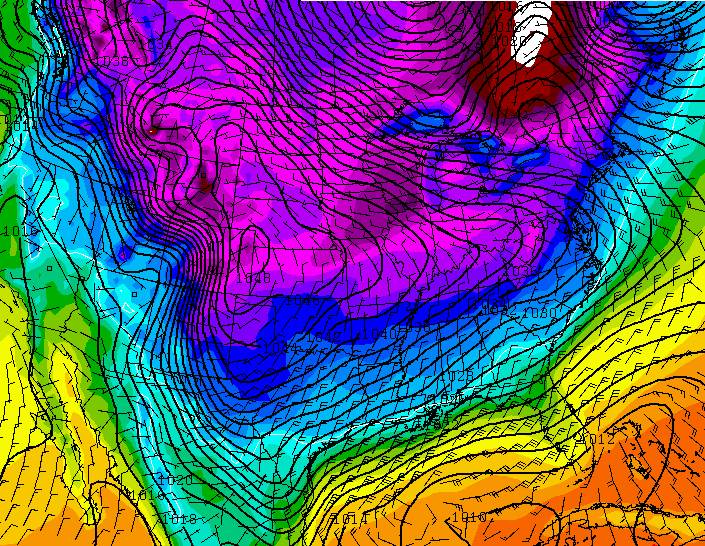
Look at the sprawling arctic high covering the country on the GFS…
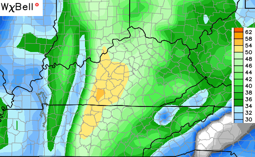
The GFS Ensembles from WeatherBELL are brutal. Days 5-10…

Days 10-15…
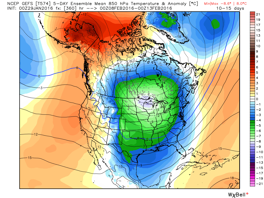
This happens as we get the familiar huge ridge up the west coast into Alaska. This was one of the main drivers in the past two wicked winters and it’s back for February. The overall pattern has that extreme look to it as we roll forward.
I will have updates later today. Make it a good one and take care.

I think ideally we need a good block near Greenland to accompany the ridge in Alaska to keep the cold air in place while precipitation chances increase with the southern jet.
I went back to last year in Feb and looked at the daily temps for KLEX. It was in the 50’s and 60s 3 days before the first big snow we had in Feb (not that it will repeat this year), but I couldn’t remember….Then the bottom dropped on the temps during/after the snow
This also happened in 76/77 and was very snowy after and again in 77/78 but not as warm. Going to fun to track and I hope the Southern jet gets a cranking again.
1977 and 1978 were also the last years the Ohio River froze deep enough to walk on, some people were even driving vehicles on it. The late 70s had some snowy winters. I remember missing several weeks of school each winter, three winters in a row.
http://www.wcpo.com/news/local-news/hamilton-county/cincinnati/strolling-on-the-river-remembering-when-tri-staters-walked-on-the-frozen-ohio
I was living in Paducah and remember the Ohio being frozen and pictures of people walking on the ice. People even drove cars out on the ice, wild.
Went from 26 when I went to bed last night to 36 when I woke up. Thought that was odd
Thanks Chris for update. Will the artic temps moving in after the severe storms bring any SNOW storms into Ky. You’ve not mentioned seeing any snow in the coming weeks just cold. Just wondering? I hope the storm Tuesday calms down,sure don’t want to see tornados in February.Have a great day.
Since he hasn’t mentioned snow and has only mentioned cold, I think he means extreme temperature risks, rather than snow chances.
I agree! Sounds like bitter cold and not much snow! Although a few posts back he set me straight when I said we wouldn’t need any snow boots or sleds! It’s KY weather so I guess we never really know!