Good afternoon, everyone. I wanted to drop by for a quick update on the severe weather potential for early next week.
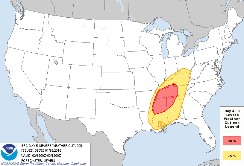
The Storm Prediction Center continues to up the ante for severe weather across our region for Groundhog Day Tuesday…
I suspect the severe weather threat around here may hinge up on what happens with the first cold front on Monday. The latest models are bringing that front farther south into the region with colder air seeping in behind it…
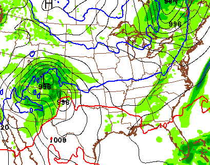
The farther south that front gets, the better the chance it forces the next storm a bit south and east of earlier forecast tracks. This is exactly what the new Canadian Model is doing…
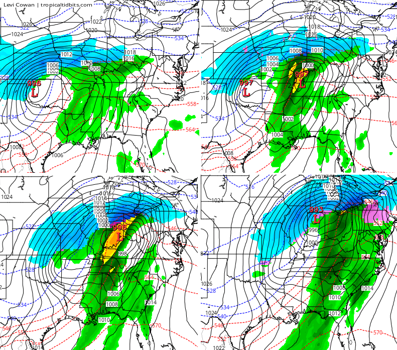
That would bring high winds to our region, but would limit the true severe weather threat. That’s IF the model is right. The GFS isn’t buying into that farther east and south track…
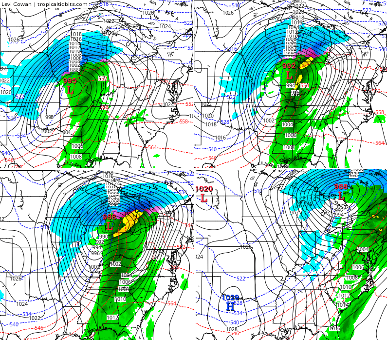
A huge temperature drop with wraparound snow showers will follow this system into Wednesday with a lot of winter on the way behind all this.
I will have another update this evening. Enjoy your Friday and take care.

I am going to take advantage of those warm days before winter sets back in. From 70’s to 20’s all in 1 week.
There are three things Thelma Lou don’t like! 1) severe storms 2) ice 3) Juanita Beasley
Rodger in Dodger dated Juanita at the diner for awhile 🙂
These updates are very, very helpful, Chris. Thank you!
Thanks CB. I hope we can stay away from the ugly part of the storm. I also hope we can get another Winter Storm Threat soon for Kentucky.
Thanks
Chris. Glad you are willing to keep us posted even this far ahead. Appreciate all you do.
Thanks for the update, Chris. Serious roller coaster weather.
Go, Canadian model !!