Good evening, weather lovers. Our weekend is off and running on a pretty nice note across the entire region. This nice weather will be with us over the next few days, but a very, very wild pattern takes shape after that.
I have no changes on the potential for severe weather on Groundhog Day. A line of strong and severe storms should race across the state that afternoon and evening…
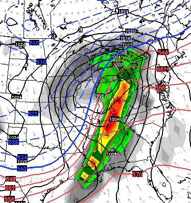
Damaging winds are the main threat from this line of storms and the overall setup. I’ve noticed the latest models have a little more of a positively tilted trough as opposed to the more threatening negative tilt. We will see how it goes, but the threat is alive and well.
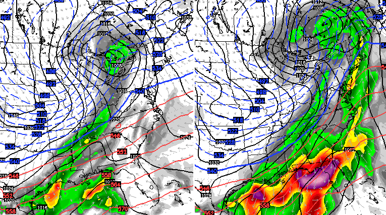
We know colder air comes in behind this for the rest of next week. Once into next weekend and beyond… look out! The pattern is threatening to send the country into the deep freeze. The GFS introduces this bitterly cold pattern with a system for us to watch for…
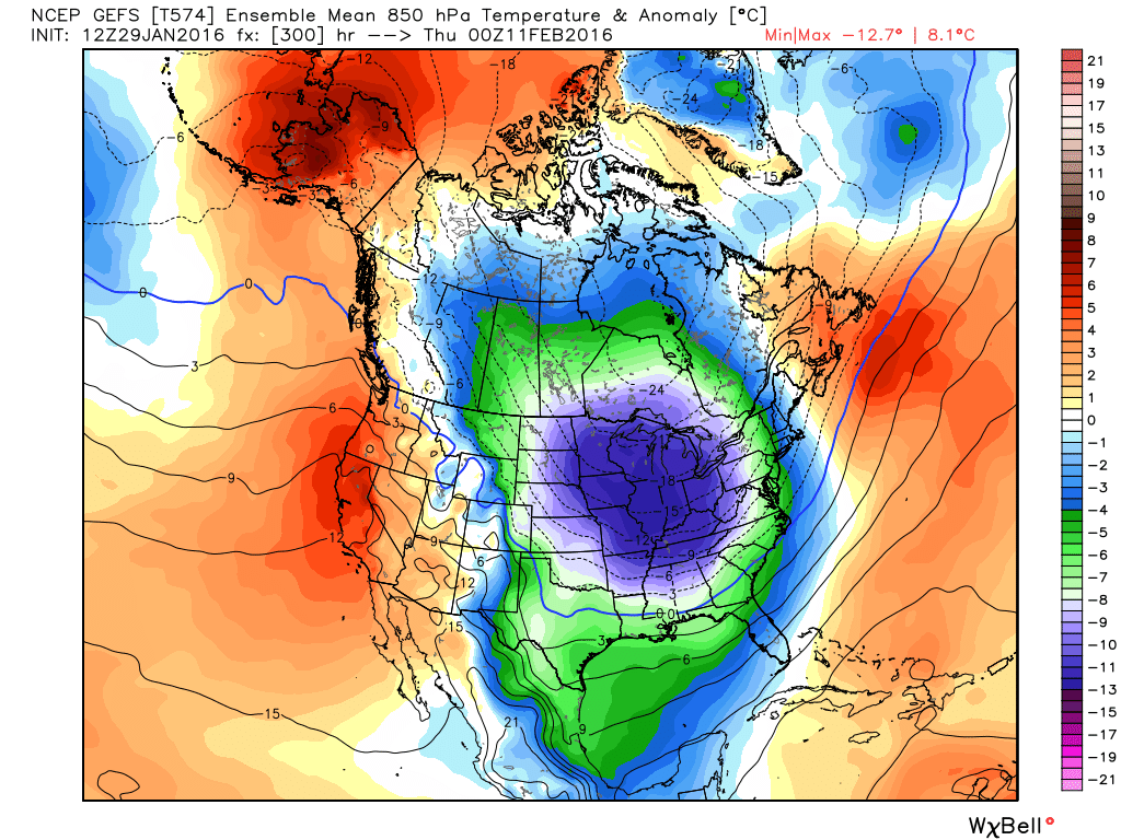
The GFS Ensembles from WeatherBELL are absolutely frigid…
 The European Ensembles from WeatherBELL are brutal. Look at the mega trough…
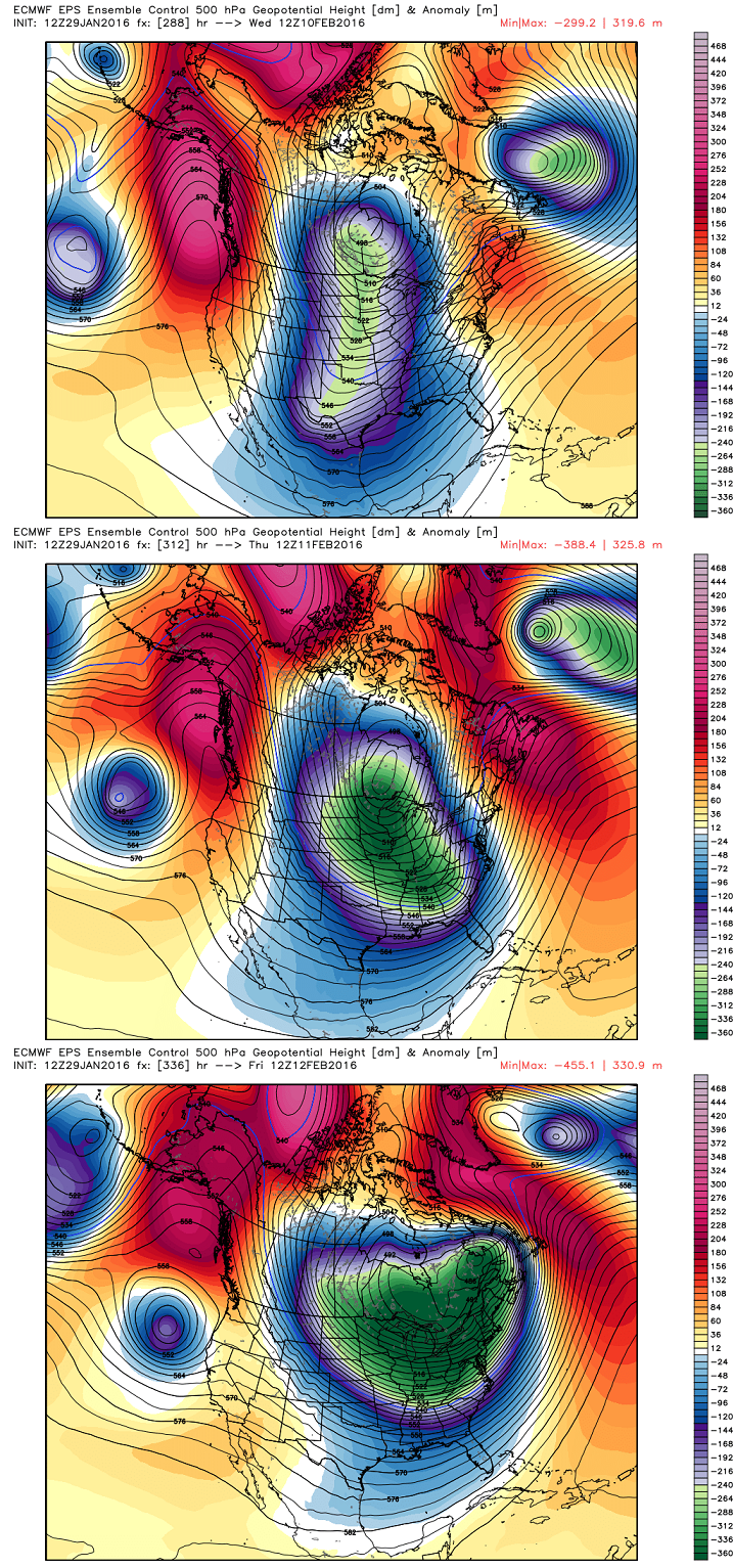
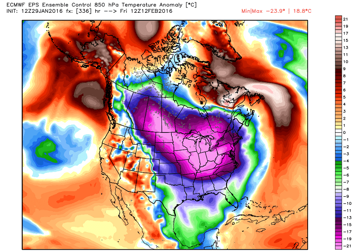
Wow is all I can say after looking at those maps. Imagine if this active southern branch of the jet stream continues to crank during this time!
I will have the full update later tonight. Take care.

CB,
Gut feeling: Are you honestly think the jet will be active during this period…or do you think this cold shot will bring more suppression? Would love another big snow redux.
Bingo. With that kind of cold all systems would be suppressed.
Not looking forward to something like that at all. I hope the storm is not too strong and nobody sees any damage.
With that cold it would not be a good thing for a big storm to hit. Definitely do not want anything like this last one. What is melting runs across the road and freezes at night. Very slick every night. And the yard is still solid white. Of course some melting and freezing has made it hard. The warm weather should at least help finish it off, I hope.
As always, looking forward to the next update. Thanks Chris.
Today has felt very chilly maybe it’s me will enjoy the mild up this weekend. Chris wasn’t it almost a year that we were hit by that big snowstorm?
February 17th
I’m thinking we are going to get something strong by Tuesday!! As much cold air there is behind this storm…I’ve been hearing that winds could crank as high as 75 to 80mph. With the possible snow storm we could receive…I think its going to be worse than the last we just had a few days ago. The weather is definitely changing.