Good afternoon, gang. We are in the middle of an absolutely gorgeous day across the commonwealth of Kentucky. Temps nearing 60 with sunny skies are combining to give us some of the good stuff. The winds could be a little lighter, but it is what it is.
Winds are going to be a big player in the coming days as a powerhouse of a storm impacts our region. Groundhog Day continues to look like it will bring a severe weather event across our region. The Storm Prediction Center continues to highlight this threat…
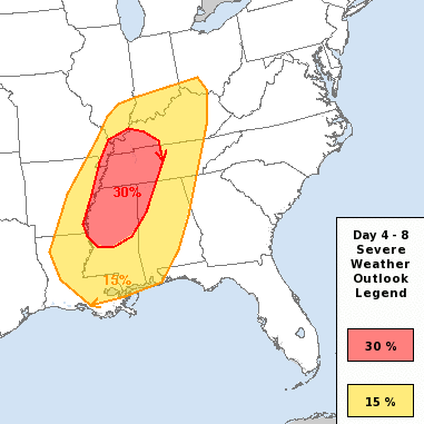
Damaging winds and a few tornadoes will be possible in this type a setup.
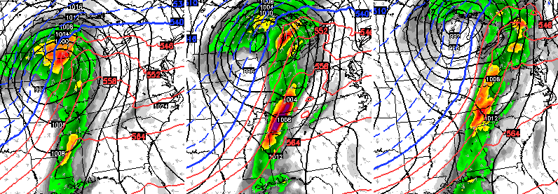
The models are indicating explosive thunderstorm development late Tuesday afternoon into the evening. You can actually see this on the forecast models. Here’s the GFS…
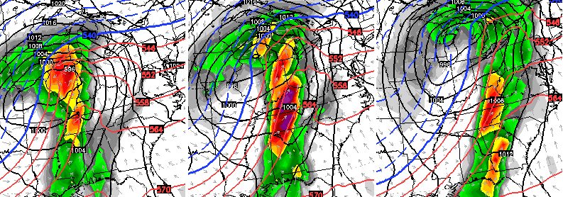
The Canadian…
Please keep a close eye on this setup as we get closer.
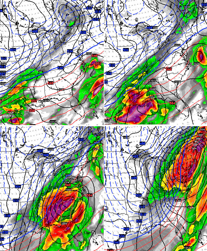
Cold air presses in behind this front for the rest of the week into Super Bowl Weekend. In my last update, I said to watch the period from February 7-11 or a possible big winter weather system developing. The GFS must have been reading that post…
The stage is setup for wicked weather over the next few weeks, and the blog will keep you updated along the way.
I will try to update this evening. Enjoy the rest of the day and take care.

Hope a major storm waits until after the 9th, as I have an appointment at UK for a medical issue that is ongoing. Then bring it! Don’t care a bit! Thanks Chris.
Wow if that verifies this could be known as the new winter of extremes.
That Winter Storm looks like it could have the potential to be bigger than the last one! Maybe…
It also doesn’t look too far from being an apps runner.
I like the look of it.
But it is a week away. But so was the last one when Chris first started sniffing it out.
Here`s hoping.
Interesting. It seems the month of February (and Mother Nature) may gift snow and cold lovers a few Valentine’s gifts. Since Chris was sooo right about the last storm, we should pay attention to all of this. He is correct almost all the time. However, he was the only one who predicted the last storm days (and almost weeks) ahead of time, AFAIK.
Hope no major damage for anyone with the system Tuesday. And that storm on the GFS looks fairly monstrous to me.
***… Uhhhh has anyone paid any attention to the 12z gfs..which followed suit from the 6z only stronger!! It shows another shutdown blizzard from gulf coast up the apps…lets see if the 18z loses it completely… Lol..
Very very shocking the 18 z hold onto the big storm next week
What days or dates are you guys talking about?
yeah, the 12z gfs looks almost frightening but sooo far out still. 18z has the storm too but in 2 parts. I think it knows something big is out there, just won’t have a good handle on it till 3 or 4 days out. wherever it tracks, looks like a monster high is gonna dig in really deep behind it. thanks Chris for all your posts. After I look at the models, the next stop is always your site. thanks also for always including a larger area than Kentucky. It really helps a lot for snow weirdos like me down here in TN.
I agree, I am in WV and have followed him for years. He is head and shoulders above any Mets in my area.