Good afternoon, my fellow weather geeks. We have another light snow and mix maker pushing across parts of the state through tonight. This is the last in our super-duper wintry pattern we’ve been in for the past week and change. It’s now snowed 9 straight days somewhere in Kentucky. After this, things warm for a few days, but Old Man Winter doesn’t stay gone too long.
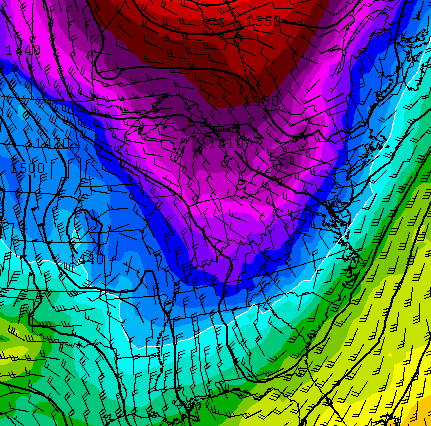
The NAM continues to be most aggressive with a swath of light, accumulating snows across the southern half of the state…

That may be a little too amped up, but some light accumulations are certainly possible in these areas.
Leftover snowflakes will hang around into early Wednesday, then the milder air takes over. Readings rebound quickly on Thursday and could push 60 from Friday into the weekend. The real warm stuff stays in the plains states, but our numbers will be way above normal…

Record highs may fall just to our west. A system zipping by to our north by Friday could throw a shower or two into the region.
The party comes to an end late Sunday into Monday as colder air returns from the north. Showers increase to end the weekend with this air mass coming for Monday…
This leads us back into a setup that should deliver additional snow threats over the next 2-3 weeks. Blocking is starting to show back up during this time, and that usually spells more winter weather. I don’t think we have seen our last “threat”, nor do I think the kiddos have missed their last day of school. I say this as someone rooting for an early spring to take control.
Another update later this evening. Until then, you know the drill…


Enjoy the afternoon and take care.

Thanks for all you do I look up to you
Me too !
I see February as the month where we get a spring tease here and there, and March to April even more so. We can make it a couple more months. 😉
I’m banking on warm air winning the storm battles now, whatever the case.
I just tried to ‘tap’ and ‘like’ that high temperature map I will take it even if only for a few days!! Thanks for keeping it real, Chris!
Constant crashing….. Ugghhhhhh!!
“…additional snow threats over the next 2-3 weeks.”
I really DO NOT want to hear that, Chris.
A lot of fog is about all we got left here in my neck of the woods. The kids were disappointed in the fact we had no snow day! This was a tough one to call Mr Bailey, thanks for your honesty. Hoping we get a couple more before we move to Spring. Looking forward to a brief warm up this weekend. Hoping it doesn’t stick around like my mother in law did on her last visit.
Heavy rain/snow mix in Warren Co
HUGE flakes in Owensboro. Sticking to everything, starting to get slick. Heavy fog last night and supposed to be again tonight. Temp is 33.
Just in case you had any snow left in Whitley, Mother nature sent some more cold rain today
I will just take average right now. I’m not even asking it to turn spring early. Average highs are 50 in my part of the state (Knox) this time of year and I would be more than happy with that.
One things seems a given. Spring growing season should be huge. Nice water table.
Thanks Chris. From Gallia Co. in Ohio
36 degrees and just switched to moderate snow with very large flakes! Visibility under 1 mile.
3 miles west of Bowling Green
Snowing in Hoptown. Dear heavens let the grandkids go back to school at least for a couple days! Our snowman died a horrible death in the rain, 5 yr old was heartbroken!
Huge heavy flakes in Casey Co. Temp still above freezing. Hoping it doesn’t amount to anything…
This weather geek just crossed Pine Mt. above Harlan where it is already ALL SNOW with the precipitation shield just reaching the area. I have a small mix at the house here in the valley. I am thinking the 1-3 inches could be on the low side for the very high peaks here as the total precip looks to reach at least a half an inch liquid–thoughts–