Good afternoon, gang. I wanted to drop by for an update on our potential impact from Michael and the flip to fall that moves in right after. That flip is going to take us from much warmer than normal to much colder than normal. I mean… Who wants to be normal anyway? 🙂
Michael if now a hurricane and is going to become a major hurricane. I threw out the Opal reference a few days ago and now it’s being thrown around in every weather circle. At the time, I did not think this would get as strong as Opal, but it may very well get there. Here’s the latest from the NHC…

It continues to be interesting to see the official track from the NHC being so far south of all the guidance. The hurricane models continue to shift a little west…

The GFS Ensembles are WELL west of the NHC track…
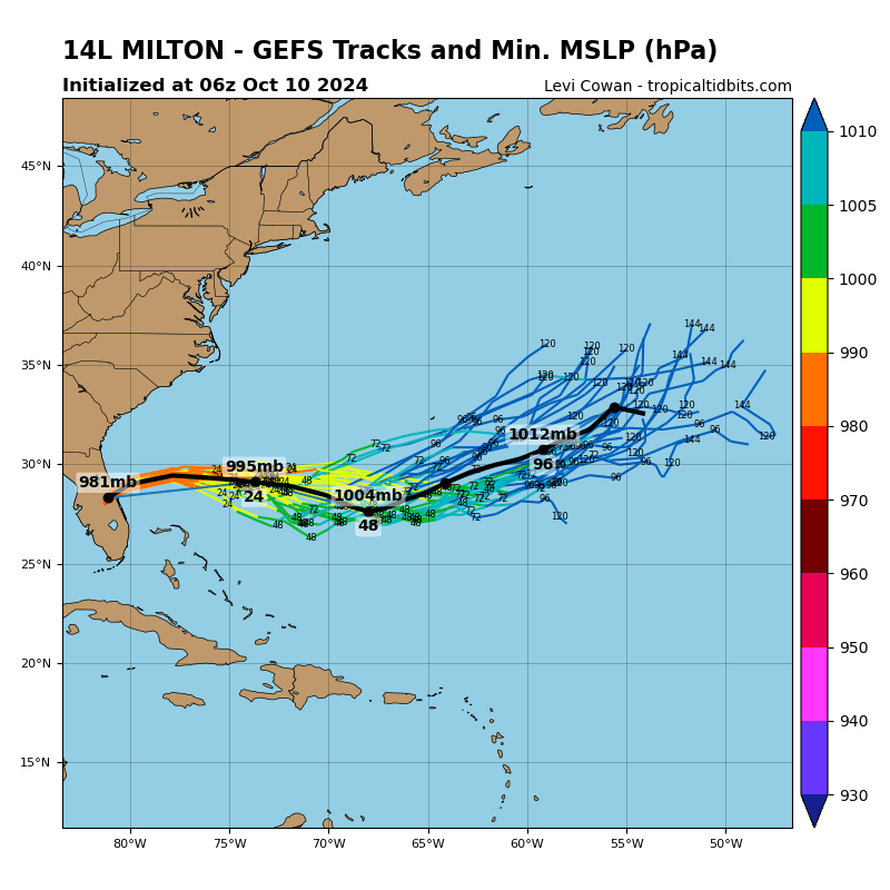
So are the Canadian Ensembles…
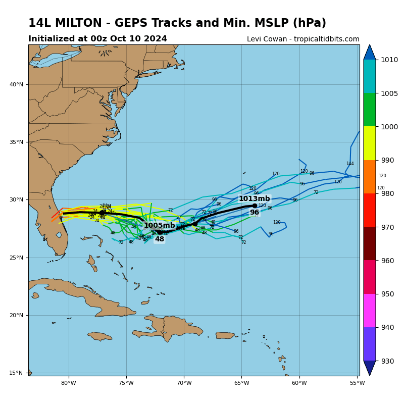
In this scenario, I would put more stock in the Ensembles than the hurricane models (which have already started to go a little west). Why? Because the Ensembles and operational models will likely handle the approaching cold front much better.
Speaking of the operational models. The Canadian Model matches the Ensembles track…

The new version of the GFS is similar…

What does all that mean for us?
- The front brings a line of showers and storms across the state late Tuesday through Wednesday night.
- Tropical moisture from Michael will get drawn into this front, upping the ante for, at least, locally heavy rains.
- Outer rains from what’s left of the tropical system may bring heavy rain to southeastern Kentucky Wednesday night and early Thursday.
- Chilly air moves in behind this from later Thursday into Friday.
Another rain maker zips into the region this weekend and is what’s left from Hurricane Sergio in the Pacific. That’s right, a tropical system from the Pacific will bring some rain our way. As that zips through, the cold crashes in…

Notice the flakes in parts of the Ohio Valley and Appalachian Mountains? Impressive to see. Needless to say, that’s some very cold air for this time of year.
I will have an update on WKYT-TV starting at 4pm, so tune in.
Scattered storms are firing across the region this afternoon and I have you all set to do some tracking…

Enjoy your Monday and take care.

There were several mets on various sites that mentioned an Opal reference as far back as late September…
Here is the beginning fulfillment of my bold prediction # 1…..from summer to winter (lol). In all seriousness though, I think SE KY gets a lot rain from Michael. The fall or even pre-winter like weather will be nice and welcome compared to near 90 and 70 dew points in October! I love the change coming☺!!!
We hope it’s cold Terry and not one of those fronts that just lowers the dew point and not much temperature change like we experience so far this Fall.
What makes you think this Schroeder? Have you not looked at the temperatures being forecasted or do you just not believe degrees meteorologists like Chris because you are so much smarter?
The whole pattern should change Schroeder with below average temps for second half of October. Chris has been about the only one to start showing us back in September!
Because the upper level winds have not changed.
More than just upper level winds drive the weather pattern Schroeder, but I don’t need to tell you this because of how smart you are.
Tons of Ky people in Florida right now. We were talking to some earlier and they are reading the blog also. Thanks Chis for the update.
Not sure we should leave-just yet. Thank you for keeping an eye out for us.
What is interesting about Hurricane Michael is how fast it develop. On Saturday morning there was nothing there and now we have the makings of a major hurricane. Chris called this first and I think now he may be correct as to the path of this storm.
Sorry for the folks in it’s path, but do not mind most in KY are likely not going to be in it’s main path.
Rainfall amounts do not look that impressive. 7-day totals look to come in at 2″ or under. Yes, we have all seen too much rain this Fall already, but at least this does not have the same look as previous storm systems. I can handle 1-2″ amounts over that period of time, and I have had a lot.