Good afternoon everyone and thanks for all the severe weather reports of the past few days. The big severe weather maker and flood event of the past 24 hours has certainly left a mark on the state of Kentucky.
Graves County is the site of a tragic story as the bodies of four children, swept away by floodwaters, have been recovered. You can get the full story Here .
As creeks and streams begin to recede… rivers are on the rise. Here is a look at some of the rivers across the state that are under Flood Warnings…
Ohio River from Newburgh Dam South
Cumberland River at Williamsburg
Stoner Creek at Paris
Roling Fork near Boston
Green River at Munfordville, Brownsville, Paradise, Clahoun and Woodbury
Rough River at Dundee
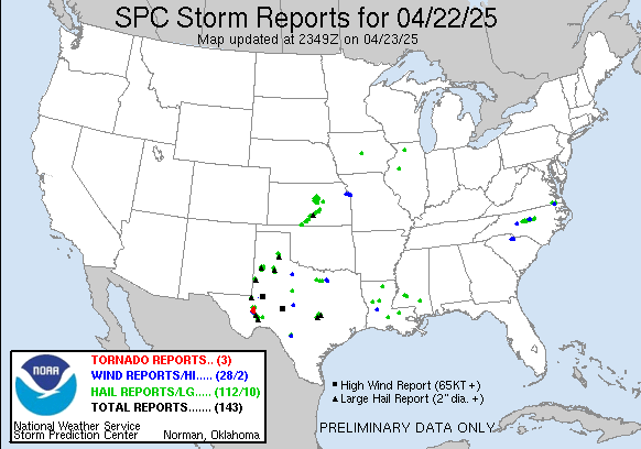
In addition to the flooding… many counties reported wind damage from the line of storms that rolled across the southern half of the state. We were not alone in dealing with severe weather as several other states were also slammed. Here is a look at the storm reports from Thursday…
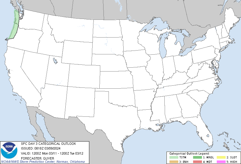
Looking ahead we find the threat for another severe weather outbreak looming for later Sunday into Monday. The Storm Prediction Center is already highlighting parts of the area for severe storms…
That risk area is likely to grow over the next few days as the parameters are there for another potent early season severe weather outbreak.
We will focus on that with updates through the weekend so check back. Have a great rest of your Friday and take care.
Select Page
No more rain! Enough is enough haha I’m tired of it
Not sure why I’m asking, cause I think I know the answer, but…anymore cold/snow down the road to march madness…I’m thinking not really!
the gfs seems to be hinting at something around march 6th. I am FAR from an expert, but it is enough to get my hopes up! Of course, if there is a snow, it will find a way to miss us. LOL
Monday sets up as a regionwide squall line event mcuh like the one we just had but with the entire region seeing it. in fact instabilty will be higher than on Thursday.
A little concerned Chris hasn’t mentioned Ole’ Man Winter in awhile. Any thoughts? Over??
cause he know it ain’t going to snow anymore!! why bring it up if you are just going to be wrong!!
Love ya Chris, but I have to agree with Tim on this one…only 7 comments here since 12:30 for a reason…big bust on winter makes a return forecast….not a hater, just tired of getting my hopes up only to be dashed time after time.
Thank God it is quite tonight.My heart goes out to those children that lost their life.Here is a link I just saw Jim Cantore reporting from there.
http://www.weather.com/outlook/videos/family-swept-away-by-flood-19788
http://www.weather.com/outlook/videos/family-swept-away-by-flood-19788
Was hinting at something but now the latest runs seems to be a cold rain..Guess we will have to wait and see what the models show us a few days from now..
heck no. the first part of march should feature one last showing from the old man.
I’m sure Chris will mention a snow chance if it is there. But flooding rains like what we had on Thursday and what might hit on Monday trump all of that for the time being due to the more immediate danger to life and property.