Good Sunday, everyone. Happy Mother’s Day to all the mom’s out there! The big mamma, Mother Nature, continues to throw well below normal temps at us. Frost and light freeze threats will carry us for a few more days then we flip to a warmer than normal pattern. This warm pattern is then likely to carry us through the rest of May and it’s likely to bring along severe weather threats.
Let’s start with today and roll forward. A frost or light freeze is with us to start the day across the eastern half of the state. Temps slowly rebound into the upper 50s and low 60s as clouds increase this afternoon. Those clouds will spit out a few showers and isolated rumbles of thunder as another cold front moves in. As a matter of fact, there’s a low end risk for severe storms in the north…

Here are your tracking tools for the day…


This sets the stage for another absolutely frigid day. Record lows and record low high temps are a good bet for many on Monday. A light freeze will again be possible to start…
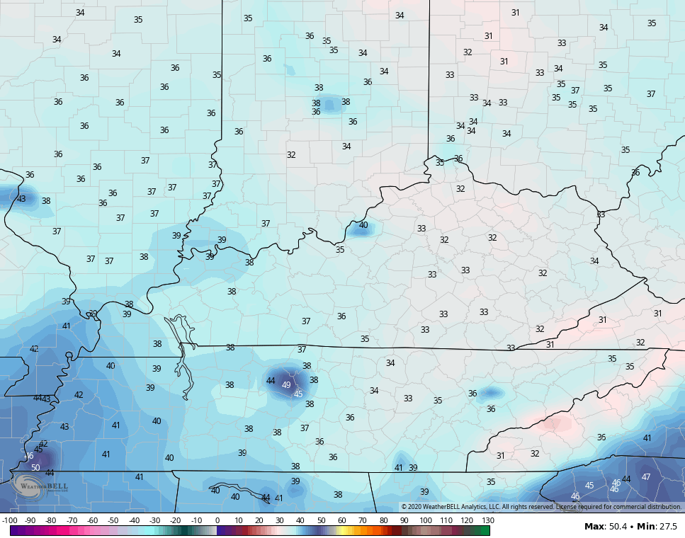 High temps may not get out of the 40s for some…
 That’s absolutely brutal for this time of year.
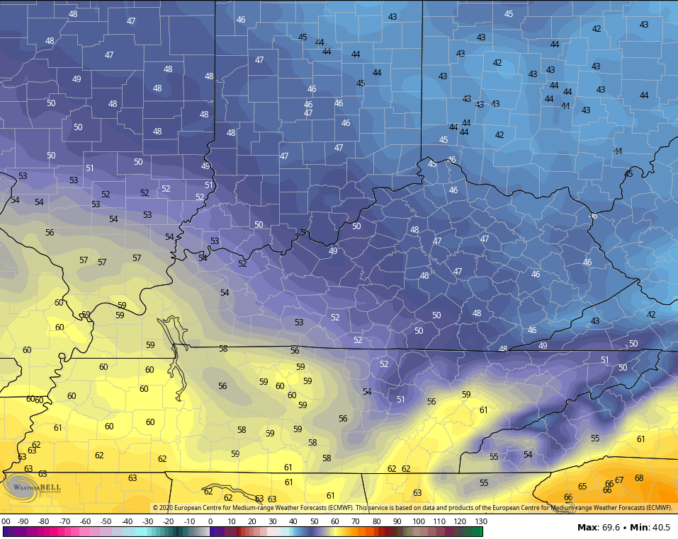
Tuesday is another day with record low potential to start, but the afternoon numbers warm all the way into the balmy 50s. Woot!
Wednesday is the day we flip the switch to come out of this historic cold wave. Temps reach the 60s with a 70 in the west, but the real warmth surges in by Thursday. Highs Thursday and Friday are into the upper 70s to low 80s…
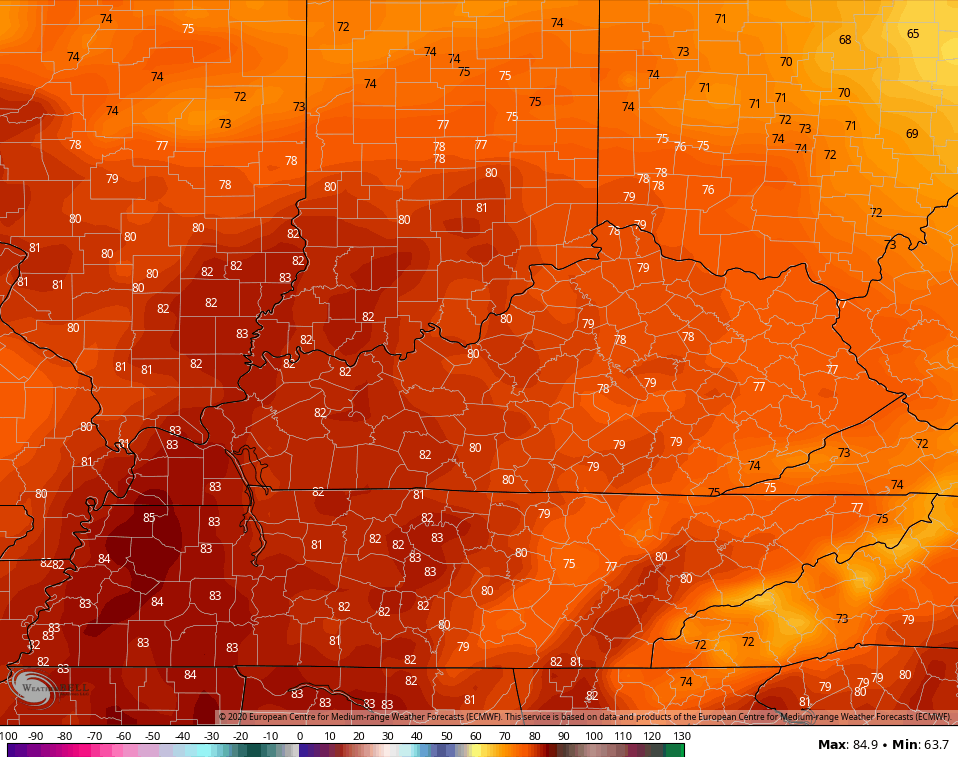 Temps next weekend may surge into the 80s…
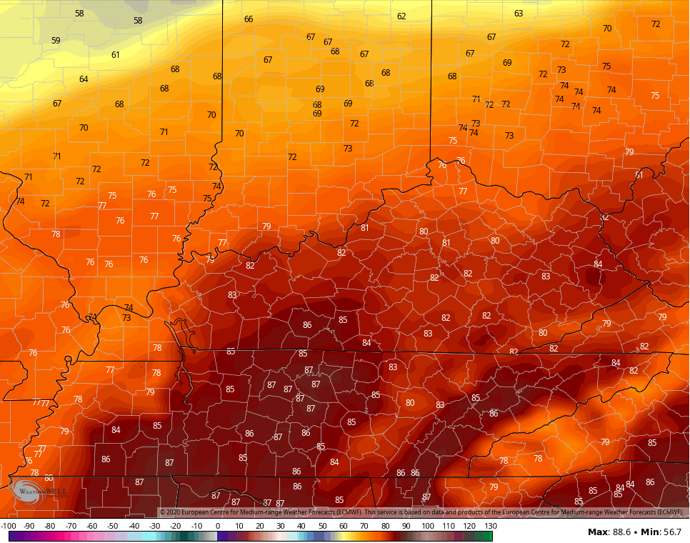 Humidity levels will also come way up as we get into a a pattern that can throw rounds of thunderstorms at us…
GFS
 EURO
EURO
Make it a great day and take care.

RIP Spring! 😉 #jokes
Is this not similar to last years May? Besides the insane cold we’ve had. I was going through the archives and it sounds eerily similar with the warm and stormy.
I’ve also been going back to the archives and finding very similar comparisons to this year. The only difference is, what is now going on in the Arctic Region. This very change happened back in the Spring of 1976 which evolved into a very hot, dry Summer followed by a colder and drier Autumn and Winter in the eastern half of our great country.
Thanks Chris, Twenty four hours ago the temperature in my backyard was right at twenty five degrees. Now the temperature is forty two degrees with scattered clouds present. I’ll take it ! Late yesterday I took an early survey of the native tree species surrounding my home and found out that most of the freeze damage occurred on our state tree the Tulip Popular ( which is actually a member of the Magnolia Family) also the trees and shrubs that were under leaf canopy had no freeze damage, just the plants that were in the open we will have to watch as the week progresses. All the native plants will recover as we move forward into mid- June.
If we had this weather pattern in January we would be taking SNOW. Notice on the Ventusky weather and wind currents the blocking taking place over northwest Canada and just southeast of Greenland.
https://www.ventusky.com/?p=64;-81;2&l=temperature-500hpa
The above is going to “flip” as Chris mentioned in his blog this morning and the western half of our great country gets cooler and we get back to our normal Spring pattern or maybe Summer pattern. I just hope it gets drier so I can stain my porch steps? lol
It’s sunny and 76 degrees this afternoon in Fairbanks, Alaska. Compare that to here in the Chicago area, where it’s a windy, chilly day with temps in the low 40s and a cold light rain… yikes!
Mike, It’s 61 degrees and very windy here in central Kentucky and mostly Sunny now. A little line of showers past through here about an hour ago, but I don’t think the cold front has past because the barometer is falling. Thunderstorms are in our forecast tonight followed by frost tomorrow morning and a very cool day tomorrow.
Alaska, is warming up because of the high pressure ridge just to the east in Canada. An actual “Alberta Clipper” caused the very cool and rainy day in Chicago. This is not normal even for your area in May.