Good Wednesday, everyone. We continue to find steamy temps and scattered storms firing up across the Commonwealth. This is the same setup we’ve had since the weekend and it has a few more days left in the tank before we change it up. That change up comes from a couple of cold fronts dropping in from the northwest over the weekend.
Today’s forecast is pretty much a rubber stamp from the past few. Highs range from the middle 80s to low 90s with humidity making it feel hotter. Scattered storms develop as the day wears on and a few of those may be strong or severe. These storms are also packing a heavy rain punch that can lead to local high water issues.
Here are your storm tracking tools for the middle of the week…

Guess what Thursday brings? If you said more of the same, you win a free subscription to Kentucky Weather Center. 😉
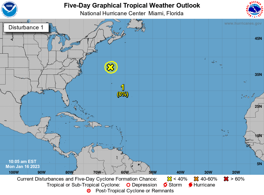
We continue to watch our disturbance slowly working off the southeast coast. This will emerge into the Atlantic and may become a tropical system as it lifts northward along the coast…

That continues to show up on the models as two systems dive in behind it, impacting our weather. The first arrives Friday with an increase in storms and the next one comes Sunday. Both could bring some strong or severe storms…
EURO
EURO
CANADIAN
Temps will come way down behind each of these and it will actually feel comfortable for a while. Once all that moves east, we will need to watch for another blossoming plains heat ridge trying to make a run at us.
Enjoy the day and take care.

Good counterclockwise circulation showing up along the southeast coast. This area of disturbance will become Tropical Storm Fay maybe ? Great weather forecasting Chris as you pointed this out a week ago ! I’ll be glad when we get a break in this terrible heat and humidity. I’m getting less tolerant of the Summer heat as I get older, I need to move to Barrow, Alaska where they still have snow around. NOT LOL
Yes, and you will also pay about $9/gal. for milk, $4 for a loaf of cheap bread, etc. I saw a special on TV a bunch of years ago, Weather Channel, I believe, about life in Barrow, how it’s icy and cold and dark about 3/4 of the year.I was very adament about the pricey groceries, etc, that is, until my former brother in-law and his g/f went to AK. Now, this was probably around 2000-01 or so, but anyway, they stopped at this little country store to grab a quick lunch, and for 2 cheese sandwiches(one not real thick slice each), 1 small bag of chips, and 2 cans of Pepsi set him back $14!!!! Omg….
Still, Barrow, Alaska would be an interesting place to visit in the Wintertime. I like cold dark days as long as it snows a bunch, and don’t forget the constant appearance of the “Northern Lights.” I might add that the Winters here in Kentucky are dark and gloomy without the snow sometimes. But, your right Debbie it is too expensive to live in Alaska unless you have won the power ball lottery. LOL
Hopefully, on the new blog, we will be able to comment without having to wait for it to be approved.
I second that!
Yeah, Having to wait on the posting is “kind of a Drag.” It’s hard to converse with one another on the Blog. I miss the old way of posting.