Good Friday, everyone. We have the first of two cold fronts moving into the region today, bringing more showers and storms and better feeling air. The second front dives in on Sunday as we keep the better feel behind it for a few days. Once that gets out of the way, the plains heat builds into our region.
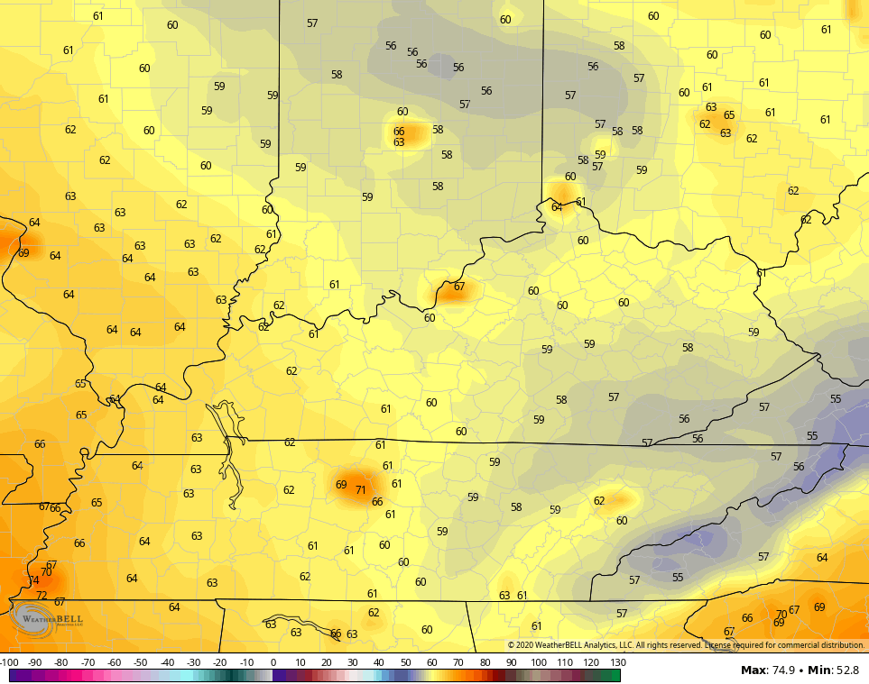
Today’s front has the majority of the showers and storms developing across central and eastern Kentucky. This is not all day stuff by any means, but a few strong storms may fire up yet again. Heavy rainfall will also be a good bet with some of the stronger storms.
Here are your tracking tools to end the day…


Tropical Storm Fay is along the east coast continues to work northward along the coast…

This is the earliest F named storm on record. Here’s the track from the National Hurricane Center…

Nothing like a July tropical system hitting New York City. Keep doing your thing, 2020.
That forces the next system to dive in here from the northwest by Sunday and reinforces the pleasant air we have ahead of it on Saturday. Showers and storms will accompany our gusty front…
 Temps behind this will be pretty darn awesome to start the week with low humidity and temps only in the 80-85 degree range for Monday. Lows may even sneak into the high 50s…
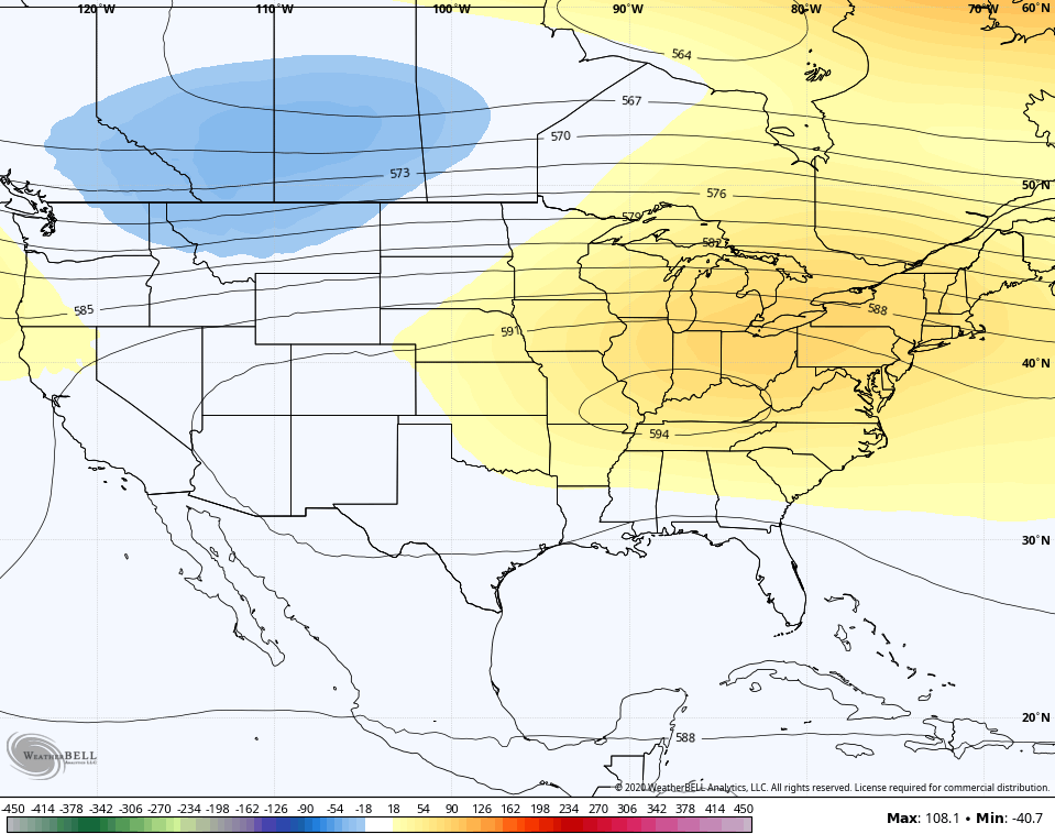
 The second half of next week will see a plains heat ridge move east, but how long and strong it gets around here remains to be seen. The latest 7 day height anomalies from the GFS Ensembles aren’t quite as strong…
 One of the things that could also cut into the numbers… Rounds of storms. We are seeing more of a storm signal showing up on the models…
GFS

CANADIAN

We shall see about that.
Have a happy Friday and take care.

I am glad that the two best weather days of the week will occur during the weekend.
I am going to go outside and finish all my lawn work before the steam inferno returns.
I plan to work around the outside of my home tomorrow morning doing something I’ve done for sixty years “pull weeds.” Hopefully without that “sweat band.” LOL
Thanks Chris, If you please, I would like to add this information to the earliest “F” named tropical or subtropical storm Fay. We are ahead of the active year 2005 in tropical storm development in the Atlantic: https://weatherstreet.com/hurricane/2020/Hurricane-Atlantic-2020.htm
Local mets in Cincinnati keep hinting that high temps on Wednesday/Thursday could touch 100.
If that upper level High pressure builds in from the west it will cut off the Northwest flow in the upper levels. And if the Tropical storms become active in the Atlantic it could hold the”hot” High pressure in place. If this scenario happens the high temperatures could approach the century mark or over and no rain either because the descending hot air aloft. I might add that we are overdue for “real deal” heat wave. Hot High pressure please stay in the west. #teamautumn