Good Thursday, folks. We have a cold front working across the state today and it’s bringing a few strong storms with it. The stormy action joins in on our Dog Days of Summer heat and humidity. That same humidity, though, will give our daily storms more juice to work with through next week.
Today isn’t all day storm action by any means and not everyone will see rain. A few lines of strong to severe storms will be possible as the front sweeps through here. The Storm Prediction Center has us in a low-end severe threat for today…

Damaging winds and large hail are the main players on the field. Locally heavy rains may also cause some quick rises on creeks and streams. Outside of the storms, temps can reach the low 90s very easily.
This same boundary stalls on top of us on Friday and hangs around through the weekend. Now, this front won’t have many defining characteristics outside of being a focal point for clusters of storms to develop. Outside of the storms… It’s seasonally hot and humid.
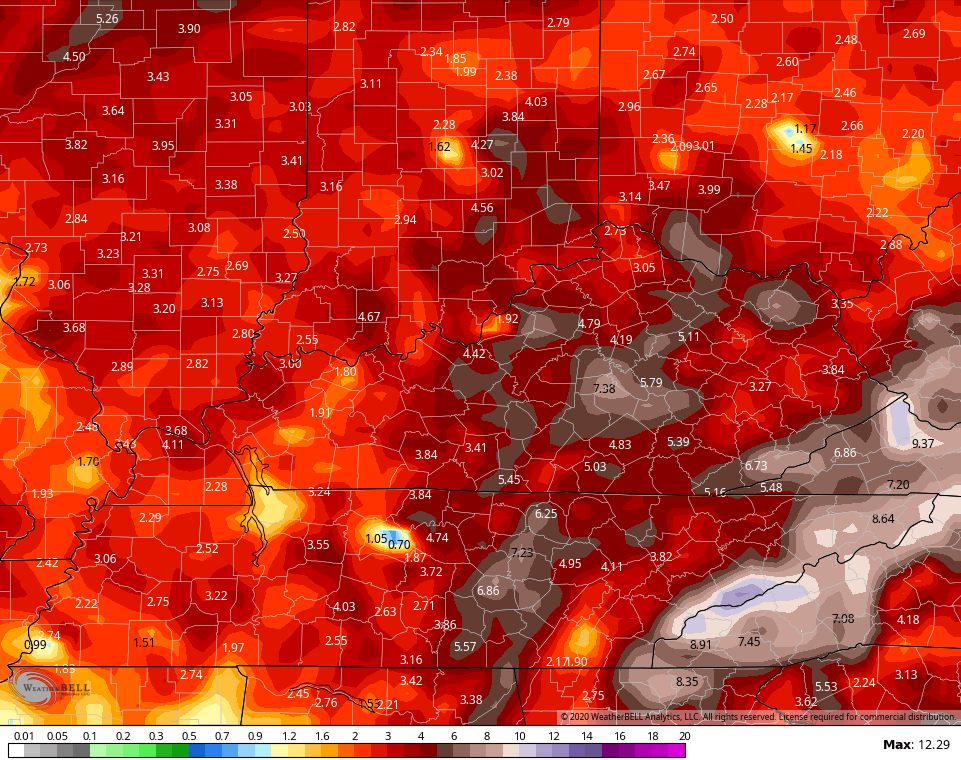
The threat for thunderstorms may increase next week as we see more of a trough trying to dig into the eastern part of the country. The GFS continues to show some hefty rain potential through next week…
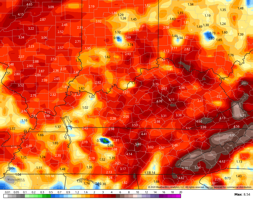
Watch the numbers jump as we take this out to the next two weeks…
Here are your storm tracking tools for the day…


Current watches

Possible Watch Areas

Have a great Thursday and take care.

Thanks Chris, After a very hot day yesterday with no relief in the way of rain showers, this early morning, as I was taking the trash down we had three drops on a “brick bat.” Glad I watered my plants yesterday, but I wouldn’t be surprised if we don’t have a “gully washer” sometime this afternoon or evening with the front in the area. I will be glad when August eleventh arrives as that is the last of the “Dog Days,” but that will not make any difference in our weather probably. lol
I am preparing myself for a long stretch of brutal temps.