Good afternoon, folks. I wanted to drop by for a quick update to focus on the potential for rounds of rain and storms later this week into the weekend. This continues to look more and more like a heavy rain maker across our region.
The Weather Prediction Center is targeting the region with the risk for excessive rainfall in their Day 3 outlook for Thursday and Thursday night…
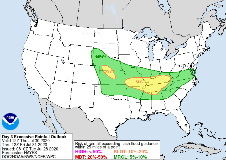 That’s awfully similar to the map I made and posted a few days ago…
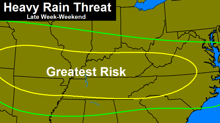
Once the first wave of heavy rain and storms roll through, we watch another one swing in for Friday into the weekend. This one is a slow-mover…

Flooding and flash flooding issues will be possible through the weekend across our region. Temps will be held below normal, obviously.
At the end of that loop, you can see a tropical system working into Florida. That’s the system we’ve been watching for days now out in the Atlantic and it’s officially Tropical Depression Nine…

The GFS takes this system in weakened fashion across Florida and into the northern Gulf. It then gets picks up by another system dropping into our region…
 That could mean another surge of heavy rains around here.
I leave you with your afternoon shower and storm tracking toys…


Have a great rest of your day and take care.

We could use a bit more rain up here in NKY. Move that just a bit further north!
When will you talk about winter weather? The potential cool start to August already has me looking ahead!
We can sure use some rain around our neighborhood. Seems like there’s an umbrella over the south-east side of Lexington and the rain misses us.
BTW, I really like the new weather blog layout. I especially appreciate that it’s now a secure site. Thanks Chris!