Good Sunday to one and all. The current weather pattern is more fitting for sometime in September than it is for the start of August. This is normally the hottest time of the year, but the setup will keep our overall temps averaging below normal through the upcoming week. This will also come with the threat for a few showers and storms.
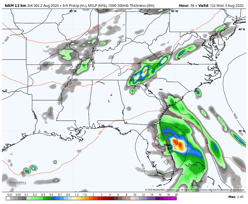
Before we get to the local weather, let’s get the latest on Isaias off the southeastern seaboard…

This storm is battering the east coast of Florida as it crawls northward with the center just off the coast. This will head toward the Carolina’s later Monday and Tuesday and I suspect it will have a pretty big impact on those areas, especially South Carolina. The interactive radar will allow you to go right into the storm and track it on your own, including access to live storm chase cams.
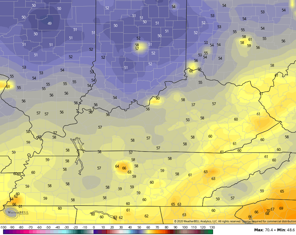
Back here in the Bluegrass State, we have temps today ranging from the mid 70s to low 80s for afternoon temps. Keep in mind that our normal high temps are in the 85-90 degree range, so this is some of the good stuff.
Scattered showers and storms will be around once again and this continues into Monday as another system drops in from the northwest…
 The setup for the rest of the week continues to feature temps coming in under our normal highs and lows. A few mornings may even dip into the upper 50s…
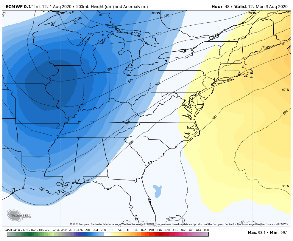
The EUROPEAN MODEL actually brings a few more upper level systems in by next weekend into early the following week…
 Later today, I’m going to post an update on how things are looking for the fall season just ahead. We’ll take a look at one of the new seasonal models to see what it’s showing. Fall? Already? Dang time flies when you’re out here living your best life. 😉
Here are your tracking tools for the day…


Have a great Sunday and take care.

This was quite an historic July for the Chicago area. The average temperature for the month at the official station from O’Hare Airport was 79.2 degrees, which is 5.2 degrees above normal. That made it the 4th warmest July on record for Chicago since 1873! There were twelve 90-degree days for the month (with 96 degrees the high), and every day averaged at or above normal. 30 of the 31 days featured highs of 82 degrees or warmer (the coolest high was 79). Usually in July we have at least four or five days days with highs in the 70s and lows in the upper 50s, but that didn’t happen this month.
Precipitation was just 2.55 inches for the month, which is 1.15 inches below normal. Here’s the link for the complete Chicago climate summary for July: http://weather.gov/lot/July2020Climate
Chicago is currently in a very impressive stretch with 38 of the last 39 days with highs of at least 80 degrees, and 39 days in a row of at or above normal temps. It looks like that streak will come to an end by Tuesday, as the same cool air mass that will be in Kentucky will be here in the Chicago area too.
This is my first time commenting on the new KWC web site, and overall it’s a really nice set-up! I like the fact, as one commenter noted a few days ago, that it’s a secure web site. I also like that the most popular KWC blog posts of all time are posted on the front page. The most popular posts had over 500 comments… wow! I think that record is untouchable, like Joe DiMaggio’s 56-game hitting streak or Wilt Chamberlain’s 100 points in an NBA game.
Thanks Chris, Over the past few days here where I live in central Kentucky we have exceeded estimating close to 5 inches plus of rain accumulation. Reminds me of the Summer weather in 1979.
As long as it stays below 90 degrees I’m good even with those “garden variety showers.”
Tropical Storm Isaias (I-say-e-as) still needs to be watched for redeveloping over the very warm waters off the east shore of Florida.
Always looking forward to your Fall forecast Chris.
Really looking forward to the cooler temps!
I agree
Looking forward to those
“Pot of chili alerts” in the coming weeks, months
Love the new site, CB!
Great Job indeed!
God bless you all
It was an historic July here in the Chicago area, the fourth warmest in history since 1873! Every day averaged at or above normal, and 30 of the 31 days had highs of 82 degrees or warmer, with twelve 90+ degree days.
Hi Mike, It wasn’t the temperature so much here in central Kentucky it was the persistent cloudy days and the high dew points and humidity.