Good Tuesday, folks. It’s another day of below normal temps taking shape as our September preview continues here in the first week of August. This overall setup continues to be darn impressive for this time of year.
Let me kick things off with the latest on Isaias from the National Hurricane Center…

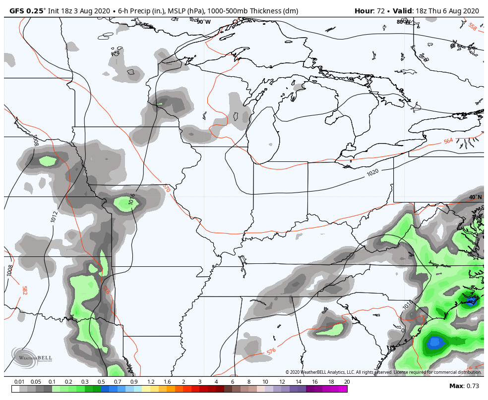
As we’ve talked about for a long time now, this storm is running the east coast and will likely bring significant wind damage all the way into New England. It’s quite the setup with a deep trough meeting up with an east coast tropical system. Here’s how that looks on satellite…

Our interactive radar will take you into the eye of the storm to do some tracking. Remember to toggle on the wind data and click on the live streams from storm chasers…
Of course, you can also use that to track the scattered storms going up across our region. 🙂
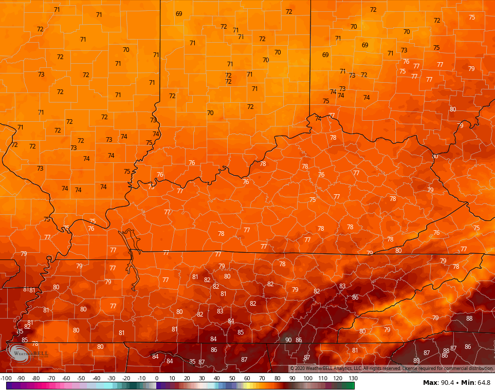
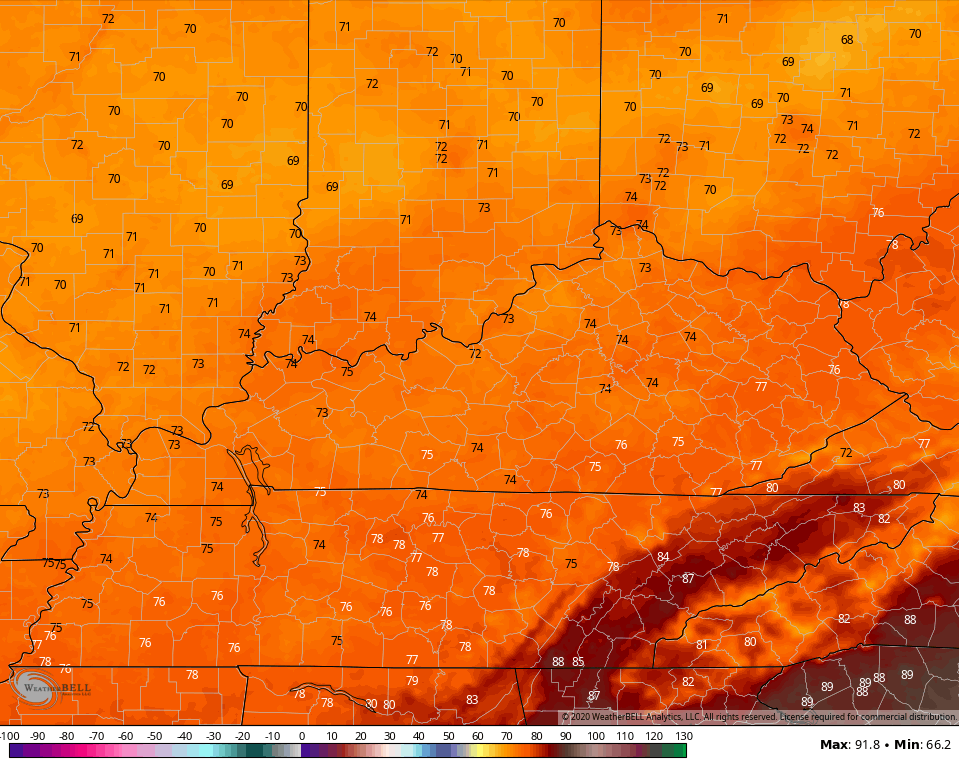
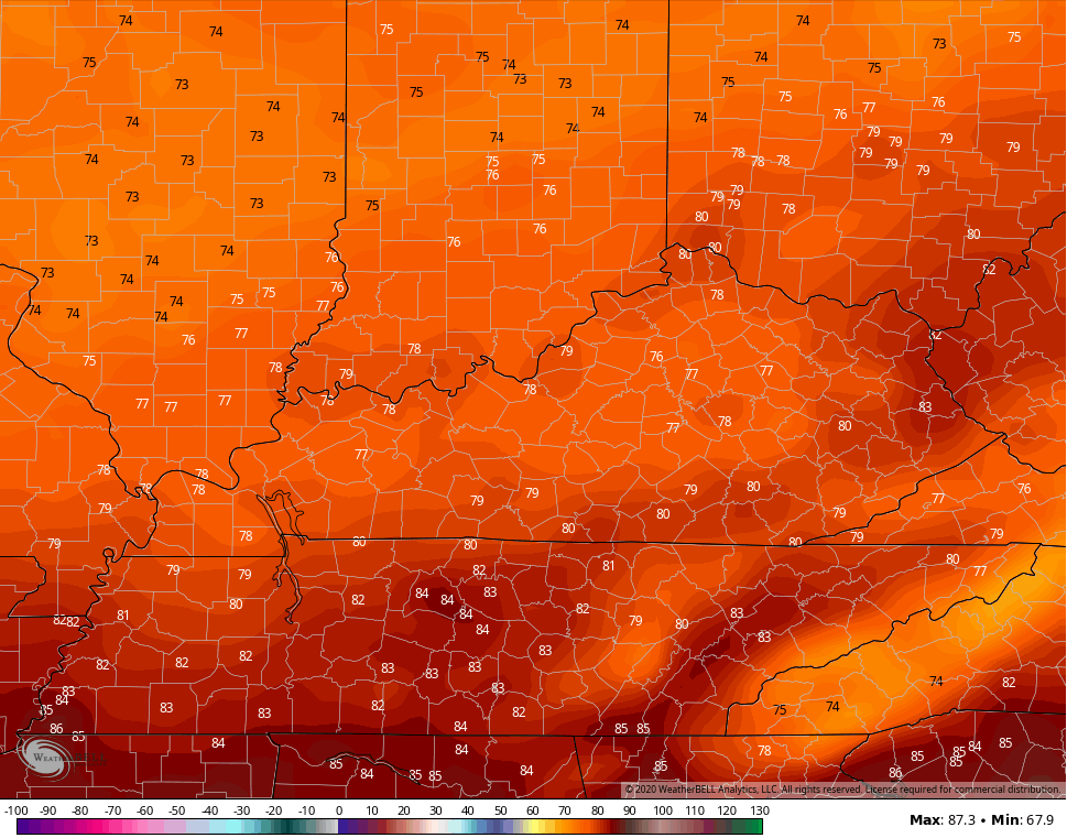
This action continues to look scattered, but local downpours will still be possible. The temps are the main story today and for the next few days. Highs may generally stick in the 70s for many. Here are the numbers from the NAM
TODAY
WEDNESDAY
THURSDAY
 A few mornings may drop it into the 50s. Woot! We will also be on guard for a daily shower or storm.
Temps do start to climb by Friday and into the weekend and that comes with a little better threat for showers and storms. A few rounds of storms may carry us into the first half of next week…
 I will have another update later today, so check back. Have a good one and take care.

Good day to get outside and do some lawn work.
I am a man with a plan.
I second that idea. Currently 61 degrees with fog forming which will likely burn off shortly after Sunrise to give us a beautiful day to be outdoors! Tomorrow forecast to be even better.
FINALLLY…THE VIRG…HAS COME BACK TO…KY WEATHER CENTER.com It has been a decent summer, I wonder if we will see another repeat of Sept 2019 where we had no rain and daily highs in the mid 90s.. That was my kind of month right there.
I would be really surprised if we had the same weather as last September, but you may get your wish.
I am disappointed that the fog and clouds rob us from having any Sunshine today. It seems like every late evening the skies clear after Sunset.
Hopefully tomorrow we will have Sunshine all day to dry the lawn out enough for mowing.
I’ve been having problems posting the last couple of days for some reason. Hopefully this gets solved soon.
Yay… looks like it did get solved!