Good Friday, everyone. Temps are still running below normal out there today, but changes are about to kick in. A much more typical August temperature pattern is on the way, but it’s a setup that will also throw an increasing amount of thunderstorms our way. Those boomers look to kick in as we head into next week.
As always, we begin with what’s going on out there today. Highs are generally in the 80-85 degree range for many, with a few extra degrees showing up on those thermometers that need some work done on them. Humidity is still low, so it’s still pretty darn comfy.
One or two showers and storms will once again show up across the southeast…

Temps return to the middle 80s across the central and east on Saturday with upper 80s in the west. Humidity still isn’t half bad as our skies look mainly dry.
Sunday is mid and upper 80s for many and that’s right at our seasonal norms for the most part. The chance for a shower or storm creeps into the picture by the afternoon and evening.
The pattern for next week will feature a big heat ridge building across the northern part of the country. A system will move in from the northwest and put a dent in this ridge and that brings an increase in showers and storms. That same system looks to hang around our region or into the south for the rest of next week and into the weekend.
Essentially, we are going into a pattern that finds Kentucky between a heat ridge in the north and more of a trough in the south….

This means rounds of storms appear likely…

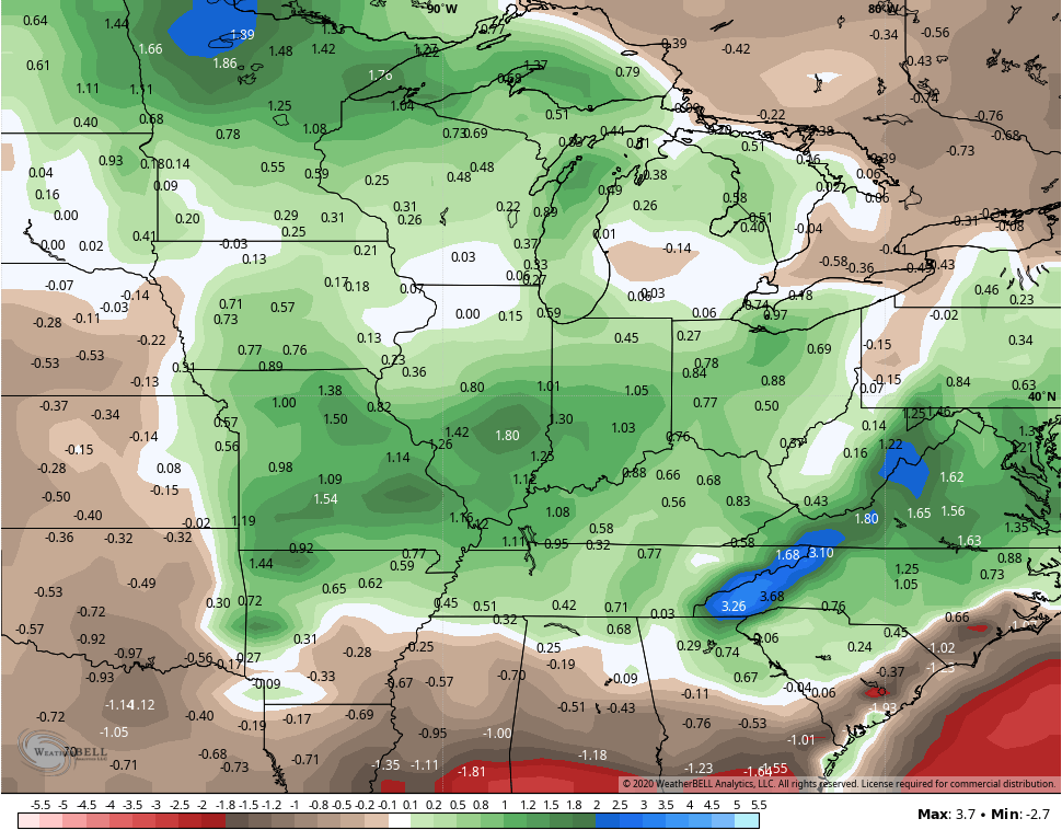
The GFS Ensembles continue to point toward a wetter than normal overall pattern for the next two weeks…
Make it a great Friday and take care.

Thanks Chris, I’m sure those folks in Canada will enjoy the warmth and Sunshine. No complaints here in my backyard. I guess those to our south will have to put up with some cloudy skies and showers like we had earlier this week. However,we will be gaining on 90 degrees on Sunday, but that is to be expected. Just typical August weather. Autumn will be here before long, and hopefully drier with very cool nights and mild Sunny days.