Good Wednesday, everybody. It’s the middle of the week and our September brand of air is in full swing across the bluegrass state. Our front brought some big storms and rain to us on Tuesday and this front is slowing down to our southeast. After a few mainly dry days, things look to get a little active again by the end of the week and into the upcoming weekend.
Let’s kick things off with the weather that’s rolling out there today. Fog is likely to start the day and may be pretty thick, so keep that in mind if you’re traveling. Highs are generally in the upper 70s to low 80s with low humidity levels and a mix of sun and clouds. There’s still the chance for a shower or storm in the far south and southeast. Here are your radars for the day…

Lows tonight into Thursday morning drop into the 50s with a partly cloudy sky. Thursday is another winner of a weather day, but the southeast still runs the risk for a few showers and storms. There’s an outside chance one or two of those make it back into central Kentucky.
Odds favor an increase in showers and storms for the entire region Friday into Saturday…
 Why is that happening? Remember how much time I spent last week harping on the potential for an upper low to spin over the area? Well, here it is…
 Locally heavy rains will be possible in that type of a setup. Temps will still run a little cooler than normal during this time, but the humidity does come up a bit, but nothing too bad.
Everything that happens from this point on likely depends on what happens with the increasing action in the tropics. Two systems are in the process of developing…

The models continue to develop both of those systems and bring them into the Gulf. The Canadian continues to be the most threatening with a twin spin…
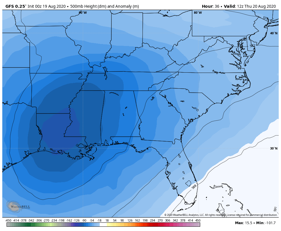
 The GFS is starting to see the potential…
 My afternoon update will touch on where we go with all this, but I will also talk a little bit about the upcoming winter. Did I just say WINTER? Yep. 🙂
Enjoy the day and take care.

Weather feeling good in the “middle of nowhere” here in central Kentucky Chris. LOL
Yesterday evening a storm came up real quick with cloud to ground lightning with very little rain 0,23 inches and the western sky turned a “eerie shade of yellow for a long time after. Very odd.
Watching the Gulf of Mexico for tropical development over the next day or so.
Ready for Fall and Winter discussion to begin.
Now this is my type of weather. Looking forward to the winter talk.