Good Saturday, everyone. What’s left of Laura is working away from the region, but a cold front can still spark a few strong storms for parts of the state today. More storms roll in later Sunday into early next week with more cold fronts ahead. The overall setup is likely to turn pretty darn chilly into the following week.
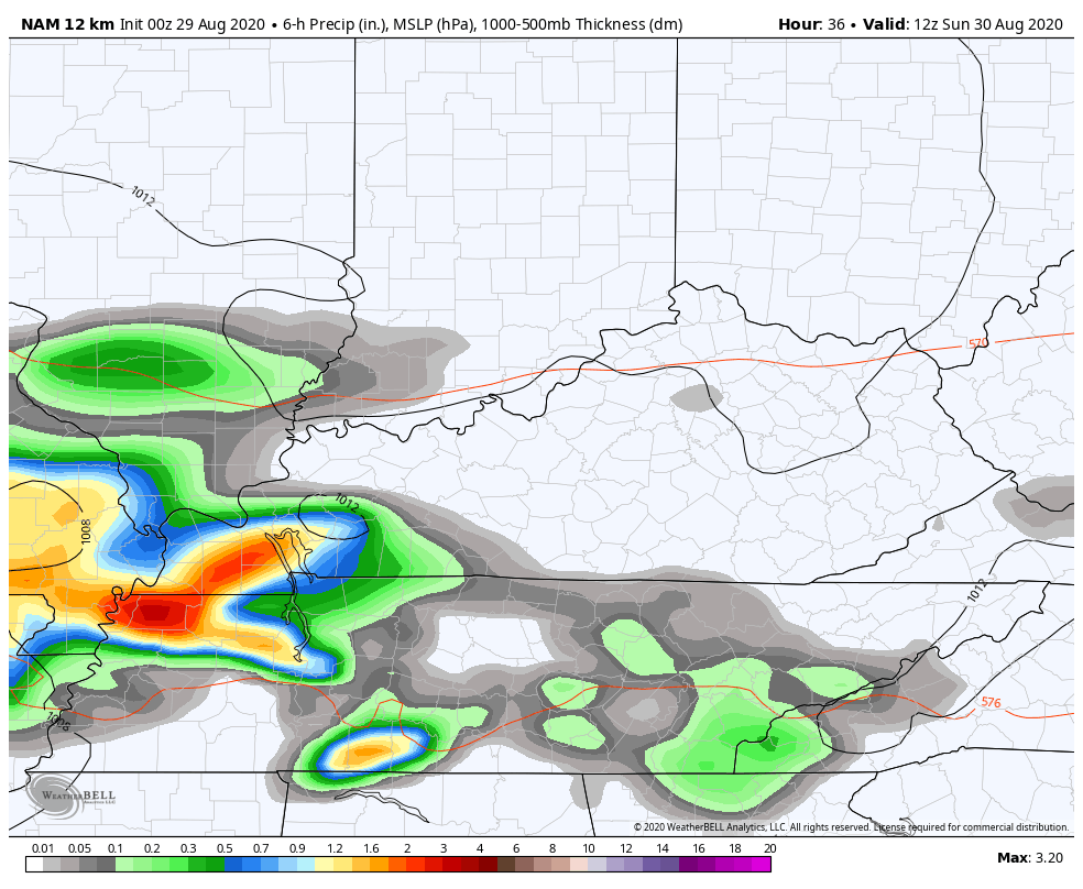
Let me begin with today’s front and what it brings. This is dropping in from the north and northwest, touching off a broken line of thunderstorms. The best chance for strong storms is across the southern and southeastern Kentucky. Here’s today’s Severe Weather Outlook from the SPC…

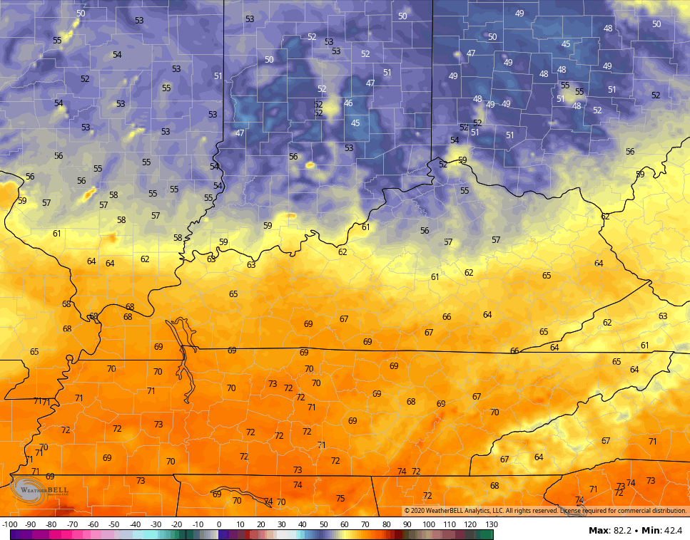
Much of the day is fairly dry for most of the region with still some tropical humidity and temps just ahead of the front. This front only gets so far into the state tonight and Sunday before it slows down. You can see this on the Sunday Morning low forecast from the Hi Res NAM…
Hight on Sunday will be in the 70s for much of the area as clouds stream back in. A few thunderstorms develop through Sunday night and Monday, with the greatest concentration likely across the southern half of the state. Heavy rains are possible…
Another system then works in here by the middle of the week and it’s being pushed by a surge of very pleasant air…
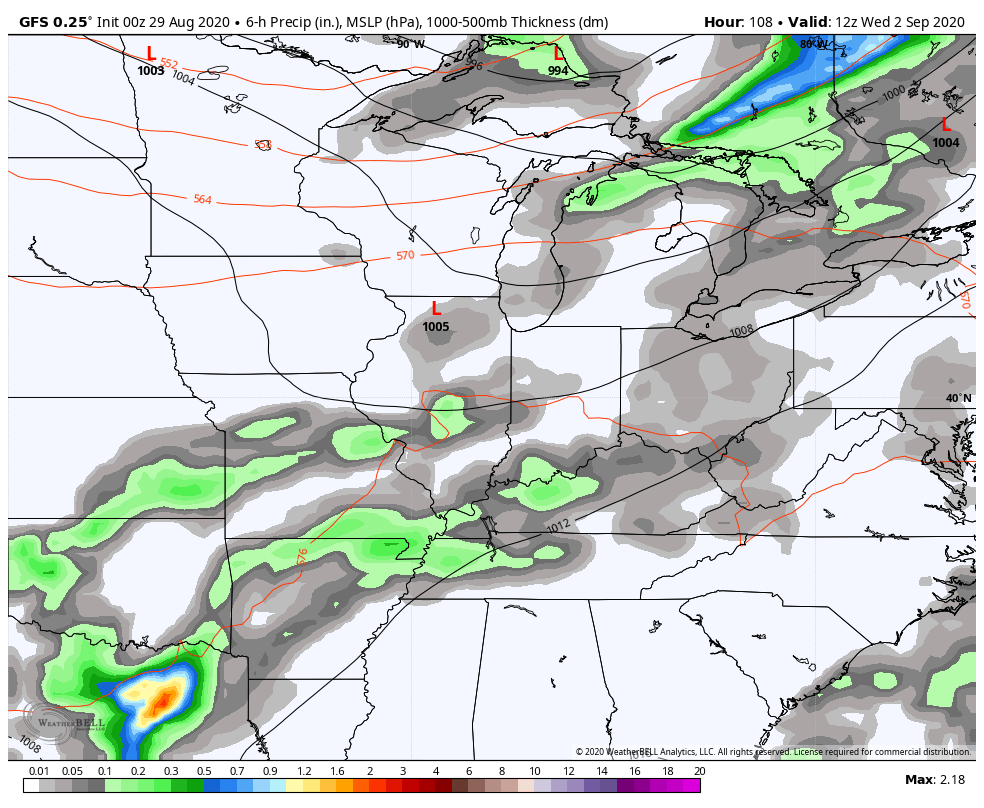
That could bring additional heavy rain producing showers and storms as it sweeps in here. As mentioned, it gets MUCH cooler than normal behind this. Lows may drop into the upper 40s…
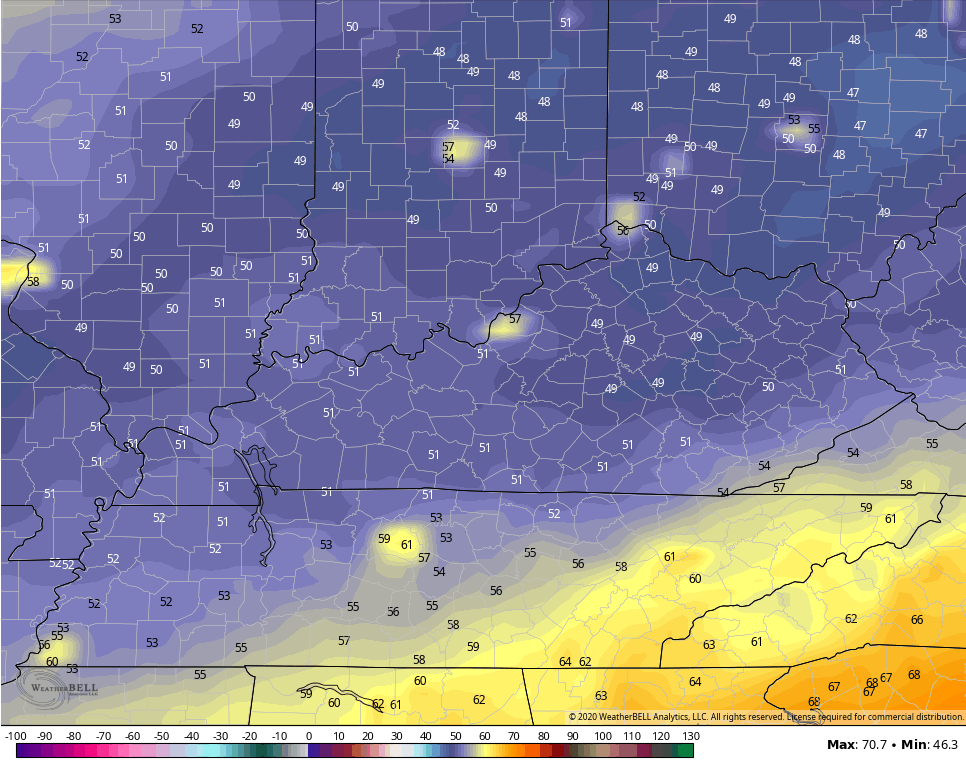
This is likely the opening act for what looks to be a blast of fall chill moving in much earlier than normal. This is a heck of a blast for early September…

A pattern like that can bring near record lows our way and several long range models have been showing this. Highs in the 60s for a few days?
Again, this is shaping up to be the polar opposite to last September when we dried and fried.
BTW… The tropics will likely throw a few more storm threats at the country over the next few weeks. Ugh.
I will have updates later today, so check back. I leave you with your Saturday storm tracking tools…

Current watches

Possible Watch Areas

Have a good one and take care.

While we escaped the rough weather, we received some rain Friday evening.
Thanks Chris, Good rain from Laura.
0.91 inches over last 48 hours. A nice slow rain without severe weather.
Looking forward to Fall like temperatures, but I’m not buying it till it happens.
This is a test to see if I can post my comments.