Good afternoon, everyone. Rounds of showers and storms continue to roll across the state, bringing the potential for local flash flooding and severe weather. This trend takes us until a fall cold front arrives late Thursday and early Friday. A much more important front and fall storm system the works in here next week.
Many areas have been drenched since last Friday. First it was Laura, then we had repeat thunderstorm action from Sunday night through this morning. Well, this action is continuing into tonight and Thursday as more storms roll in here from southwest to northeast. Another 1″-3″ of rain is likely for some. The Weather Prediction Center has much of Kentucky in the Slight Risk for flash flooding…

A FLASH FLOOD WATCH is now for many.
There is also a low-end risk for severe storms to develop and the Storm Prediction Center highlights this…

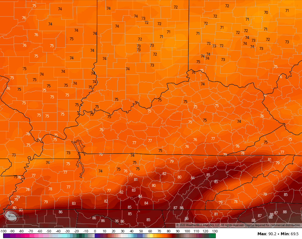
The front responsible for this slides through here by Friday morning, taking lingering showers to our south. Much cooler air then moves in for Friday into Kentucky Derby Day. Check out afternoon temps for both days from the NAM…
FRIDAY
SATURDAY
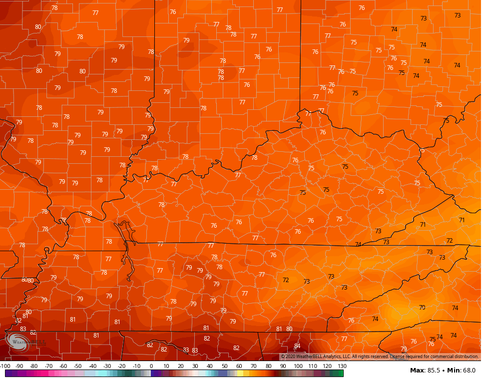
That comes with low humidity levels and absolutely awesome air. Lows Saturday will make a run at 50 and some of the colder valleys may hit the upper 40s.
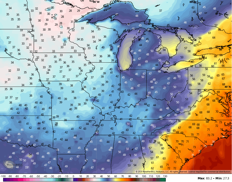
The setup for next week continues to feature a big fall storm system developing across the plains and rolling toward the Ohio Valley. Heavy rain, strong storms and gusty winds are possible ahead of this, with some major chill showing up behind it…
GFS

CANADIAN

Record cold is likely across the plains states and that chill moves our way by the second half of the week. Look at the forecast lows one week from tonight…
All models and Ensembles agree on this except for the Euro. That model now takes the deep trough all the way to the west coast. The EURO has been struggling all year and I’ve called it out multiple times. Still, I see weather folks sharing it on social media without ever checking to see how bad it actually is. Had this model been correct, we would have had multiple 100-105 degree days this summer and Houston would be cleaning up from Hurricane Laura.
I will have the latest on WKYT starting at 4pm and will drop by another update if needed. I leave you with your tracking tools for the rest of the day…

Current watches

Possible Watch Areas

Make it a great day and take care.

Thanks Chris, We do not need the heavy rain here, enough is enough. Our dew point shot up this afternoon to 79 degrees ! Pure tropical. This is the highest dew point I’ve seen here in central Kentucky.
So ready for Autumn weather. Maybe next week ?
Looks like Saturday is the best day to get some much needed yard work done.
I can officially say my flowers are being drowned. We have had decent amounts of rain here in Wayne
Yeah, we have too and now it’s raining “cats and dogs” again.
I’m hoping next week we will have a change in the overall weather pattern to clear, cool and dry.
If you have good drainage your plants will be okay.
When I had my plant nursery business years ago we always planted in “raised beds” so we wouldn’t over water them.
Unfortunately they don’t get good drainage I’m finding out since last week. I’m hoping this weekend the sun will perk them up right now just way to much rain