Good Friday, folks. A little better brand of air is blowing out there today, but storms are set to increase as we head into the weekend. Rounds of showers and storms kick in late Saturday and continue through Sunday. That’s when a cold front moves into the state, bringing a little better weather for the first half of next week. Beyond that, things look to turn active again as the tropics start to play a bigger role in the pattern.
As mentioned, temps out there today are down from the past few days and that bodes well for the kickoff of high school football this evening. There is the slightest chance for a shower or storm going up, especially in the south. Here are your radars to follow anything that goes up…

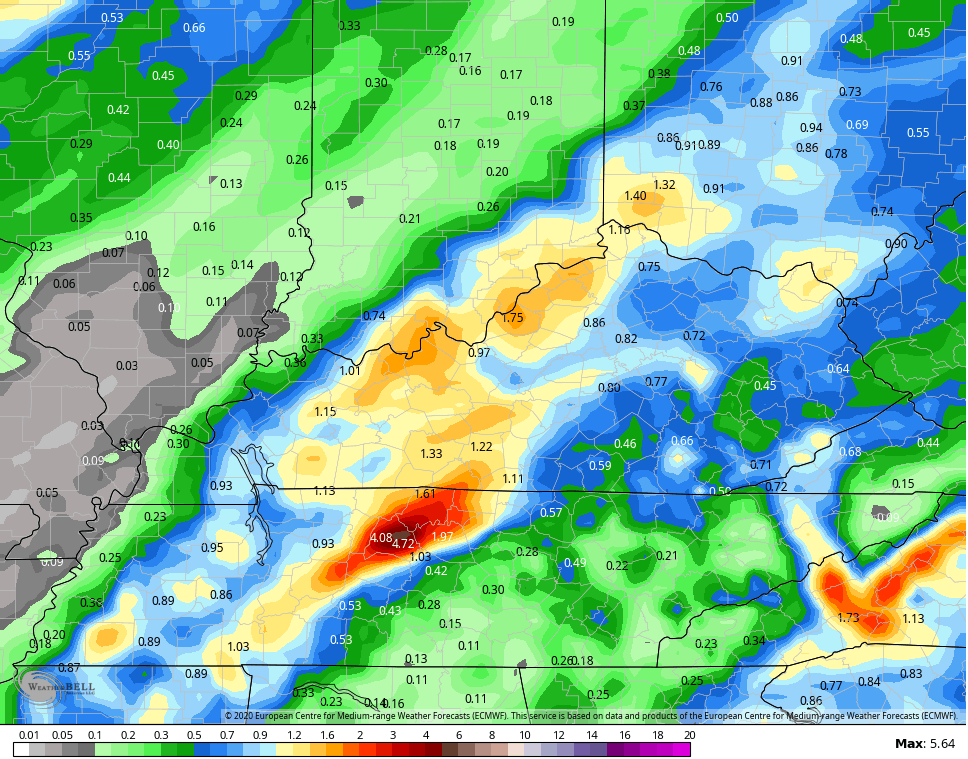
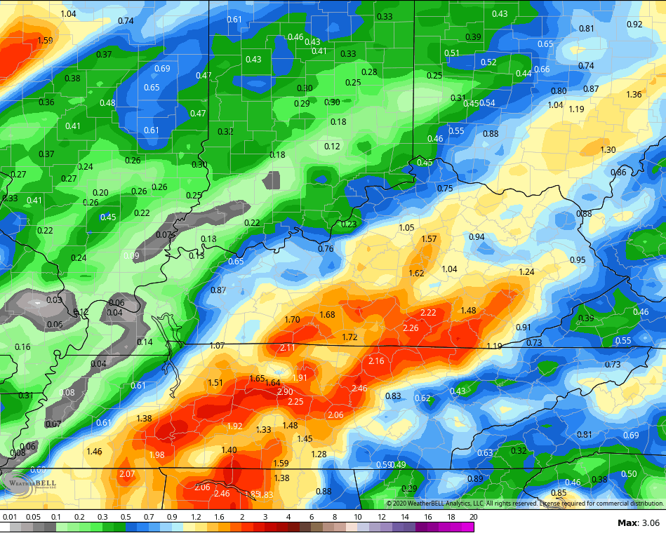
Showers and storms will increase quickly during the afternoon and evening on Saturday as a cold front drops in and slows down. The setup is there for repeat showers and storms through Sunday. This may put down enough rain to cause some issues across areas of central and eastern Kentucky. Here are some of the model numbers…
EURO
GFS
CANADIAN
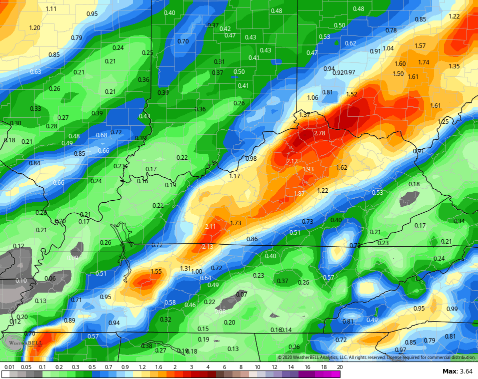
You will notice the slight difference showing up in the placement of the heaviest totals and that’s something to watch as it unfolds.
Temps for Sunday are likely held in the 70s for many and highs in the 70s look common early next week as the front sags to our south. Lows by Tuesday and Wednesday have a shot at the upper 40s in a few spots.
This is where our weather becomes pretty tropical dependent. This is about as busy of a map as you’re ever going to see for the tropics…

The system crossing south Florida and into the Gulf is one to watch as it may increase into a named system. Moisture from that may very well get drawn northward into the region late next week or into the weekend. That could team up with a fall cold front dropping in here. Then, we will need to see if the system closest to Africa can make it all the way across the Atlantic to threaten the southeast or Gulf.
That would have a big impact, obviously, on the overall weather pattern. The EURO Ensembles are attempting to stick a deep trough into the east the week after next…
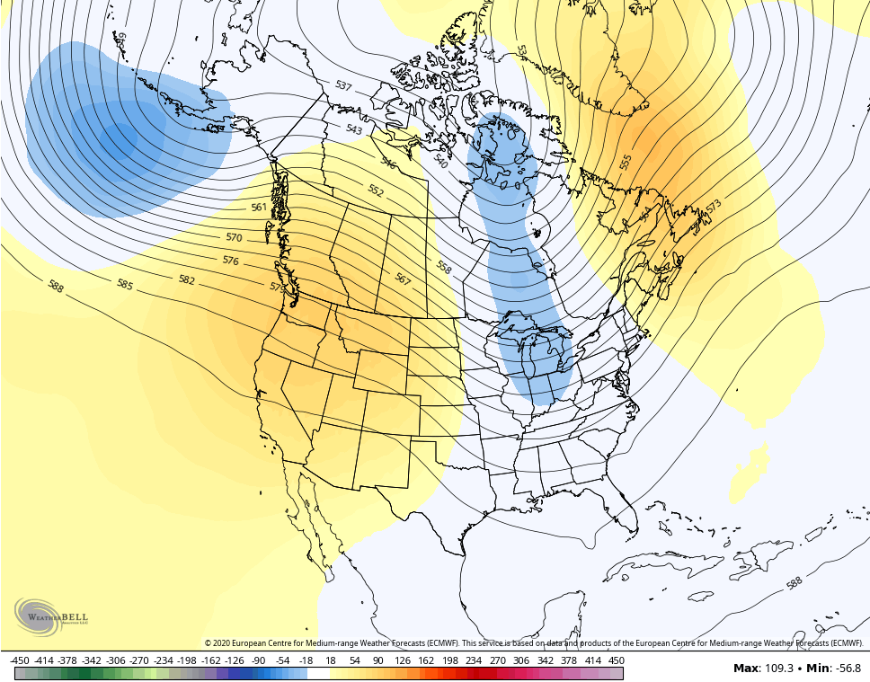
Winter weather lovers should be hoping for that same look to show up a few months down the road.
I will have another update later today. Make it a good one and take care.
