Good afternoon, folks. It’s a much cooler day out there as low clouds are slow to erode behind a weak cold front. The focus of this update continues to be on the rounds of showers and storms rolling in here for the weekend. This will bring an increase in heavy rain producing showers and storms. Once that front settles through, we turn it very pleasant for a few before the Gulf of Mexico and a front play tag team over us.
The weather out there today continues to be really good in terms of temps, making for a great evening for high school football for most. The exception to the rule may be in the west and south. That’s where a couple of showers and storms may go up…

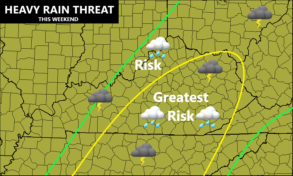
As the next system works in later Saturday into Sunday, rounds of showers and storms increase. Here’s a quick overview…
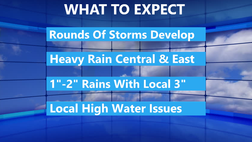
I’ve outlined the areas that may see the heaviest rainfall setting up…
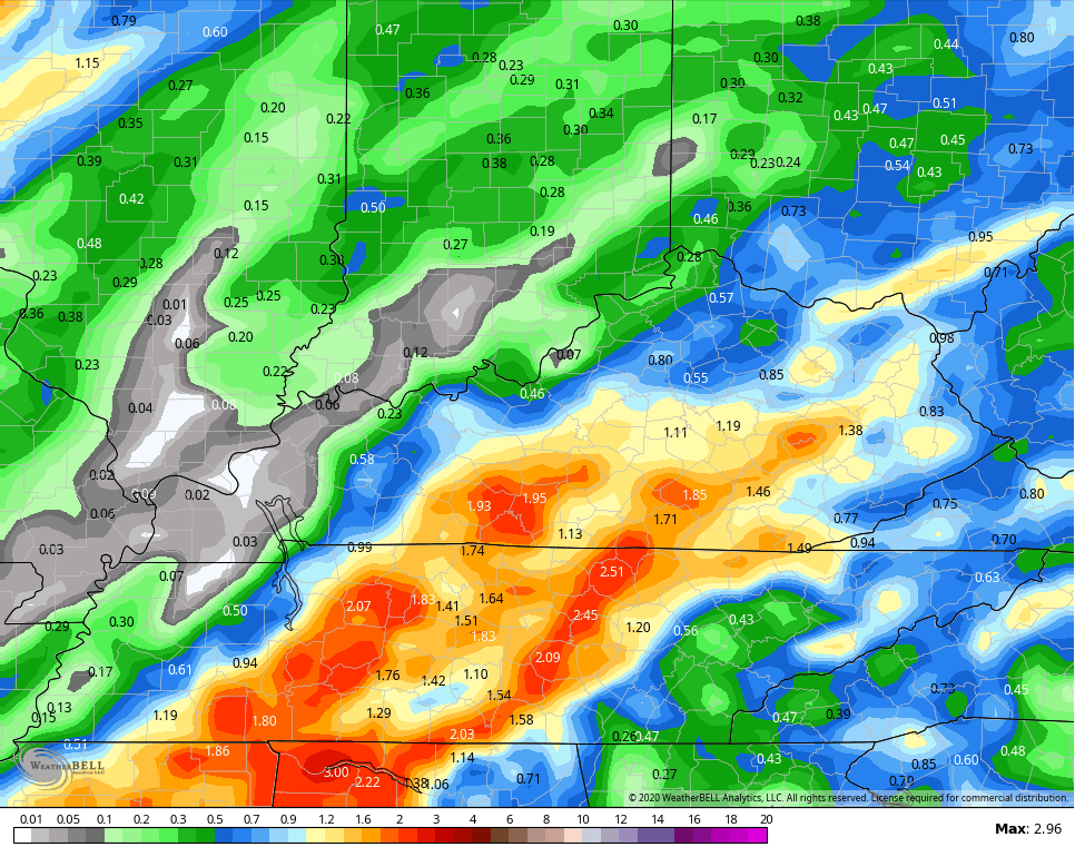
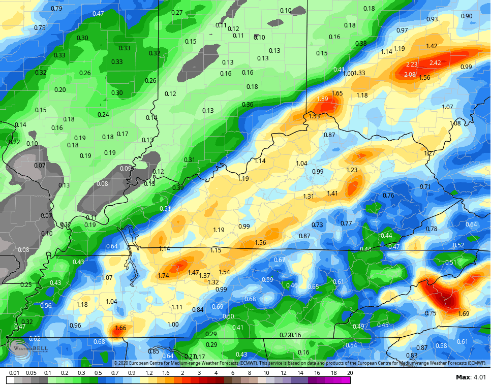
The Forecast models have quite the variance in terms of who gets the most rain…
GFS
CANADIAN
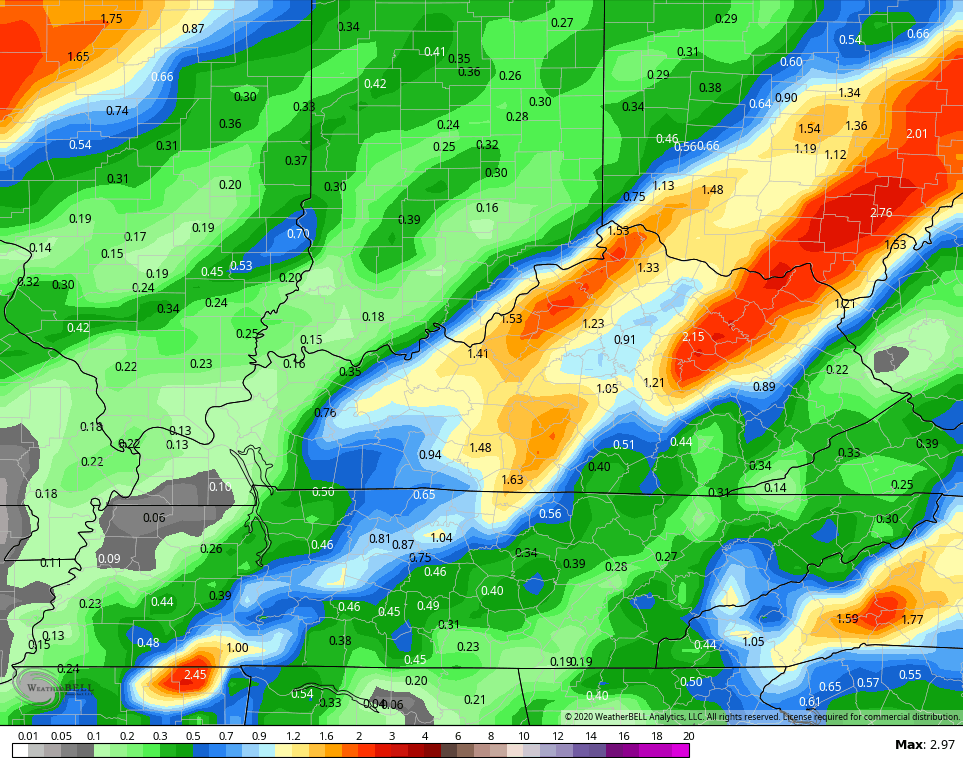
EURO
Temps behind this front will be very pleasant into the first half of next week, but the focus quickly shifts to what’s happening in the Gulf of Mexico. That’s where a tropical system is likely to develop as we continue to track a super active tropical setup…

The Gulf system is likely to roll toward the central Gulf Coast states in a few days. You can see that on the tropical models…

Moisture from this system is likely to get drawn northward during the second half of the week. It may combine forces with another fall cold front dropping in here from the northwest, but how this evolves is still fairly low confidence.
I’ll see you guys with another update later tonight. Have a good start to the weekend and take care.
