Good Sunday, weather weenies. A cold front continues to slowly work across the state, bringing more heavy rain producing showers and storms. As we watch the storms rumble through, we are also focusing on what’s going on in the Gulf of Mexico. Sally continues to intensify and will become a hurricane by Monday, and it could impact our weather by the second half of the week ahead.
Today’s showers and storms will be common across central and eastern Kentucky. Several areas picked up on an inch or two of rain Saturday, so we will need to be on guard for local high water issues. Here are your tracking radars…

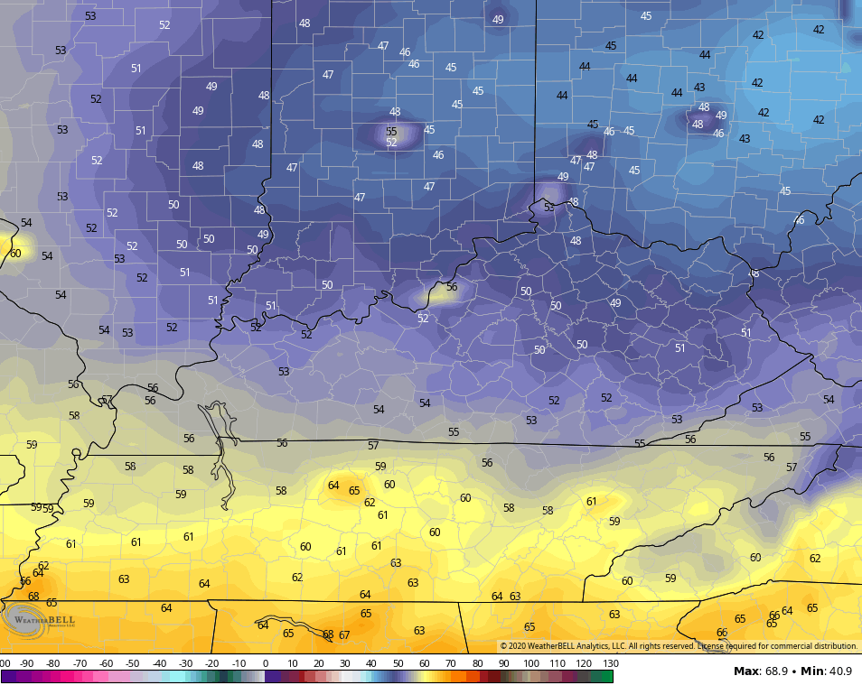
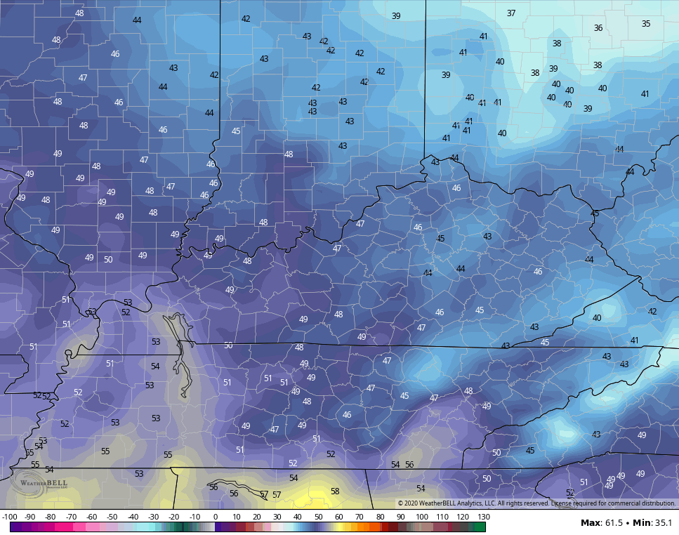
The showers and storms end from west to east today as cooler and drier air works in to start the new week. Lows by Tuesday morning should drop into the upper 40s for some…
Tropical Storm Sally continues to strengthen in the Gulf of Mexico as it churns toward the west and northwest…

Sally will become a hurricane over the next few days and I’m worried about further intensification as it gets closer to making landfall. Here’s the latest forecast from the National Hurricane Center…

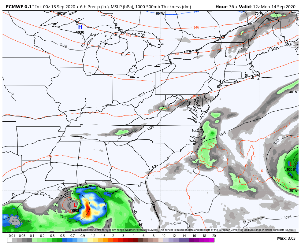
How far north can the remnants from Sally get? That’s going to be the question of the week as we watch a deep trough dive in and try to pick up, at least, some moisture from this. The EURO continues to bring what’s left of Sally into Kentucky, with a lot of rain falling…
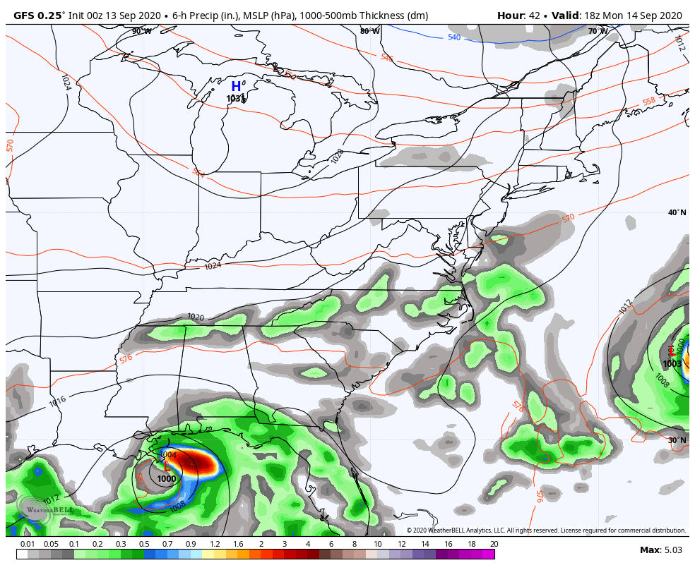
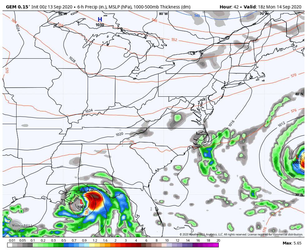
The GFS and Canadian Models both bring some tropical rains in…
GFS
CANADIAN
Regardless of how much rain we can get from Sally, that’s a pleasant fall blast of air behind that for the end of the week into the weekend. Lows can drop deep into the 40s…
Can you smell the Pot Of Chili Alert?
I will have another update later today. Until then, make it a good one and take care.

Finally a sunny day here in the Chicago Metro Area today with highs forecast to be in the 70s after five straight days of clouds and highs mostly in the 60s. In fact, since last Sunday, the area has seen seven days in a row of measurable rain, with between 2 1/2 and 3 inches of rain having fallen throughout the Chicago Metro Area (2.52 inches at O’Hare, and 2.63 inches at the NWS forecast office in Romeoville in the SW suburbs) in that span. At least the lawns here are no longer brown.
Very little if any rain is in the forecast here for the next week with seasonable temps in the 70s. A beautiful stretch of weather!
Happy first Sunday of 2020 NFL Football!
Thanks Mike for sharing and keeping us posted here on KWC. Always good to know what the weather is from a friend’s perspective who lives several miles north from the state of Kentucky.
I wish we could get some of those cool Fall temperatures here in Kentucky. We are just to close to the Gulf and Atlantic where the waters are “crazy warm to hot.”
In my opinion, NFL Football is not fun to watch anymore without the “Fans in the Stands.”
You’re welcome! And yes, football, along with other sports, are very different to watch without any fans in attendance.
Thanks Chris, when we were having our zoom meeting Friday evening with my sister and brother in law in Florida it was raining there then and we could here the thunder. I told them that I believe a tropical storm would form just to their southeast. Yesterday, it happened and I called her and told her that “Sally” has formed just to the south/southeast and expect some very heavy rains and flooding in their backyard. This morning I checked out the radar that is close to the area they live and found widespread rain falling, not good as most of Florida is in a flood plain. I will check back later with them to see if any flooding has happened.
Back to central Kentucky weather, I recorded 1.29 inches of rain late yesterday. A very tropical feel to the air here lately with showers forecast throughout the day. hoping that the remnants of Sally will stay south of our area and we can finally get a cold front to clear the state later next week, but the latest weather models are not in agreement over what will happen.
I found out yesterday that a weak La Nina has formed over the cooler Pacific waters and has a better than 50% chance of spending the coming Fall and Winter here in the US. For us “Winter Lovers” we can only hope we have the Arctic Oscillation and the North Atlantic Oscillation in the negative phase for most of the Winter. We shall see.