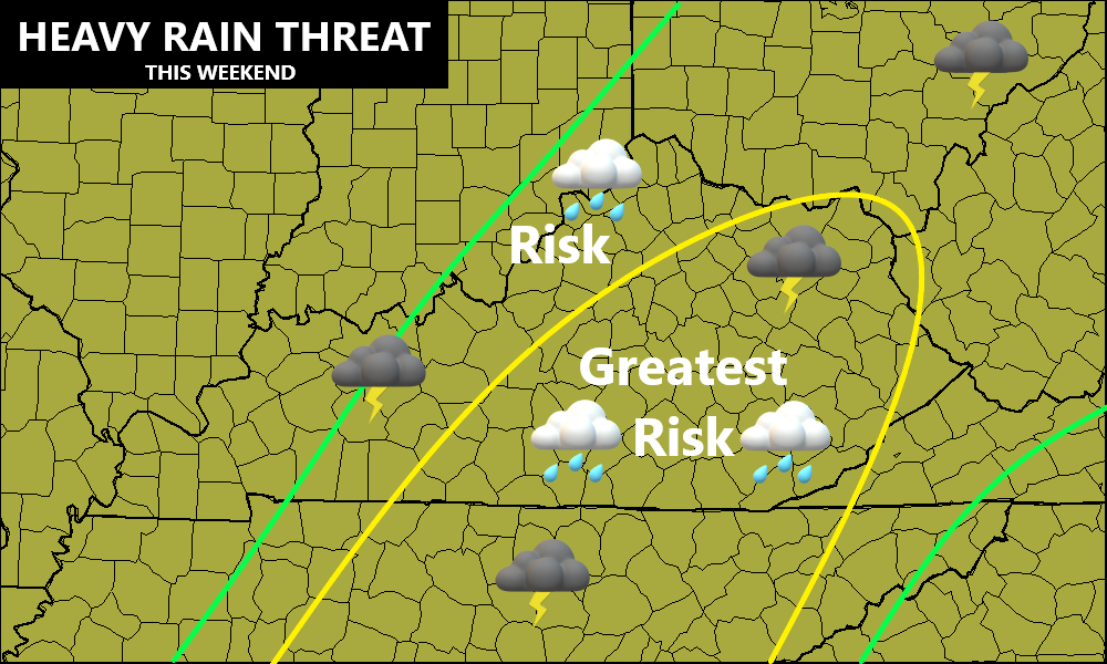
Good afternoon, everyone. Our pipeline of rain continues to very slowly push to the east, but it’s leaving behind all kinds of issues. Flooding and flash flooding has been common and the threat continues into the evening for areas of eastern and southeastern Kentucky. Not only is this important for today, but it’s likely to play a big role later in the week as we watch to see if Sally bring tropical rain into Kentucky.
Rainfall since Saturday has been prolific in several spots with some areas now better than 5″. Here are current numbers from the Kentucky Mesonet through 3pm today…
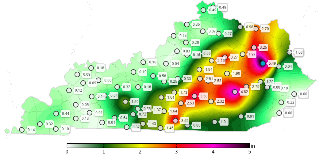
This matches up well with the area I highlighted a few days ago for the best potential for heavy rain…
Here are your radars to follow the rest of the days rains…

Thankfully, the rain tapers from northwest to southeast into this evening as cooler and drier air works in from the northwest. Monday looks awesome with highs in the 70s under increasing amounts of sunshine. This sets the stage for temps to reach the upper 40s and low 50s for many by Tuesday morning…
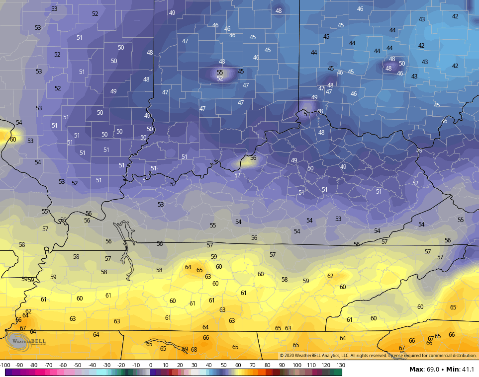
Some of the coolest valleys may push 45 degrees to start the day. The rest of the day features more nice weather with highs back into the 70s.
Once into the middle of the week, what’s left of Sally has a decent chance to bring more rain into Kentucky. Tropical Storm Sally continues to strengthen in the eastern Gulf of Mexico…

Sally will become a hurricane as it heads toward a Tuesday landfall in southeastern Louisiana. Here’s the latest from the National Hurricane Center…

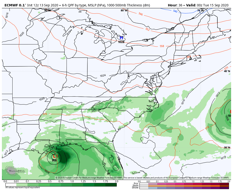
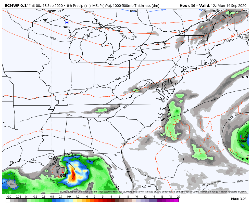
While the center of Sally is likely to stay to our south, moisture from that may wind up being on the northern side of it and interact with a front dropping into Kentucky. Tropical moisture combining with a cold front ahead of a deep fall trough can sometimes be the recipe to put down decent rains. Here’s a look at how the models handle this…
EURO
GFS
GFS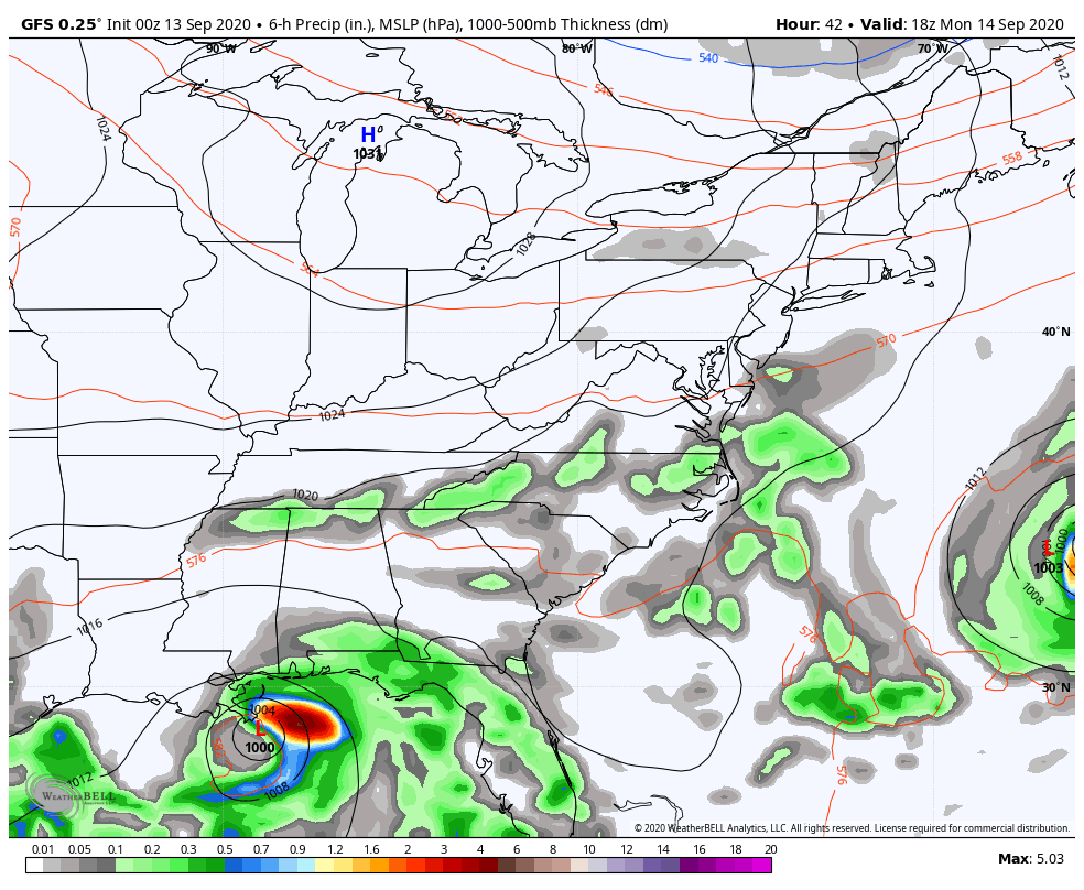
How much rain can actually make it into the region remains to be seen, but the best chance will be across the south and southeast.
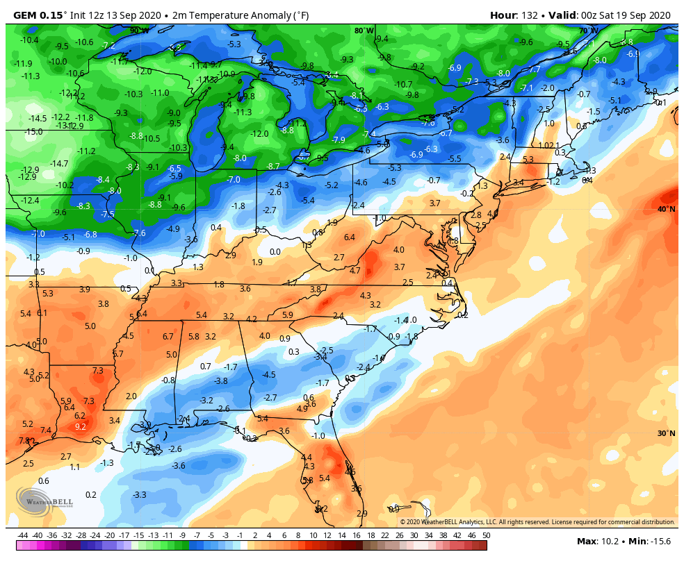
Once that front blows through here, it’s game on for awesome fall air as temps go below normal…
CANADIAN
EURO
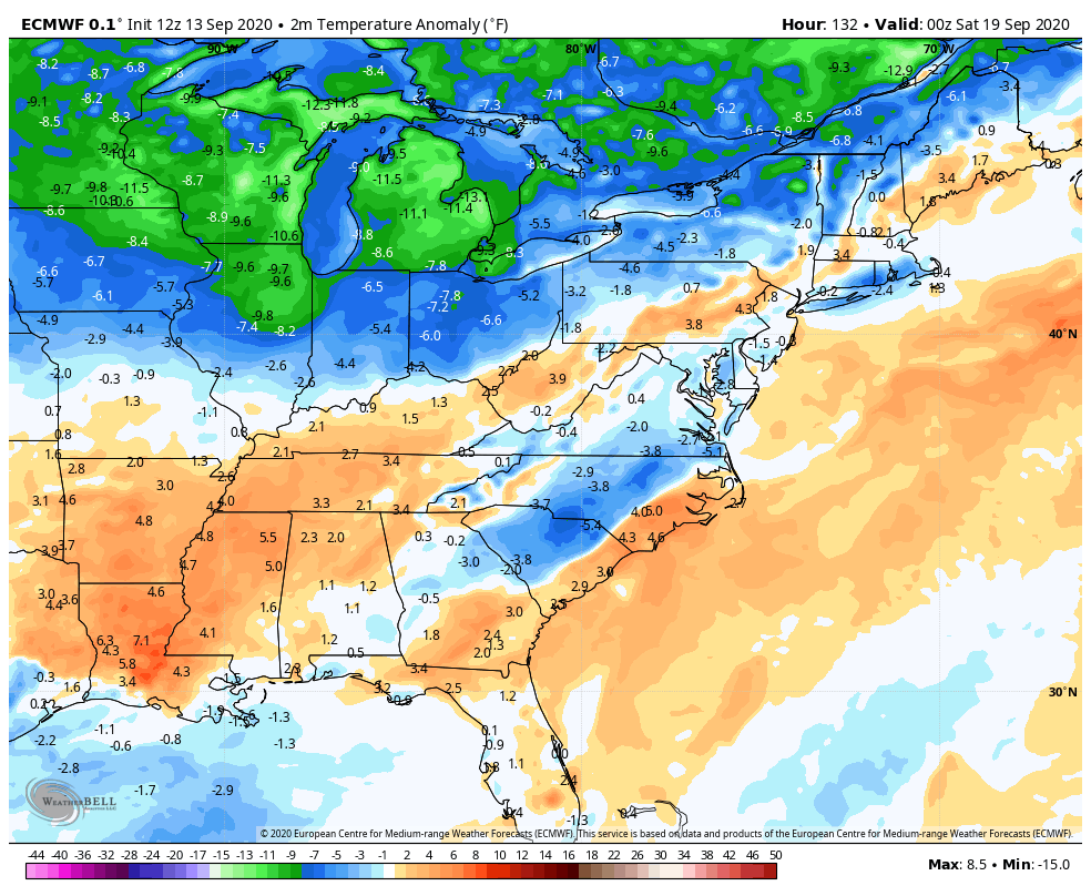
Temps should rebound a bit after that but the Ensembles continue to point toward another deep trough digging in here later in the following week…
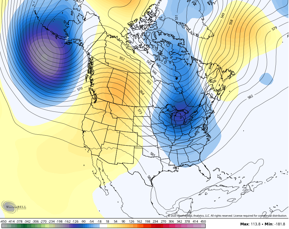
That’s a terrible look for the fire ravaged areas of the west, though. Ugh.
I may drop by for another update this evening. If not, I’ll see you guys later tonight. Have a good one and take care.

Thanks Chris, 1.73 inches in the last 48 hours is enough rain. We need to dry out ! I just wish we would get a light frost to start Fall. Temperatures in the mid to upper 30’s would feel delightful after this awful Summer of high dew points.
Unfortunately, Sally is going to be a problem somewhere along the Gulf coast. Maybe as a Cat. 1 or 2 at landfall. Only three names left on this season’s hurricane list and then we go to the Greek alphabet. I think we need to relocate some ice bergs up from Antarctica to the Gulf and the Atlantic Ocean to cool off the very warm waters. LOL Wouldn’t work.
Thanks for the update.
It appears the Louisville area will continue to miss out on the heavy rain.